
Bentley Education Program Expands to Global Scope
26th October 2021
Bentley Education Program Expands to Global ScopeThe creation, visualisation and use of three-dimensional representations of real or virtual world terrains, surfaces, elevations and built objects
Three-dimensional models are used increasingly in the public and private sectors and in academic research to visualise and analyse real or virtual world features and objects. This topic encompasses the creation of 3D geometric models from captured spatial data and their use in applications that include architecture, construction, engineering, urban planning, city and infrastructure modelling, transport and utility network planning and management, asset management, entertainment film production, video gaming and the geosciences. Additionally, the topic covers the creation and use of 3D models that make use of Virtual, Augmented and Mixed Reality techniques
26th October 2021
Bentley Education Program Expands to Global Scope21st October 2021
Maptek Geology challenge winner solves data complexity problem21st October 2021
Sepura Launch SmartView, Combining Indoor and Outdoor Location Reporting13th October 2021
Bentley Systems and SMRT Trains Collaborate to Improve Safety and Reliability of Metro Rail Services in Singapore7th October 2021
The Cohesive Companies Expand in Transportation Infrastructure Globally with Acquisition of OXplus and through Executive Succession6th October 2021
SimActive Releases Version 9.0 with Distributed Processing21st September 2021
Bentley Systems Announces Finalists for the 2021 Going Digital Awards in Infrastructure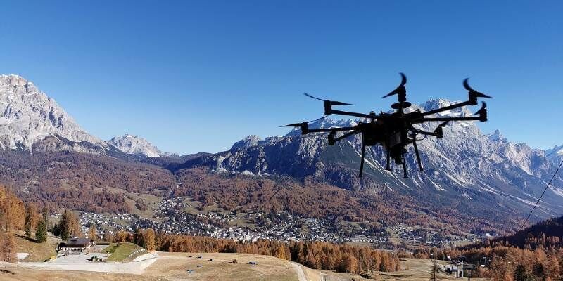
16th September 2021
Intergeo 2021 Live + Digital, September 21-23, 2021: Join RIEGL at booth 20C.22, Hall 20 or digitally16th September 2021
Hexagon to showcase groundbreaking autonomous solutions and smart digital realities at INTERGEO 2021 Live+Digital19th August 2021
New Trimble GEDO GX50 Laser Scanning System Introduced19th August 2021
Trimble X7 and Perspective 3D Scanning Solution Garners Three International Design Awards19th August 2021
FARO Expands Digital Twin Product Suite - Acquires HoloBuilder19th August 2021
Hexagon expands its smart digital reality capabilities with the acquisition of Immersal
19th August 2021
Esri ArcGIS Pro certified for 3D stereo visualization with 3D PluraView monitors
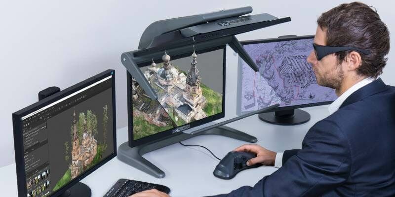
11th August 2021
Agisoft Metashape Pro and 3D PluraView monitors enable 3D-stereo photogrammetry at its best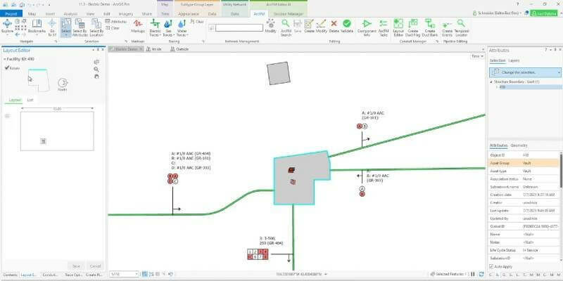
21st July 2021
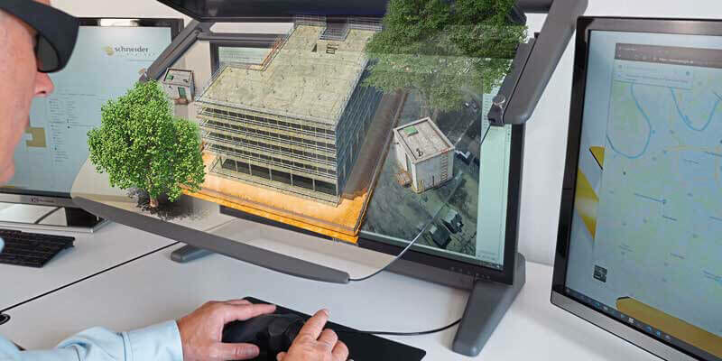
Schneider Electric Announces New Features for ArcFM Editor XI14th July 2021
1Spatial unveils new 1Integrate 3D rules engine13th July 2021
New Trimble GEDO GX50 Laser Scanning System Introduced for Clearance Analysis and Asset Data Collection for Railway Applications
12th July 2021
Riegl Ricast: Forest Inventory By Means Of Laser Scanning Technology
8th July 2021
Recordings Are Now Available For The Riegl Ultimate Lidar June 2021 Webinars8th July 2021
Bentley Systems Announces Seequent’s Acquisition of Aarhus GeoSoftware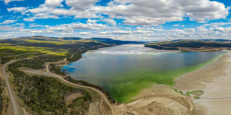
1st July 2021
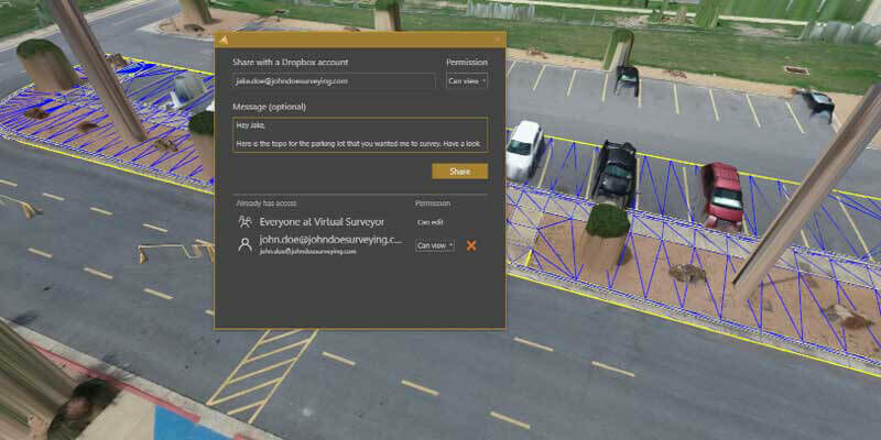
Virtual Surveyor Introduces Dropbox Integration for Easy Collaboration and File Access from Anywhere
1st July 2021
Bluesky MetroVista Mesh Models Underpin Dynamic Map of London1st July 2021
XenomatiX launched the next generation true-solid-state LiDAR1st July 2021
Pix4D launches survey-grade 3D modeling on mobile devices with RTK accuracy1st July 2021
GeoSLAM launches next generation data processing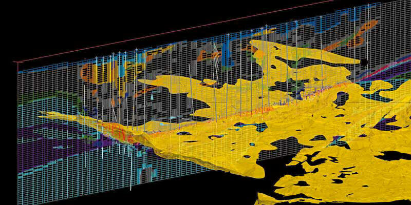
1st July 2021
New tech from Maptek to uncork geology bottleneck30th June 2021
Trimble X7 and Perspective 3D Scanning Solution Garners Three International Design Awards25th June 2021
Bluesky Models Transform Real Estate Marketing with Lunas 3D Visualisations24th June 2021
Creaform Announces the Release of VXelements 9.015th June 2021
Bentley Systems Announces Acquisition of SPIDA, Leader in Utility Pole Structure Management28th May 2021
Trimble Introduces Vegetation Management Solution for Improving Electric Utility Infrastructure Resilience28th May 2021
Sheena Gaynes of Bentley Systems, Incorporated Featured on CRN’s 2021 Women of the Channel List
23rd May 2021
3D GeoInfo and 3D Cadastres – paper deadline extended!12th May 2021
GeoSLAM Technology put to the test in Deep Time isolation experiment12th May 2021
Golden Software Enhances 3D Functionality in Surfer Surface Mapping Package7th May 2021
Bluesky 3D Building Models Strengthen BIM Workflows for Buttress Architects
5th May 2021
BIM Planning and viewing - consistently in 3D stereo: 3D PluraView and ELITECAD make it possible
29th April 2021
Newcastle University Pioneers Hyper-Resolution Flood Risk Modelling using Bluesky 3D Aerial Survey Data
29th April 2021
Automated harmony or destined for discord?
28th April 2021
Bentley Systems Brings Infrastructure Digital Twins to NVIDIA Omniverse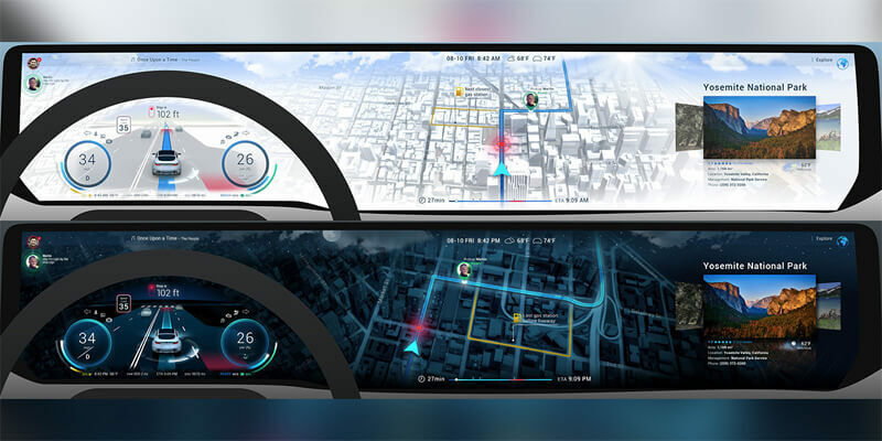
28th April 2021
Unity and HERE Collaborate On Real-Time 3D In-Vehicle Experiences28th April 2021
Bentley Systems Enters into ~ $1.05 Billion Agreement to Acquire Seequent28th April 2021
FARO Announces Two New Global Sustainability Goals to Advance ESG Efforts
28th April 2021
3D at Depth Launches Worldwide Offshore Geophysical Survey Services Business