Share
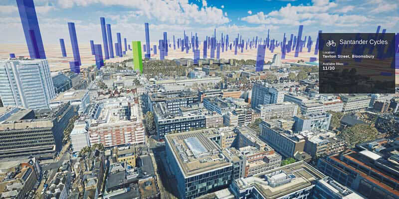
Photorealistic 3D models from Bluesky are being used to produce a new interactive map of London. Created by the Centre for Advanced Spatial Analysis (CASA), part of the Bartlett Faculty of the Built Environment at University College London (UCL), the 3D virtual map brings together live real-time data streams including sensor readings, TFL transport updates, and social media information such as geolocated tweets from Twitter. These are then visualised over the Bluesky MetroVista mesh models to provide a live view of the city. The MetroVista product range uses new aerial mapping technology to simultaneously capture vertical and oblique photography together with laser scanned height measurements. These provide real world context for CASA’s mapping platform which is intended to support uses in environmental monitoring, transport, architecture and urban planning. www.bluesky-world.com


