
VertiGIS Acquires 1Spatial to Expand its Product Portfolio and Global Reach
30th April 2026
VertiGIS Acquires 1Spatial to Expand its Product Portfolio and Global Reach
30th April 2026
VertiGIS Acquires 1Spatial to Expand its Product Portfolio and Global Reach
18th March 2026
Ctrack Brings AI-Enhanced Software Platform To The UK For Intelligent Fleet And Asset Management
3rd February 2026
Beyond Geospatial: Safe Software’s Journey to a Global, AI-Driven Integration Platform
28th January 2026
Eos Positioning Systems Launches “Eos MDM Configurator” Web Tool to Streamline Deployments with MDMs

16th January 2026
Puget Systems and Pix4D Enter into Strategic Collaborative Partnership; Pix4D Names Puget Systems Official Certified Hardware Provider

3rd December 2025
FME by Safe Software Now Runs Inside Snowflake, Delivering Faster, Safer, In-Database Data Integration
14th November 2025
Safe Software Ahead of Target to Reach $250M in Revenue by 2028
30th September 2025
1Spatial Major $1.7M Enterprise Contract with Caltrans
23rd September 2025
Safe Software Launches 24/7 Support For FME Users Worldwide
15th August 2025
Trimble Names Sixteen Construction Technology Startups as Finalists for the Trimble 0-60 Challenge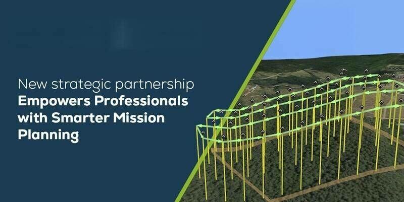
24th July 2025
New Partnership Between Pix4D and UgCS Empowers Professionals with Smarter Mission Planning
9th July 2025
Bentley Systems Introduces New Open API and Self-Service Tools in its Blyncsy Roadway Intelligence Offering to Accelerate the Development of Innovative Applications
19th June 2025
Hexagon releases Luciad 2025, featuring enhanced real-time visuals and new capabilities for defense and intelligence agencies
16th May 2025
Trimble Promotes Connected Workflows At Digital Construction Week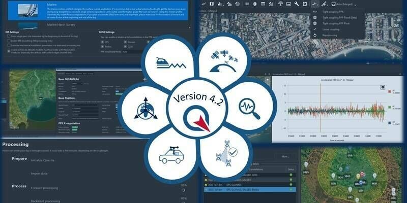
3rd April 2025
SBG Systems Releases Qinertia 4.2 – The Next Evolution in Post-Processing Software
31st March 2025
IQGeo enters exclusive negotiations to acquire AI software developer Deepomatic
19th March 2025
Hexagon unveils new portfolio of physical security solutions
17th February 2025
FREQUENTIS LifeX Software goes Asia: FREQUENTIS advances Malaysia’s emergency response with NG999 project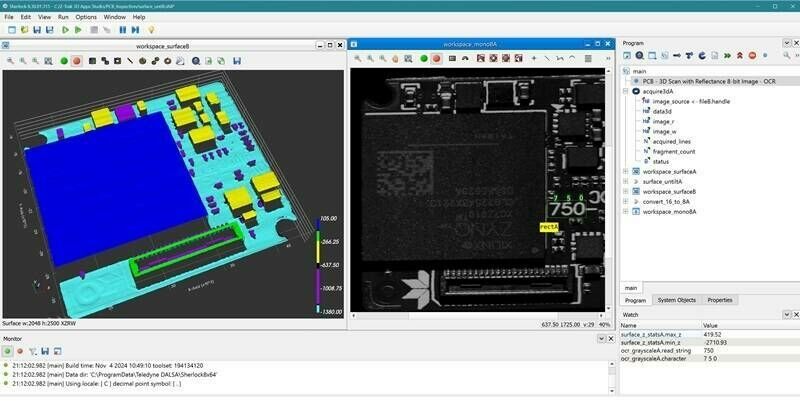
27th November 2024
Teledyne launches Z-Trak 3D Apps Studio software tools for in-line 3D measurement and inspection
13th November 2024
Trimble Announces 2024 Construction Innovation Award Winners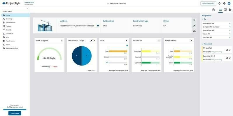
12th November 2024
Trimble Expands Access to Advanced Construction Project Management Capabilities with Free Version of ProjectSight Software
11th October 2024
Golden Software Improves Grapher Scientific Graphing Package for Greater Ease of Use, Faster Learning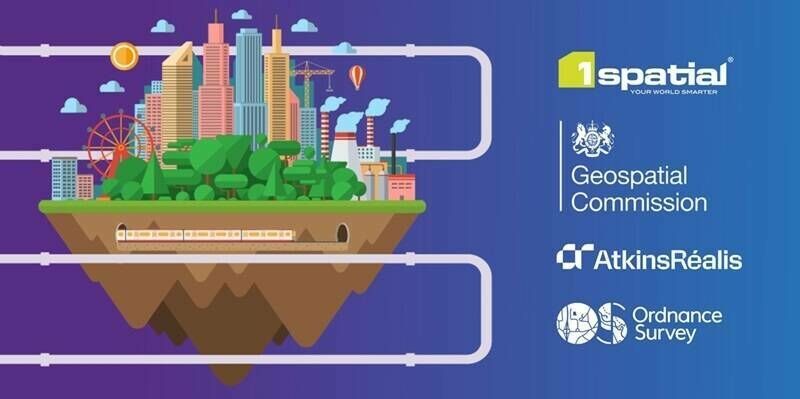
9th October 2024
1Spatial supports AtkinsRéalis and Ordnance Survey to deliver the National Underground Asset Register
27th September 2024
Digitalisation, Efficiency, Innovation: AUTOMA 2024 Tackles Key Challenges in Oil & Gas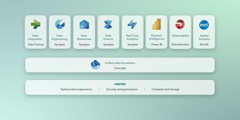
17th July 2024
Esri Partners with Microsoft to Provide Spatial Analytics in Microsoft Fabric
8th July 2024
Geospatial Business Management Software Firm Announces Ambitious Growth Plans
19th June 2024
Introducing HxGN APM from Hexagon: a revolutionary solution to optimise asset management strategies
13th June 2024
Viridien makes sale of Sercel Marlin vessel monitoring and alert system to ExxonMobil Guyana
3rd May 2024
Emlid and Pix4D launch a mobile terrestrial scanning kit to accelerate data capture
16th April 2024
SimActive Integrated with Multi-Camera Systems for Precision Photogrammetry
2nd February 2024
PCS looks to the future with IQGeo’s Network Manager Telecom
30th January 2024
1Spatial Announces new customer multi-year contract with European utility company
10th January 2024
1lntegrate 4.2 Leverages Inheritance for less taxing Rule Building
8th January 2024
Teledyne announces newest version of the Sapera Vision software including Rotated Object Detection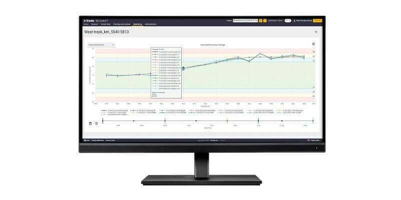
11th October 2023
Trimble Monitoring Software Expands Sensor Support to Deliver Broader Rail and Structural Deformation Analytics for Survey, Monitoring and Construction Professionals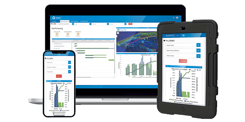
11th September 2023
Topcon introduces Aptix integration platform for heavy civil construction
25th May 2023
Esri Releases New Desktop Software to Easily Synthesize All Sources of Information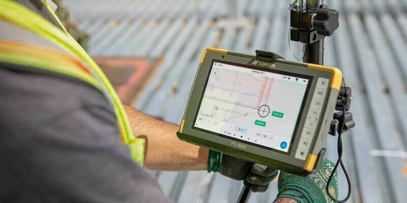
25th April 2023
Topcon Launches Easy-to-Use Digital Layout Software for Fast-Paced Building Construction Industry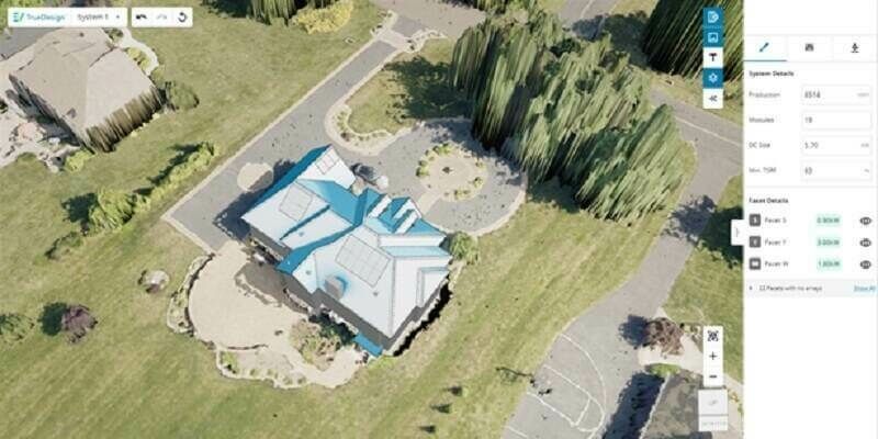
20th April 2023
EagleView Technologies Launches TrueDesign Version 2.0
14th April 2023
Teledyne announces advanced AI enhancements to its image processing software
2nd March 2023
Airservices Australia selects FREQUENTIS mission critical multimedia communication platform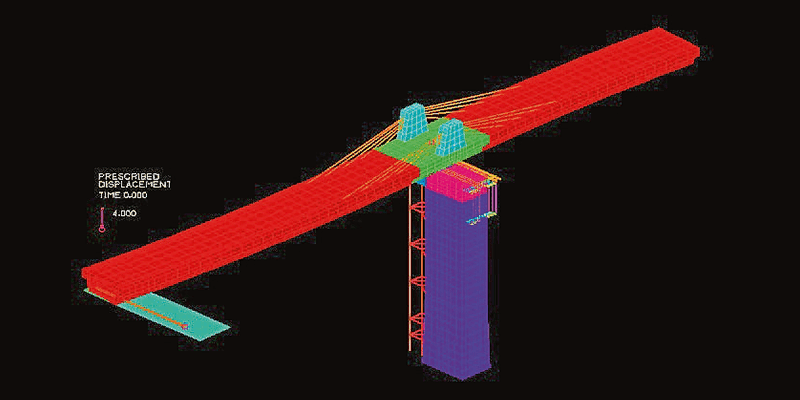
19th July 2022
Bentley Systems announces acquisition of ADINA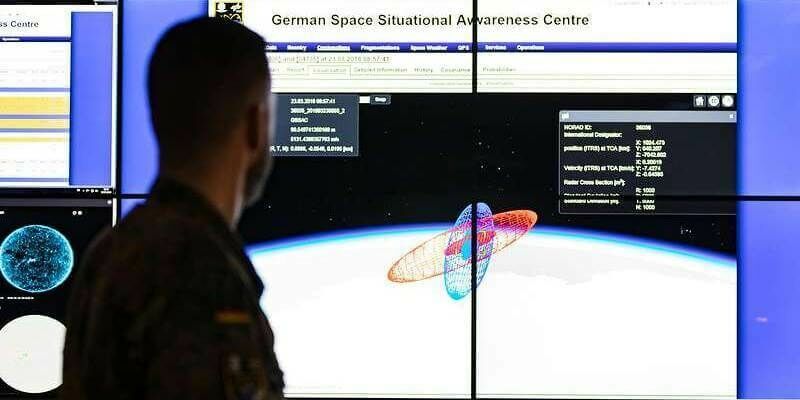
4th May 2022
GMV Provides Core Software for German Armed Forces’ SSA Center12th April 2022
TerraGo joins the Esri ArcGIS Marketplace with GeoPDF Publisher for ArcGIS Pro12th April 2022
1Spatial unveils new survey capabilities in 1Edit