
Esri Helps Bring Up-to-Date Road Closure Information to Google Maps and Waze
16th July 2026
Esri Helps Bring Up-to-Date Road Closure Information to Google Maps and WazeComputer-based tools and techniques for the storage, processing, querying and visualisation of geographic data, most notably in the form of maps, charts and atlases
This topic covers the software systems and services– both desktop, mobile and cloud-based - that are used across the public, private and consumer sectors to store, process and display geographic data, most notably in the form of maps, charts and atlases. It also covers the tools provided by such software and cloud-based services to manipulate, analyse and query that data, as well as to integrate a variety of non-spatial datasets. See also Geographic Information Systems (GIS)
16th July 2026
Esri Helps Bring Up-to-Date Road Closure Information to Google Maps and Waze
15th July 2026
Esri Introduces ArcGIS for ServiceNow, Bringing Location Intelligence into Everyday Enterprise Workflows
14th July 2026
Intermap Expands Aquarius RMA Platform with Property Valuation Analytics and Accelerates European Growth
13th July 2026
Overture Maps Foundation Reaches 50 Members as Industry Converges on Open Data to Ground AI
13th July 2026
TomTom and Transit Technologies partner to deliver enhanced fleet and logistics operations
13th July 2026
Esri and Global Partners Release HydroSHEDS v2 for the Americas
6th July 2026
Waymap and Plowman Craven partner up on trailblazing solutions for wayfinding and geospatial
1st July 2026
Diamond Aircraft Delivers First DA20i Katana Aircraft to AELO Swiss Academy
26th June 2026
Lockheed Martin Partners with European Industry for NATO Next Generation Modelling and Simulation Competition
26th June 2026
Bluesky Launches National Clutter Map to Boost Telecoms Network Planning
24th June 2026
SFL Missions Begins Phase A Study for ESA Moonraker Lunar Mapping Project
15th June 2026
GEO Business 2026 breaks attendance records with 6,200+ professionals
12th June 2026
Arup and Ordnance Survey hit major milestone in development of national heat network zoning model
12th June 2026
Esri’s Jack Dangermond Honored with Award from International Fund for China’s Environment
15th May 2026
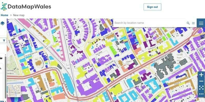
The Welsh Government is leading the way with a single mapping and data platform for Wales – powered by trusted Ordnance Survey data
8th May 2026
Iconic Blackpool Pleasure Beach mapped in unprecedented 3D detail for the first time to aid emergency services
6th May 2026
US Army Corps of Engineers awards Fugro five‑year contract for critical infrastructure mapping
5th May 2026
How Ordnance Survey is bringing together leaders and innovators to explore how location can help tackle real-world challenges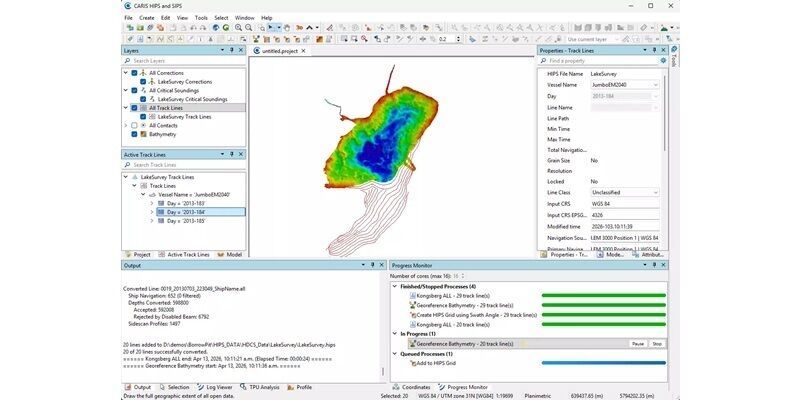
30th April 2026
Teledyne CARIS Releases HIPS and SIPS 13 with Modernised User Interface and Multilingual Support
15-17
Sep
Trade Fair Centre Messe, Munich
INTERGEO 2026, September 15-17, Munich
21st April 2026
Ordnance Survey develops a ready-to-use land and habitat data tool to help with Biodiversity Net Gain

19th April 2026
Association for Geographic Information Takes Centre Stage at GEO Business
16th April 2026
Trimble Applanix POSPac Complete: RTX-Powered, Base Station-Free Surveying for Air, Land and Marine Mapping
15th April 2026
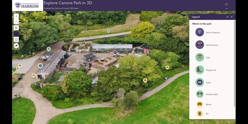
London Borough of Harrow cuts maintenance costs with digital twin
8th April 2026
Blue Marble Geographics and Avenza Systems Unite to Bring Together Complementary Products in a Field to Office Geospatial Platform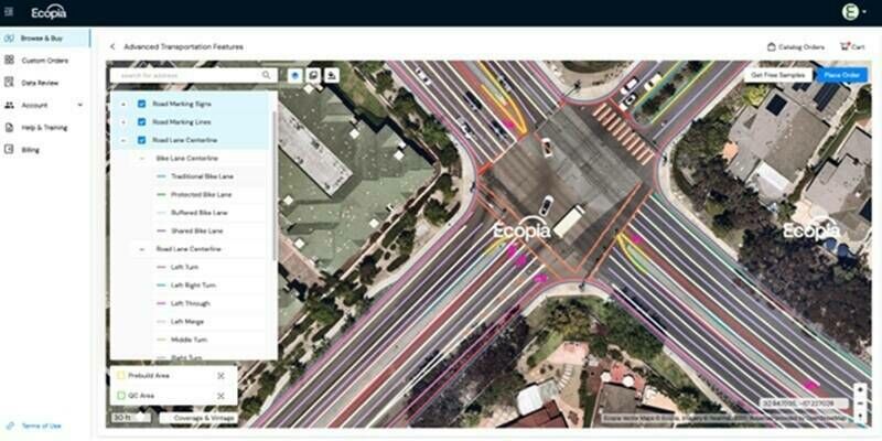
6th April 2026
Ecopia Launches Self-Serve Platform for High-Precision Geospatial Data Downloads
25th March 2026
Innovative comms system will save vital time in multi-agency emergency responses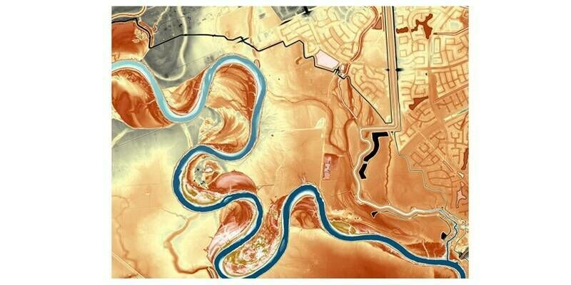
19th March 2026
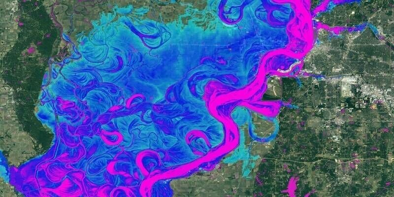
Fugro maps Texas river basins to improve flood resilience
01-03
Sep
Caesar’s Forum Las Vegas USA
Commercial UAV EXPO 1-3 September 2026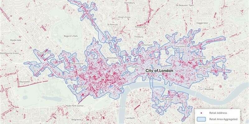
12th March 2026
Ordnance Survey’s new national retail area data confirms London is the country’s biggest shopping destination
11th March 2026
Mapping Critical Infrastructure: How Do You Ensure Accuracy?
5th March 2026
AISPECO Introduces CORE, a Modular Platform for Scalable Airborne Sensor Integration, Reducing Aircraft Installation Complexity
18th February 2026
Esri and Pix4D Launch Real-Time Terrestrial Mapping Workflow
13th February 2026
Association for Geographic Information Announces 2026 Council Changes
22nd January 2026
Accelerating Mapping with Distributed Processing
20th January 2026
Mapping Italy’s future: A first-of-its-kind seagrass mapping project to support ocean health and the blue economy
16th January 2026
Swiss Re integrates Fathom data into its internal view of flood risk
14th January 2026
Open Maps For Europe 2 successfully delivers harmonised cross-border data as 18,000 users download 15,500 datasets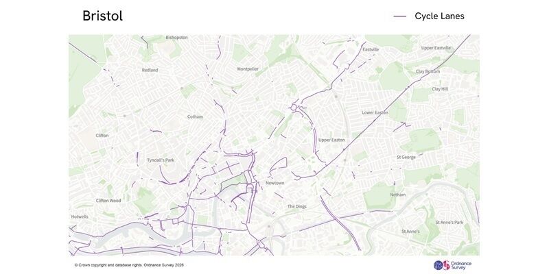
8th January 2026
New national cycle lane data will support local authorities and central Government in promoting Active Travel and public safety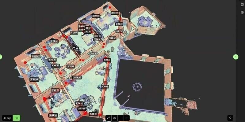
8th January 2026
Pointorama unveils AI floorplan generator that delivers instant, accurate floorplans
6th January 2026
HERE showcases AI-powered map data with Snapdragon Ride at CES 2026
29th December 2025
Intermap Awarded Malaysian Flood Mapping Program
17th December 2025
Open Maps For Europe 2 (OME2) adds five new countries and hydrography theme to final release of high-value data prototype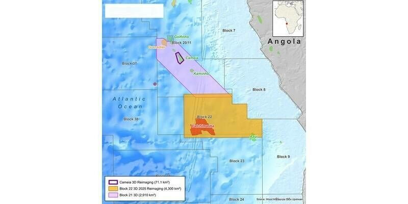
15th December 2025
Viridien announces new seismic reimaging program over block 22 offshore Angola to support upcoming licensing round