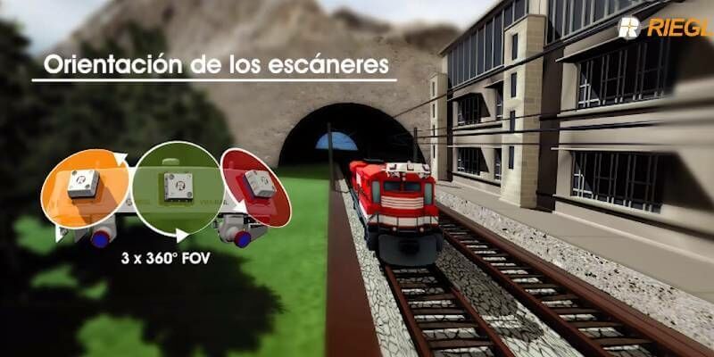
The Riegl VMX-RAIL triple scanner mobile mapping system
13th May 2020
The Riegl VMX-RAIL triple scanner mobile mapping systemThe creation, visualisation and use of three-dimensional representations of real or virtual world terrains, surfaces, elevations and built objects
Three-dimensional models are used increasingly in the public and private sectors and in academic research to visualise and analyse real or virtual world features and objects. This topic encompasses the creation of 3D geometric models from captured spatial data and their use in applications that include architecture, construction, engineering, urban planning, city and infrastructure modelling, transport and utility network planning and management, asset management, entertainment film production, video gaming and the geosciences. Additionally, the topic covers the creation and use of 3D models that make use of Virtual, Augmented and Mixed Reality techniques
13th May 2020
The Riegl VMX-RAIL triple scanner mobile mapping system
8th May 2020
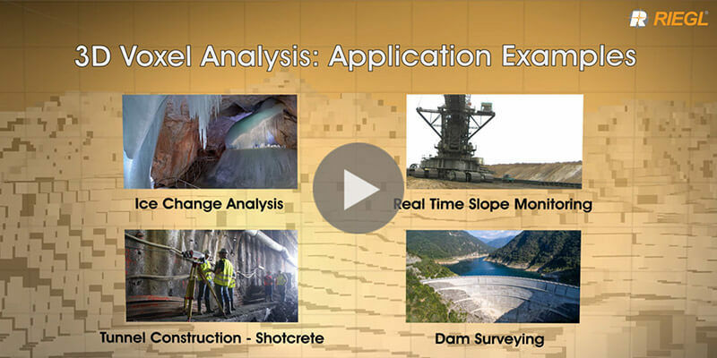
Riegl's new 3D Voxel Analysis Tool within RiSCAN Pro
4th May 2020
MicroSurvey - FieldGenius For Android Point Line
24th April 2020
MicroSurvey - FieldGenius for Android Staking