Share
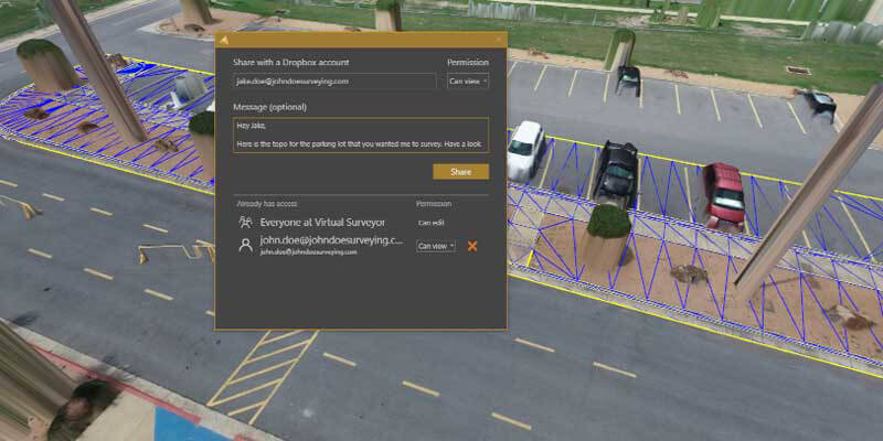
Virtual Surveyor has introduced Dropbox integration in Version 8.0 of its popular drone surveying software. This means Virtual Surveyor users can now access their project files from anywhere while enjoying easy and affordable collaboration with team members and file sharing with external clients – even in low-bandwidth situations. Virtual Surveyor is a powerful surveying software that bridges the gap between drone photogrammetric processing applications and engineering design packages, enabling surveyors to derive topographic information from drone data needed by engineers for construction, mining, and excavation projects. The software presents an interactive onscreen environment with drone orthophotos, digital surface models (DSMs), and/or LiDAR point clouds where users generate CAD models, create cut-and-fill maps, and calculate volume reports. www.virtual-surveyor.com


