Share
High in the Peruvian Andes, a pilot study to test remote sensing technology for far-flung tailings dams using a combination of satellite Earth observation, in-situ sensors and numerical modelling has just come to a close. Craig Goff explains the project and the pioneering DAMSAT system, which could be a major contributor to dam safety in the future
Tailings dams are vital for storing toxic waste from mining operations worldwide, but the likelihood of them failing is higher than for water dams. Tailings dams are often found in remote locations and frequently in low-income countries that do not have the resources to monitor them effectively. This combination can be a recipe for disaster, causing catastrophes such as the failure of the Brazilian Brumadinho dam in 2019, which released 12 million cubic metres of mining waste, killing around 300 people.
Satellite Earth observation (EO) data products offer new solutions to the challenges of managing remote dams faced by owners and regulators. The data is available around the world, including for remote and inaccessible locations, is provided promptly and covers wide areas at different frequencies. And using EO-based methods can complement, or sometimes even replace, traditional methods, such as physical site surveys, which makes them cheaper and easier to use.
In 2018, HR Wallingford partnered with the UK Space Agency and led an international team to develop DAMSAT (DAm Monitoring from SATellites). DAMSAT can analyse the past condition of a dam, monitor what is happening now and forecast potential scenarios.
DAMSAT works by spotting changes to a dam’s normal behaviour patterns to detect dangerous movement and leakage, and uses a variety of satellite EO data products to identify behaviour patterns, including interpreting data from Interferometric Synthetic Aperture Radar (InSAR) and Global Navigation Satellite System (GNSS). The DAMSAT team mostly chose automated, easily available and consistently good quality InSAR data from the Sentinel-1 satellite, but also incorporated high-resolution supervised InSAR analysis, based on COSMO-SkyMed (CSK) satellite images, because of their high data density, which can reach tens of thousands of points per km2.
The data is then used in different downstream workflows to trigger warnings when danger signs are detected. For instance, DAMSAT tracks the surface movement of the dam and the surrounding area, then sends an alert when movement tolerances are exceeded. Downstream leakage and pollution incidents are also monitored using multispectral data that identify changes in vegetation health and the presence of iron oxide.
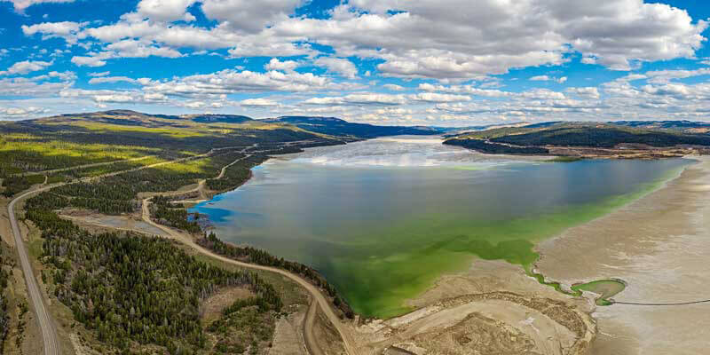
To ensure water is kept away from tailings dam embankments (to minimise saturation and subsurface drainage), the team created a change detection algorithm using statistical measures of similarity between multivariate data, combined with an image change detection algorithm using the Normalised Water Difference Index. But, of course, optical satellite imagery has limitations and clouds obstructing the view and the temporal resolution may not prove enough to identify small changes such as releases of material that are quickly repaired.
The weather damage forecast
Forecasting the impact of rainfall is another vital safety measure for dam safety, because overtopping of dams – which occurs when the volume of water held back by the dam exceeds the dam’s spillway limit – is one of the main causes of dam failure. To predict water levels, DAMSAT incorporates hydrological modelling of drainage into the reservoir and water levels behind the dam driven by five and 10-day weather forecasts from either the National Oceanic and Atmospheric Administration (NOAA) or the European Centre for Medium range Weather Forecasting (ECMWF).
Usefully, DAMSAT also displays information about the possible impacts downstream if there is a dam breach. To do this the team used numerical models, such as EMBREA-MUD and the Life Safety Model (LSM). EMBREA-MUD simulates the movement of non-Newtonian fluids, such as the sludge from tailings dam, to simulate the growth of a breach. The LSM, an agent-based model, helps with the development of emergency plans by assessing the risks to people and evacuation times for various scenarios. The LSM represents the behaviour of each individual person, vehicle and building and their interactions with the floodwater and sludge.
Alongside its EO and modelling components, DAMSAT can incorporate data from any other Internet of Things (IoT) sensors that are already in place, such as piezometers and movement sensors, to enable real-time measurement and for independent calibration and validation of measurements.
All this information is gathered in a web server, that also hosts the running of the DAMSAT processes, before being offered to the user as an application. The application not only generates safety alerts, but also provides an easy platform for users to interrogate and analyse the performance of their dams. And DAMSAT is not a one-size-fits all solution, but rather it can be adapted to meet the needs of the user by offering a series of modules. This may mean incorporation of historical monitoring device data streams, higher or lower resolution data, general surveillance records of the dam or more targeted monitoring of an existing area of concern.
Testing
After its development, DAMSAT was tested at 31 dams, tailings dams and tailings deposit slopes in the Cajamarca and Pasco regions of Peru, with the project coming to a close in March this year.
Peru was a great choice to test the new system as it has a long history of mining. It has some of the largest reserves in the world of many metals including silver, zinc and gold and the largest reserves of any country in South America. Abandoned and illegal mines are a major problem in Peru, and cause real problems with monitoring.
To test the system, the DAMSAT team worked with the Peruvian institutions responsible for areas related to dam monitoring and EO technologies. These included: the National Space Agency; mining authorities; regulators in the water and environmental sectors; and local authorities and allowed the team to refine the system to best suit the end users, identify improvements before it was complete, and ensure the final product received end-user approval.
During the pilot study, DAMSAT identified leakage incidents at tailings dams and provided information that helped in-country partners to analyse minor movement incidents.
Following the initial trial for tailings dams, the pilot was also extended to include water dams. Whilst the statistical risk of failure for these dams is lower, there are many more of them and are often in hard-to-reach locations. Certainly, these dams represent a risk to populations downstream, as was seen recently with near-misses at Oroville in the US in 2018, and at Toddbrook Reservoir above the UK town of Whaley Bridge in 2019.
So what’s next for DAMSAT? Given the success of the trials in Peru, DAMSAT is now available for commercial use, for both tailings and water dams. Systems are currently under construction for all the large reservoirs owned by a major UK water company, and for other dam owners globally. It’s hoped that the leading-edge technology will increase the effectiveness, and drive down the costs of dam monitoring, particularly important in some of the world’s most underdeveloped nations. And, if this aim can be achieved, then tragedies on the scale of Brumadinho may be averted in the future.
Craig Goff is a technical director at HR Wallingford (www.hrwallingford.com)


