Bluesky MetroVista Mesh Models Underpin Dynamic Map of London
14th April 2021
Bluesky MetroVista Mesh Models Underpin Dynamic Map of LondonThe creation, visualisation and use of three-dimensional representations of real or virtual world terrains, surfaces, elevations and built objects
Three-dimensional models are used increasingly in the public and private sectors and in academic research to visualise and analyse real or virtual world features and objects. This topic encompasses the creation of 3D geometric models from captured spatial data and their use in applications that include architecture, construction, engineering, urban planning, city and infrastructure modelling, transport and utility network planning and management, asset management, entertainment film production, video gaming and the geosciences. Additionally, the topic covers the creation and use of 3D models that make use of Virtual, Augmented and Mixed Reality techniques
14th April 2021
Bluesky MetroVista Mesh Models Underpin Dynamic Map of London
6th April 2021
Call for papers and open registration announcement
29th March 2021
Bentley Systems Issues Call for Nominations for the 2021 Going Digital Awards in Infrastructure25th March 2021
Bentley Acceleration Initiatives Launches OpenTower iQ, a Digital Co-venture with Visual Intelligence and Aeroprotechnik for 5G Towers
17th March 2021
Bentley Systems Enters into ~ $1.05 Billion Agreement to Acquire Seequent12th March 2021
Bluesky 3D Building Models Bring Architectural Studies Online During Lockdown9th March 2021
3D at Depth Launches Worldwide Offshore Geophysical Survey Services Business4th March 2021
Creaform Releases the HandySCAN 3D | SILVER Line-Up2nd March 2021
Golden Software Enhances Surfer Visualization Functionality for Deeper Data Insights2nd March 2021
Ayres Acquires True View 620 3D Imaging System2nd March 2021
HERE releases 3D city models for industries to build reality-based applications and simulations
1st March 2021
thinkWhere Wins Contract to Open Up Access to European Mapping1st March 2021
Newcastle University Pioneers Hyper-Resolution Flood Risk Modelling using Bluesky 3D Aerial Survey Data26th February 2021
Leica Geosystems Offers Mobile, Agile 3D Reality Capture Solution for Boston Dynamics Spot25th February 2021
Scientists Calculate Juneau Icefield Melting with 2D, 3D Glacier Models
24th February 2021
Redefining affordable high-quality drone LiDAR/Imagery sensors
12th February 2021
Bluesky 3D Building Models Drive Efficiency and Collaboration in Water Construction10th February 2021
Fugro's Virtual 3D Network Model Helps Keep Powerlines Safe In Tasmania7th February 2021
10,000 tons a day: renovating a major runway at Brussels Airport
5th February 2021
Recordings are Now Available for the RIEGL Ultimate LiDAR January Webinar Series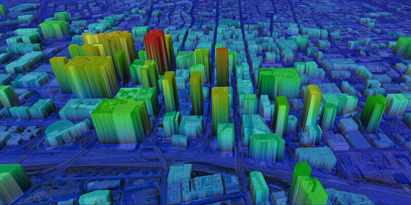
14th January 2021
UP42 Partners with Intermap to Bring High-Resolution Elevation Data to UP42’s Geospatial Marketplace
14th January 2021
Shell Deepwater Selects Bentley’s iTwin Platform for Project Delivery
14th January 2021
Pix4D launches new ground image capture app for 3D modelling with the iPad Pro and iPhone 12 Pro
14th January 2021
3D PluraView Monitor product family expanded – new 22" Full-HD Model
14th January 2021
UK Firm Invests in Revolutionary 3D Ground Probing Radar System

13th January 2021
Bentley Systems announces appointments of Chief Marketing Officer
13th January 2021
Golden Software Enhances Surfer Visualization Functionality for Deeper Data Insights
29th December 2020
Leica Geosystems announces new Leica Cyclone ENTERPRISE Project Management Hub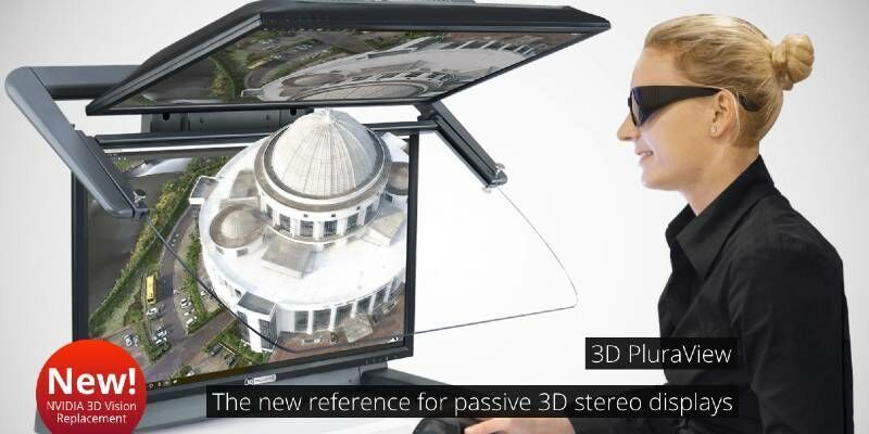
2nd December 2020
The 3D PluraView stereo monitor family – Meeting the highest requirements for Geospatial applications30th November 2020
Autodesk Acquires Spacemaker: Offers Architects AI-powered Generative Design to Explore Best Urban Design Options27th November 2020
Walter Automobiltechnik chooses automated quality control solutions from Creaform26th November 2020
Bluesky 3D Maps Enhance Ambiental’s Future Climate Change Flood Risk Model16th November 2020
Siradel receives Smart 50 Award at Smart Cities Connect

13th November 2020
Illinois Institute of Technology to Establish Trimble Technology Lab for Civil, Architectural, and Environmental Engineering12th November 2020
New digital twin technologies from Bloc Digital to reduce time and cost of satellite development lifecycle
10th November 2020
RIEGL’s Ultimate LiDAR Webinar Series: November 2020
10th November 2020
Pix4D launches new ground image capture app for 3D modeling with the iPad Pro and iPhone 12 Pro
29th October 2020
Bluesky Laser Maps Quantock Hills to Reveal Archaeological Past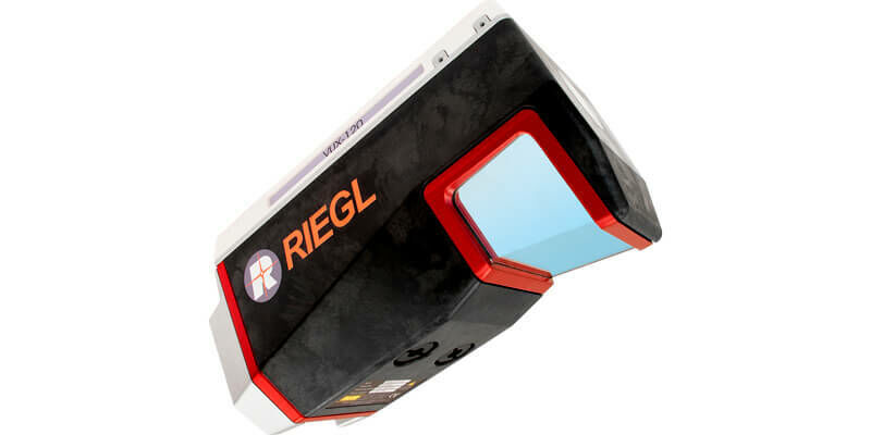
29th October 2020
Riegl presents new products at Intergeo 202029th October 2020
Golden Software Improves Surfer File Handling for Faster Mapping29th October 2020
CGG GeoSoftware Launches Interactive Well Path Planning Technology29th October 2020
Esri Acquires nFrames to Enhance Its 3D Capabilities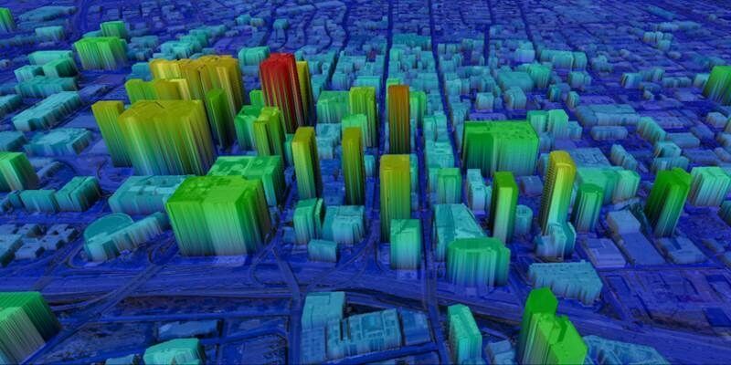
29th October 2020
UP42 Partners with Intermap to Bring High-Resolution Elevation Data to UP42’s Geospatial Marketplace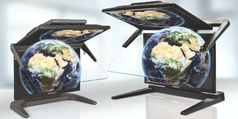
27th October 2020
3D PluraView Monitor product family expanded – new 22″ Full-HD Model21st October 2020
FutureOn Secures Investment from the Bentley Acceleration Fund to Accelerate Oil & Gas Digitalization