Share
Leica Geosystems, part of Hexagon, leader in 3D scanning technology announced a reality capture solution for a variety of industries.
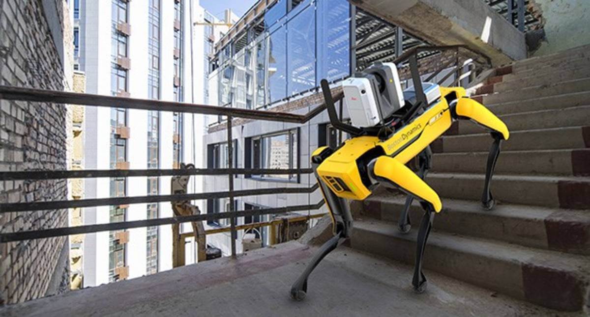
By combining Boston Dynamics agile mobile robot Spot with the industry-proven Leica RTC360 3D laser scanner, scanning time spent by human operators is significantly reduced by programming the devices to repeat automated scanning paths through sites. This requires minimal monitoring by the user, allowing for increased scanning efficiency, productivity, and flexibility when planning reality capture tasks. Professionals in many different industries such as construction, manufacturing, facility management, public safety, defence, media and entertainment or any other industry with autonomous scanning needs can benefit from programmed scanning tasks, especially for locations that must be repeatedly scanned for up-to-date digital twins.
Whenever accurate, reliable, and up-to-date 3D data is needed, the integration of Leica Geosystems’ RTC360 technology onto the Spot mobile robot provides significant additional customer value in a variety of industries and jobsite scenarios where flexible and agile laser scanning workflows are required. Spot’s ability to cover many types of terrain and the RTC360’s VIS (Visual Inertial System) creates this solution. While mounted atop Spot, the Leica RTC360’s VIS technology uses five cameras to track the scanner’s movement within the site between the scans. The VIS system provides an unmatched level of accurate and automated in-field pre-registration to streamline the reality capture process. While scanning, the user only needs to trigger each scan remotely via mobile device while Spot and the RTC360 navigate the programmed scanning path.
The RTC360’s VIS technology creates an easier, faster scanning workflow. For example, users can essentially “walk” Spot through a site by using a mobile device to control the RTC360 scanner. This allows users to speed up routine as-built documentation tasks and capture data accurately, quickly, and frequently. It also automatically combines captured scan data from station to station as it knows its location in space, resulting in a completely pre-registered point cloud of the entire scanned site, which makes final data processing in the office much easier.
Subscribe to our newsletter
Stay updated on the latest technology, innovation product arrivals and exciting offers to your inbox.
Newsletter

