When remote sensing meets Artificial Intelligence & GIS
20th August 2021
When remote sensing meets Artificial Intelligence & GIS
20th August 2021
When remote sensing meets Artificial Intelligence & GIS


19th August 2021
The importance of grids, spheroids and datums
19th August 2021
Data, data, data: the future of surveying
19th August 2021
A new approach to geo-information and intelligence


19th August 2021
AsteRx SB3: next-gen GNSS receiver in a ruggedized enclosure19th August 2021
New Trimble GEDO GX50 Laser Scanning System Introduced
19th August 2021
Spectra Geospatial Introduces Next Generation of Field Solutions19th August 2021
Eos Positioning Systems announces the Eos Bridge19th August 2021
Mutoh Europe appoints General Manager Sales19th August 2021
Catherine Jestin joins Airbus’ Executive Committee as EVP Digital and Information Management
19th August 2021
Fotech appoints new CTO to scale up the business
19th August 2021
Nigel Clifford elected as President of the Royal Geographical Society (with IBG)19th August 2021
HERE appoints Jason Jameson as Senior Vice President (SVP) and General Manager for Asia Pacific19th August 2021
Trimble X7 and Perspective 3D Scanning Solution Garners Three International Design Awards
19th August 2021
Topcon Positioning GB management Systems Accredited to ISO9001:2015
19th August 2021
UAVOS Demonstrates its Customer UVH-500 Cargo Drone19th August 2021
New Partnership creates the world’s most capable commercial SAR-Elettro Optical satellite constellation19th August 2021
AWS Announces General Availability of Amazon Location Service19th August 2021
Thuraya Launches SatTrack, a Tracking and Monitoring Service for its Maritime Customers19th August 2021
RMSI partners with Enzen UK to support Scotia Gas Network (SGN), UK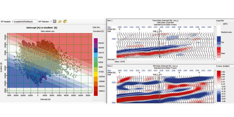
19th August 2021
CGG Launches GeoSoftware 11.0 Integrated Portfolio for Reservoir Characterization
19th August 2021
senseFly Introduces eBee TAC Fixed-wing UAS19th August 2021
xyzt.ai becomes a member of the Open Geospatial Consortium19th August 2021
Schneider Electric Announces New Features for ArcFM Editor XI19th August 2021
Satellite Vu raises £3.6m for Thermal Satellite Insights to Support the Green Industrial Revolution19th August 2021
Airbus completes integration of 3rd Copernicus Sentinel-219th August 2021
North Dakota Department of Transportation Selects GeoCue True View LIDAR/Imaging Technology19th August 2021
Lincad Appoints Eltron Technologies as North American Sales Agent
19th August 2021
Cobham SATCOM launches XTR – a new generation antenna platform19th August 2021
Tallysman introduces eXtended Filtering to its TW3900 Family of Accutenna Precision Antennas19th August 2021
Septentrio announces partnership with XenomatiX19th August 2021
Northamptonshire Fire and Rescue Service adopts GIS software for Risk Analysis19th August 2021
GMV develops a new maritime Galileo receiver19th August 2021
Creaform Announces the Release of VXelements 9.19th August 2021
Trimble Expands its Geospatial Automated Monitoring Portfolio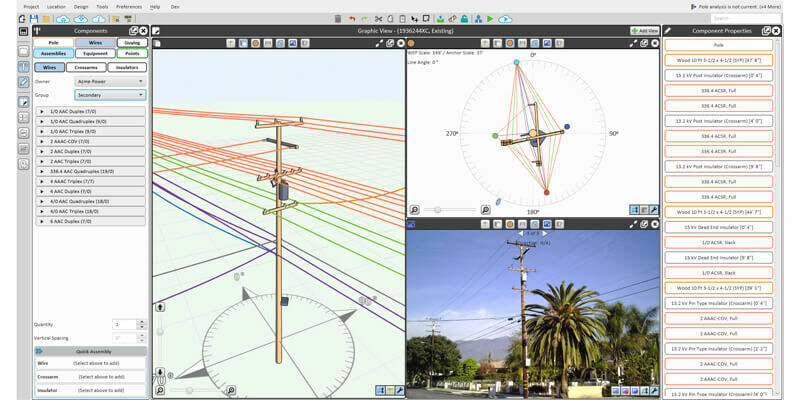
19th August 2021
Bentley Systems Announces Acquisition of SPIDA19th August 2021
EUMETSAT becomes largest operator of Sentinel missions in Copernicus 2.0 agreement with European Commission19th August 2021
FARO Expands Digital Twin Product Suite - Acquires HoloBuilder19th August 2021
Hexagon expands its smart digital reality capabilities with the acquisition of Immersal19th August 2021
Visiontrack Makes First US Acquisition To Drive Video Telematics Growth19th August 2021
GeoSLAM Launches New Underground Mining Solutions19th August 2021
1Spatial Strengthens Strategic Partnership with Ordnance Survey19th August 2021
UCL Virus Watch Study Tracks Location of Volunteers During Covid-19 pandemic19th August 2021
Delaware partners with VertiGIS to expand Geospatial Asset Management capabilities19th August 2021
Airborne Snow Observatories takes delivery of the RIEGL VQ-1560 II-S LiDAR System19th August 2021
Globalstar SPOT Gen4 to Provide Tracking and Safety for Thousands of Adventure Travellers19th August 2021
HERE announces mobile LiDAR data and more accessible within Bentley’s Orbit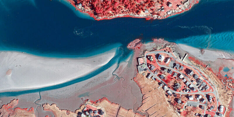
19th August 2021
Boston University Uses Bluesky Aerial Photomaps to Research Climate Change
19th August 2021
Esri ArcGIS Pro certified for 3D stereo visualization with 3D PluraView monitors19th August 2021
SPH Engineering announces the update of UgCS for UAV-based LIDAR mapping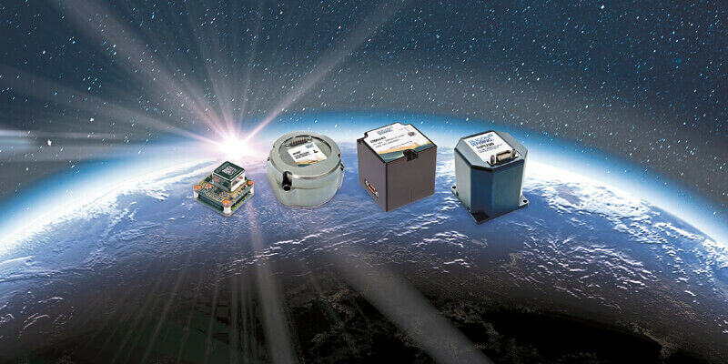
19th August 2021
Silicon Sensing Showcases New, Space-focused Inertial Measurement Products at Space-Com19th August 2021
NTIA Creates First Interactive Map to Help Public See the Digital Divide Across the Country
19th August 2021
SimActive Software Used with both LiDAR and Imagery to Map Venice Beach19th August 2021
iGPSPORT’s latest cycling computer uses u-blox M10 to deliver ultra-long performance