Presagis Launches Cloud-Based Velocity 5D Digital Twin Production Platform
1st March 2023
Presagis Launches Cloud-Based Velocity 5D Digital Twin Production Platform
1st March 2023
Presagis Launches Cloud-Based Velocity 5D Digital Twin Production Platform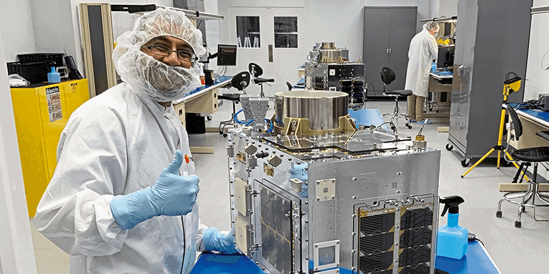
1st March 2023
Space Flight Laboratory (SFL) Awarded Development and Production Support Contract for 15 Additional Hawkeye 360 Radio Frequency Geolocation Microsatellites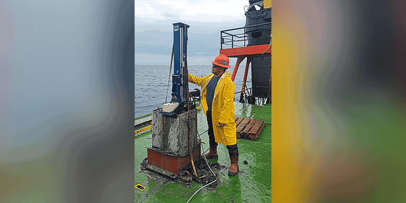
1st March 2023
TDI-Brooks Completes Third Geotechnical Program in the Black Sea for Denar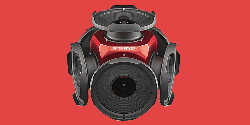
1st March 2023
Teledyne Announces New Ladybug6 Cameras for High Accuracy 360-Degree Spherical Image Capture
1st March 2023
Synspective and GCRS Announce Partnership for SAR Satellite-Based Risk Analysis Solutions in South Asia
1st March 2023
Ageagle Introduces the New Ebee Vision Intelligence, Surveillance and Reconnaissance Drone
1st March 2023
New Geospatial Data Projects to Shape the Future of Land Use
1st March 2023
Ubotica and Open Cosmos Agree to Launch AI Centric Satellite
1st March 2023
GMV Assesses Impact of Turkey Earthquake From Space
1st March 2023
1Spatial Launches the Most Disruptive Traffic Management Planning Solution in 30 Years

1st March 2023
Austrian Federal Railways and Frequentis Collaborate on Hanger-based Drone Operations
1st March 2023
Bluesky Geospatial Launches Metrovista 3D Aerial Mapping Program in U.S.
1st March 2023
Terradepth Announces Commercial Launch of Absolute Ocean Marine Data Management Platform
1st March 2023
New Maps Platform Positions TomTom for Accelerated Growth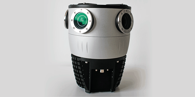
1st March 2023
Mosaic Announces Integration of High Resolution 360º Camera With Laser Scanning Solutions
1st March 2023
Esri Enters into Agreement with United Nations Population Fund to Help Modernize National Statistics Programs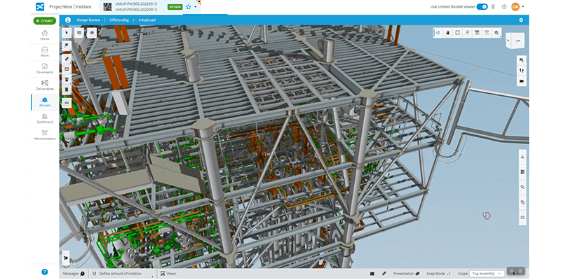
1st March 2023
Bentley Systems Announces Bentley Infrastructure Cloud, Powered by Itwin
1st March 2023
The New VXintegrity Software Platform: Surface Damage Assessment Modernized
1st March 2023
Trimble Introduces Innovative Rail Module for Real-Time Monitoring Software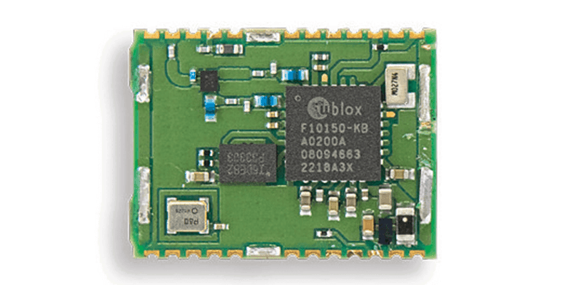
1st March 2023
U-Blox Announces a Secure High-Precision Dual-Band GNSS Timing Module
1st March 2023
Cadcorp Expands Cloud Options for Desktop GIS, Web Mapping and Spatial Data in G-Cloud 13
1st March 2023
Field is the Name of One of Europe’s Largest Geodata, Collection and Analysis Company
1st March 2023
Axians France Enters Into a Partnership With Pix4D
1st March 2023
Silicon Sensing Brought Latest Inertial Technology to Space Tech Expo, Europe
1st March 2023
Esri UK Provides Mapping Expertise for Department for Education’s Major New Climate Project
1st March 2023
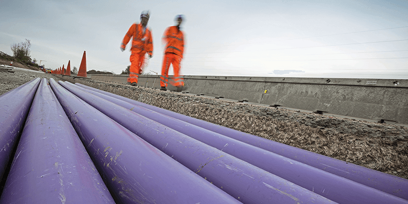
Fugro Awarded Major Offshore Wind Contract with Energinet to Support Denmark’s Renewable Energy Goals
1st March 2023
UP42 Launches Arcgis Pro Add-in as Part of Esri Partner Network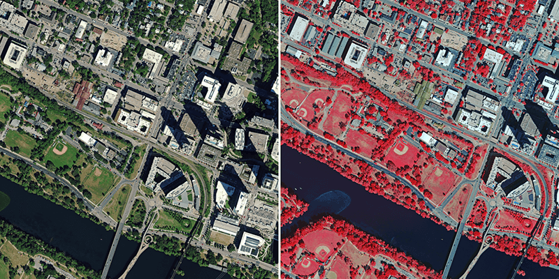
1st March 2023
Hexagon to Update Aerial Data of Eight U.S. States at Six-Inch Resolution in 2023 for the Hxgn Content Program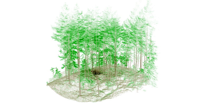
1st March 2023
Mobile LIDAR’s Role in Bringing ‘Industry 4.0’ to Norwegian Forestry


1st March 2023
Digital transformation and land administration
1st March 2023
Four ways to better connect, handle and share our captured data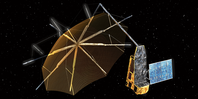
1st March 2023
Swedish Space Corporation to Support ESA’s Next Earth Explorer Mission
1st March 2023
Climate Change Monitoring: CUBE4ENVSEC Growing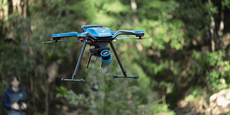
1st March 2023
Emesent Launched Three Time Saving Products for Geospatial Professionals
1st March 2023
The Space Partnership – A coalition for growth
1st March 2023
Building effective climate resilience information systems
1st March 2023
CompassData Appoints Kate Schlatter as New CEO
1st March 2023
Aeronautics' board of directors appoints Dan Slasky as CEO of the Aeronautics Group
1st March 2023
Paul Walker Will be Leading TDI's Geotechnical, Geochemical, and Environmental Labs as Director of Laboratory Operations
1st March 2023
Qammer H. Abbasi awarded Royal Academy of Engineering Fellowship with Celestia UK
1st March 2023
Change in leadership at GAF AG – Dr Gernot Ramminger named new Managing Director

1st March 2023
The all-new Mesa Pro Rugged Tablet by Juniper Systems is now available
1st March 2023
New Trimble TerraFlex Software Edition Simplifies GIS Data Capture
1st March 2023
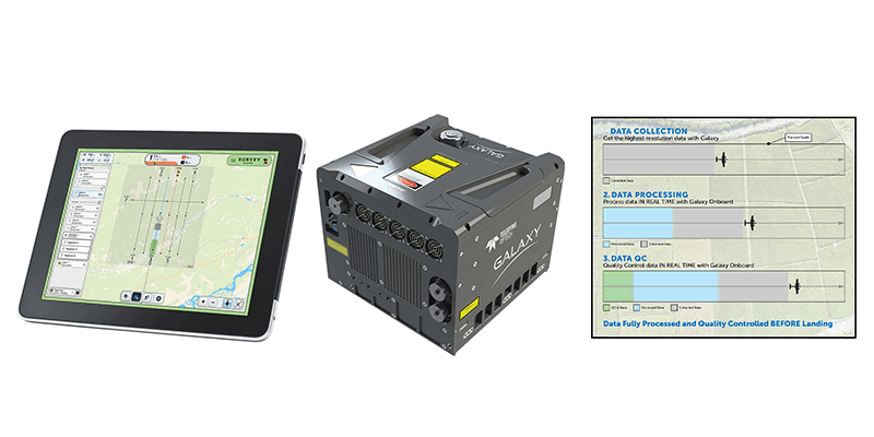
Teledyne Geospatial revolutionizes airborne lidar ROI with Galaxy Onboard: a real-time workflow solution


1st March 2023
The MUDDI Path Towards a Clearer Underground
1st March 2023
BAAM.Tech Named North American Distribution Partner for RIEGL USA Mobile Laser Scanning Solutions
1st March 2023
VisionTrack Launches Groundbreaking AI-Powered Video Analysis
1st March 2023
Integrated GIS, Web Mapping and Spatial Data for Peel L&P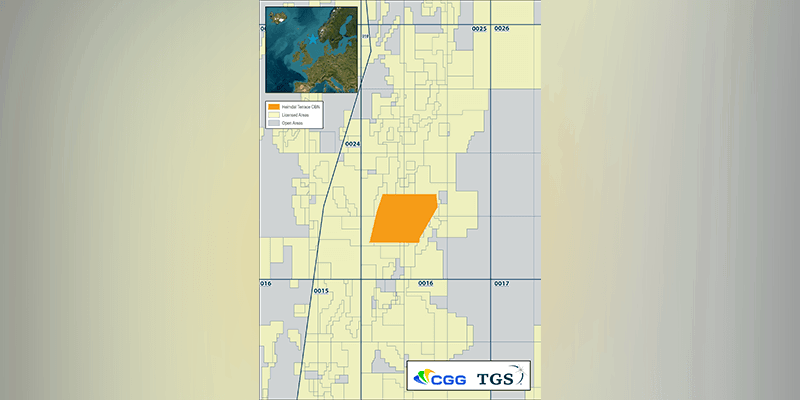
1st March 2023
CGG And TGS Announce a Dense OBN Survey in Balder And Ringhorne Areas of Norwegian Continental Shelf (NCS)
1st March 2023
Kongsberg Nanoavionics Officially Opened its Mait Expansion Facility, Doubling Overall Production Capacity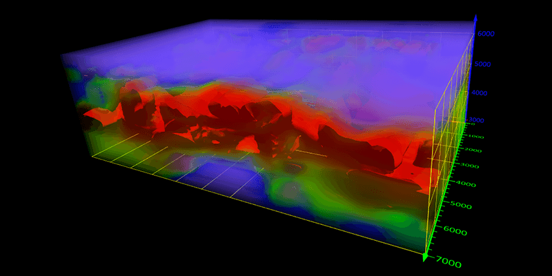
1st March 2023
Golden Software Adds Powerful New 3D Subsurface Visualization Functionality to Surfer Surface Mapping Package
1st March 2023
AirWorks and Datasight Announce Strategic Partnership for More Efficient Map Production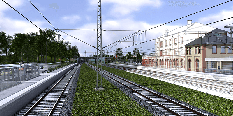
1st March 2023
Hexagon Adds Speed, Scalability and Automation to Digital Twin Creation With the Acquisition of LocLab
1st March 2023
Aero-Graphics Purchases Two 4th Generation Ultracam Eagle 4.1 Aerial Cameras
1st March 2023
Geoteric Announced World-First Software Release
1st March 2023
Immervision Partners With ModalAI to Offer a Complete Drone Vision Solution
1st March 2023
Leica Geosystems Announces Performance Upgrades for Airborne Deep Bathymetric Surveys
1st March 2023
Intermap Announces $3.1 Million Contract with Multiple European Insurers