Share
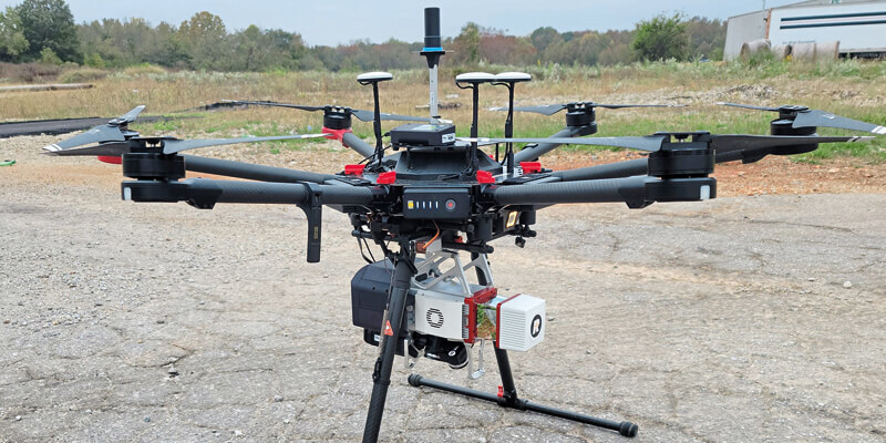
North Dakota Department of Transportation recently acquired a GeoCue True View 640 3D Imaging System (3DIS) for their UAS program. GeoCue’s True View 3D Imaging Sensors allow for both drone LIDAR and imagery to be collected in a single flight on most UAS platforms. The simultaneous data collection, bundled fusion processing software and data management package offers a fully integrated solution giving NDDOT a significant advantage over traditional LIDAR/camera systems as they can single-pass collect, process, and deliver high quality fused 3D data without leaving the True View ecosystem. www.geocue.com


