Share
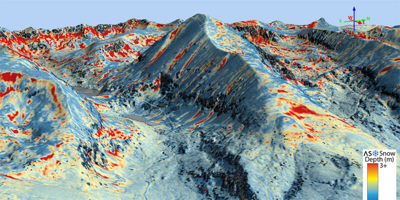
Airborne Snow Observatories has taken delivery of one of the first in North America cutting-edge RIEGL VQ-1560 II-S airborne laser scanners, just as the ASO program at NASA pioneered the use of the first of RIEGL’s dual laser scanner, the LMS-Q1560 in 2013. This new LiDAR system, with its doubled laser power and high pulse frequency, will allow ASO to achieve its needs far more efficiently to uniquely measure snow water equivalent across extensive mountain basins. ASO is a public benefit corporation that was created via technology transfer from the NASA Jet Propulsion Laboratory to continue and expand ASO operational snow mapping and runoff forecasting to the world’s mountains. Through coupling of RIEGL LIDAR, imaging spectrometer data, and physical modeling, ASO Inc. maps mountain snow depth, snow water equivalent, and snow albedo. www.riegl.com


