Share
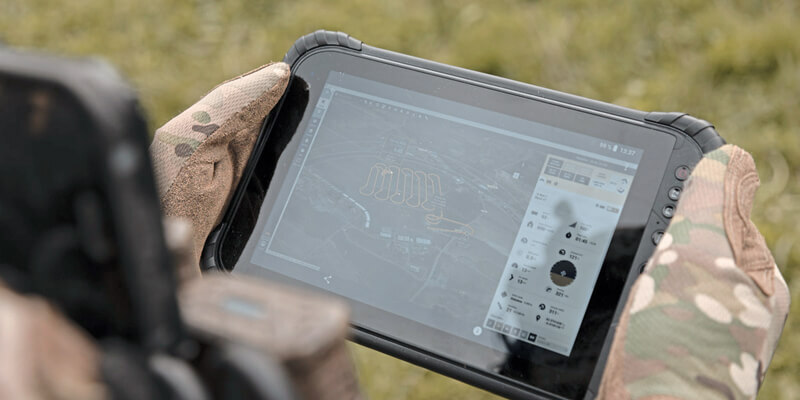
senseFly announced the launch of eBee TAC, an advanced fixed-wing Unmanned Aircraft System (UAS) optimized for covert tactical mapping operations in defence, security and governmental sectors. The eBee TAC offers active field personnel access to accurate and reliable location data and maps, delivering the field intelligence and situational awareness needed to act with confidence and precision across rapidly changing environments. More importantly, the eBee TAC is fully National Defense Authorization Act (NDAA) compliant. At just 1.6 kg (3.5 lbs), eBee TAC is a lightweight, ultra-portable and robust solution specially designed for tactical mapping and analysis in defense applications and its product platform is currently employed by U.S. forces. www.sensefly.com


