Share
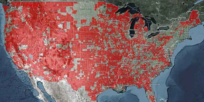
The U.S. Department of Commerce’s National Telecommunications and Information Administration (NTIA) released a new publicly available digital map that displays key indicators of broadband needs across the country. This is the first interactive, public map that allows users to explore different datasets about where people do not have quality Internet access. The public “Indicators of Broadband Need” tool puts on one map, for the first time, data from both public and private sources. It contains data aggregated at the county, census tract, and census block level from the U.S. Census Bureau, the Federal Communications Commission (FCC), M-Lab, Ookla and Microsoft. www.ntia.gov


