Share
Nick Klenske reports on how precise positioning is helping protect a unique bird habitat in Northern Ireland from an invasive species of plant
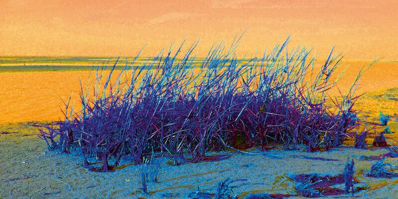
Not only is Northern Ireland’s Strangford Lough the largest inlet in the British Isles, it’s also one of the most ecologically diverse. Home to an abundance of flora and fauna, the lough holds the distinction of being Northern Ireland’s first Marine Conservation Zone, and tourists flock to the area for its outstanding fishing and scenery.
As one of the most richly biodiverse regions in Europe, the area is protected as a Special Area of Conservation by the European Union. It is also designated as an Area of Outstanding Natural Beauty, Area of Special Scientific Interest, and an Important Bird Area.
Unfortunately, the entire area is being threatened Common Cordgrass (Spartina anglica).
Mapping alien invaders
Spartina is an invasive alien grass that is colonising Strangford’s inter-tidal mud flats, resulting in a loss of feeding habitat for thousands of wildfowl and waders. As Spartina moves in, it colonisesthe mud flats that are rich in invertebrates. It can also displace other resources such as Zostera, commonlty known as Eel Grass. The Zostera is the main source of food for the Pale-bellied Brent Goose (Branta bernicla hrota), who fly in from Arctic Canada and stop off in Greenland and Iceland before landing on Strangford Lough’s shores. The invertebrates in the mud flats serve as the food supply for most of the other waterfowl.
Any hope for controlling Spartina’s spread and environmental impact starts with having a precise picture of how widespread the problem is – something the National Trust and the Northern Ireland Environment Agency (NIEA), key managers of the area, didn’t have.
To remedy this, the National Trust, supported by the NIEA, contracted HeritageNI, a drone and mapping company based in Northern Ireland. “We provide comprehensive ground-based and aerial mapping solutions, right through to deliverables in various GIS formats,” says company founder David Craig.
Together with Allen & Mellon Environmental, the company was charged with mapping the distribution of Spartina along the lough’s more than 150-kilometer intertidal area.
Where drones fear to fly
The original plan was to conduct the survey via drone. In fact, HeritageNI had already developed a technique specifically for recognising Spartina. “Equipped with a 20-mp Hasselblad camera, our drone had the necessary resolution to capture the spectral signature of Spartina’s specific shade of green, along with its location,” remarks David.
The problem, however, was that the technique could only be used during the summer growing season. That’s because Spartina decays and becomes brown during the winter and spring. Although the drone could identify large clumps of decayed Spartina, this was not the case for small clumps.
Add to this the flight restrictions surrounding an airport located at the head of the Lough, where Spartina is particularly dense, and the idea to use a drone was simply impractical.
“Using drone imagery alone would have missed the very small, single outbreaks happening in the middle of this natural salt marsh,” explains David. “We decided very early on that the trained eye was the best method for identifying all Spartina outbreaks.”
A versatile surveying solution
For David, this meant heading out on foot. And in a region notorious for short days, cold winters, lots of rain, varying tides, and hundreds of kilometers of challenging terrain – not to mention nearly 100 islands that can only be accessed by boat – this was no easy feat.
To succeed, the company needed a versatile surveying solution that was light to transport, easy to use, and capable of providing the precise level of accuracy the project required.
For HeritageNI, that solution was the Trimble Catalyst.
“We already used Catalyst when plotting ground control points to use in our originally-planned mapping by drone, so we were aware of the lightweight nature of the system and found it ideal for this new task,” says David.
Trimble Catalyst is a subscription-based GNSS solution offering professional-grade positioning as an on- demand service. It’s easy-to-use, lightweight, plug-and-play USB antenna – and the fact it leverages the computing power of the smartphone already in David’s pocket – made the Catalyst particularly convenient for visually inspecting the entire shoreline on foot.
Over the past year David has registered more than 30,000 GNSS data points along the lough’s 150 km of shoreline - using Catalyst for the clumps along the perimeter identified by eye and by drone for the larger swaths located in salt marsh areas.
“Location accuracy and data acquisition speed (within 15 seconds), as well as the ability to identify even a single plant, are the main advantages of using Catalyst,” explains David.
Although David could identify individual small clumps using a single GPS location, because the changing shape of larger clumps, he recorded their perimeter using several GPS readings. He then entered this data into the previously installed Trimble UAV Ground Control app, which has two editable fields for inputting vegetation attributes.
A very accurate picture
At the end of the day, this data is shared out of the app by email as a CSV attachment and then imported as a layer in Quantum GIS (QGIS). These points are hand digitised on a separate overlaid polygon shapefile layer. The polygon points in the CSV file are then removed and the remaining points merged into a global shapefile layer containing just single points.
The resulting dataset contained two shapefiles, one with points representing single plants or small clumps less than 0.5m2 and the other containing polygons of the larger clumps. The area of these clumps is automatically calculated and stored in the attribute layer of the shapefile.
“While it takes longer to map a given length of shore compared to drone mapping, the back-office data processing takes less time as the CSV data file loads straight into QGIS,” adds David.
The data files were then turned over to the National Trust and the NIEA. “Having a very accurate picture of nearly every occurrence of Spartina in the entire Strangford Lough region means these organisations can prioritise their control and mitigation efforts and, hopefully, preserve this important habitat for generations to come,” concludes David.
Nick Klenske, based in Chicago, USA, is a freelance writer and editor specialising in science, technology and innovation


