
Aerial Imaging: High-Resolution Geospatial Data for Mapping, Analysis, and Decision-Making
Aerial imaging is revolutionizing the way we capture, analyze, and utilize geospatial data. Using high-resolution aerial photography and remote sensing technologies, it provides accurate and detailed visual information essential for mapping, environmental monitoring, infrastructure planning, and disaster response.
Modern aerial imaging solutions include manned aircraft, UAVs (drones), and satellite-based systems equipped with advanced sensors such as LiDAR, multispectral, and hyperspectral cameras. These technologies enable high-precision mapping, 3D terrain modeling, change detection, and real-time geospatial analysis, supporting industries such as urban planning, agriculture, forestry, defense, and construction.
With cloud-based processing, AI-powered image analysis, and real-time data streaming, aerial imaging continues to advance, offering faster, more accurate, and scalable solutions for GIS professionals and decision-makers.
GeoConnexion provides the latest insights on aerial imaging trends, innovations, and applications, helping professionals leverage aerial data for better spatial intelligence and operational efficiency.
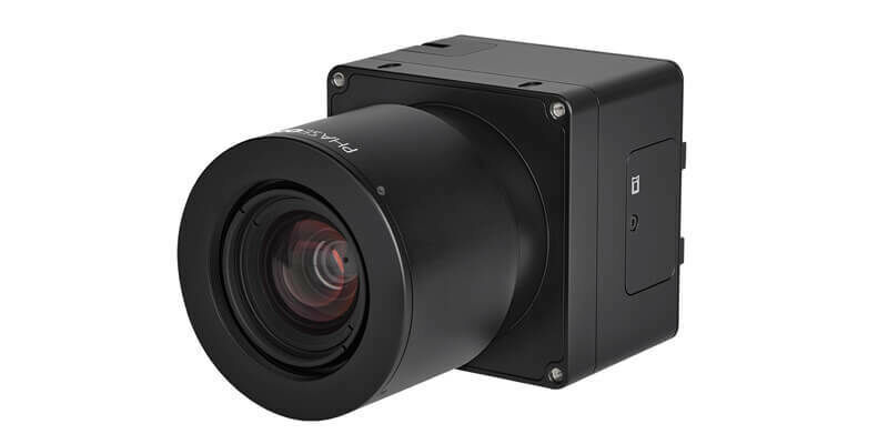
Phase One unveils wide-area, 120MP aerial camera with global shutter sensor technology
12th April 2022
Phase One unveils wide-area, 120MP aerial camera with global shutter sensor technology
EAASI summit highlights role of aerial survey in technological response to global challenges
12th April 2022
EAASI summit highlights role of aerial survey in technological response to global challenges
UltraCam Eagle delivers efficiency and quality for Arrowhawk Imaging
12th April 2022
UltraCam Eagle delivers efficiency and quality for Arrowhawk Imaging
UP42 partners with near space labs to offer very high-resolution imagery using zero-emission balloons
12th April 2022
UP42 partners with near space labs to offer very high-resolution imagery using zero-emission balloons
Teledyne FLIR introduces Neutrino SX12 ISR1200 MWIR camera with zoom lens for Ground ISR
12th April 2022
Teledyne FLIR introduces Neutrino SX12 ISR1200 MWIR camera with zoom lens for Ground ISR
Phase One announces iX suite for seamless aerial mapping workflow
12th April 2022
Phase One announces iX suite for seamless aerial mapping workflow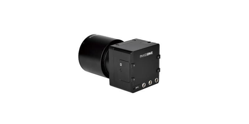
Phase One to Showcase iXM-GS120 Wide-Area Aerial Camera at GEOINT 2022 in Colorado
12th April 2022
Phase One to Showcase iXM-GS120 Wide-Area Aerial Camera at GEOINT 2022 in Colorado
UP42 Partners with Nearmap to Offer High-Resolution Aerial Imagery of U.S., Canada, Australia, and New Zealand
11th April 2022
UP42 Partners with Nearmap to Offer High-Resolution Aerial Imagery of U.S., Canada, Australia, and New Zealand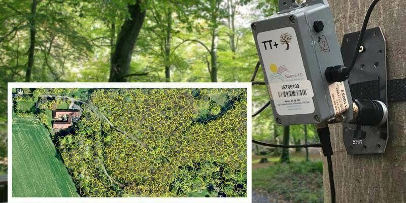
Tree Pest and Disease Monitoring System Uses Bluesky’s UK Tree Map
5th April 2022
Tree Pest and Disease Monitoring System Uses Bluesky’s UK Tree Map
Immervision launches low-light UAV navigation camera module
31st March 2022
Immervision launches low-light UAV navigation camera module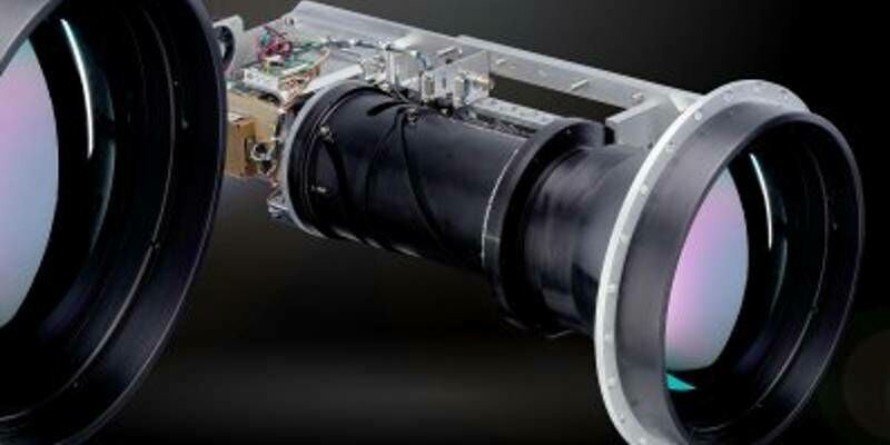
Teledyne FLIR Introduces Neutrino SX12 ISR1200 MWIR Camera with Zoom Lens for Ground ISR
21st March 2022
Teledyne FLIR Introduces Neutrino SX12 ISR1200 MWIR Camera with Zoom Lens for Ground ISR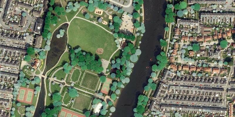
Tree carbon capture figures are more accurate thanks to Bluesky’s National Tree Map
9th March 2022
Tree carbon capture figures are more accurate thanks to Bluesky’s National Tree Map
UltraCam Eagle Delivers Efficiency and Quality for Arrowhawk Imaging
25th February 2022
UltraCam Eagle Delivers Efficiency and Quality for Arrowhawk Imaging
UP42 Partners with Near Space Labs to Offer Very High-Resolution Imagery using Zero-Emission Balloons
24th February 2022
UP42 Partners with Near Space Labs to Offer Very High-Resolution Imagery using Zero-Emission Balloons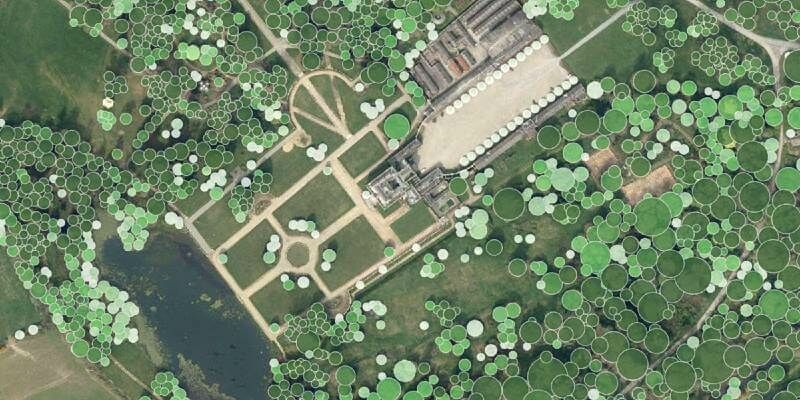
Waterford City and County Council Use Bluesky National Tree Map Data to Support Carbon Neutral Plans
10th February 2022
Waterford City and County Council Use Bluesky National Tree Map Data to Support Carbon Neutral Plans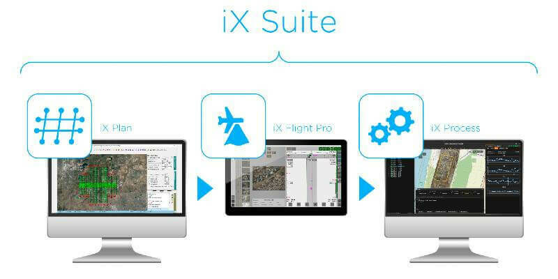
Phase One Announces iX Suite for Seamless Aerial Mapping Workflow from Flight Planning to Image Delivery
4th February 2022
Phase One Announces iX Suite for Seamless Aerial Mapping Workflow from Flight Planning to Image Delivery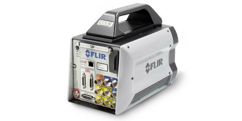
Teledyne FLIR Introduces X858x and X698x Families of High-Speed, High-Resolution Thermal Science Cameras
28th January 2022
Teledyne FLIR Introduces X858x and X698x Families of High-Speed, High-Resolution Thermal Science Cameras
Phase One Unveils Wide-Area, 120MP Aerial Camera with Global Shutter Sensor Technology
18th January 2022
Phase One Unveils Wide-Area, 120MP Aerial Camera with Global Shutter Sensor Technology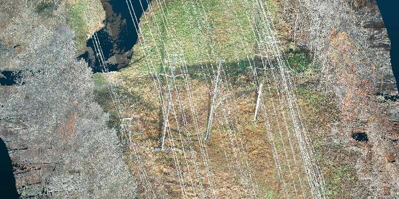
Exelon Clearsight Acquires GeoCue’s True View 615 LIDAR/Imagery Mapping Sensor
22nd December 2021
Exelon Clearsight Acquires GeoCue’s True View 615 LIDAR/Imagery Mapping Sensor
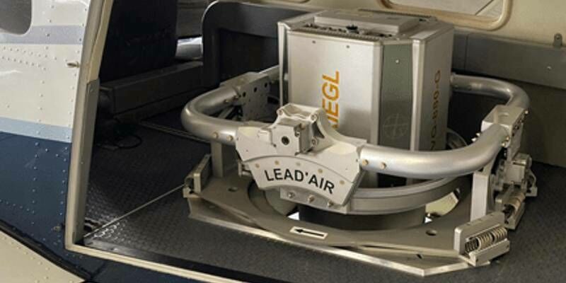
RIEGL USA Signs New OEM Partner Agreement
24th November 2021
RIEGL USA Signs New OEM Partner Agreement
Bluesky National Tree Map Data Included in First Online Natural Capital Calculator
17th November 2021
Bluesky National Tree Map Data Included in First Online Natural Capital Calculator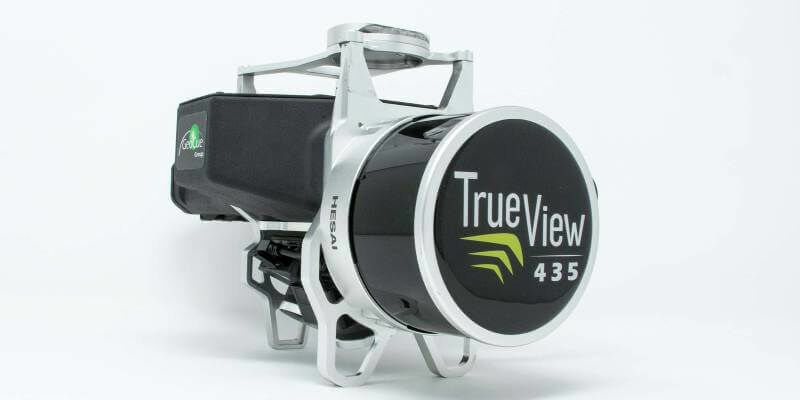
GeoCue Expands True View 3DIS Line with True View 435
12th November 2021
GeoCue Expands True View 3DIS Line with True View 435
Our P3 Payload exceeds Gresco's expectations for cellphone tower inspection
10th November 2021
Our P3 Payload exceeds Gresco's expectations for cellphone tower inspection
Phase One - P3 Payload Power Line Inspection Test Flight
5th November 2021
Phase One - P3 Payload Power Line Inspection Test Flight
Phase One - P3 Payload Bridge Inspection Test Flight
5th November 2021
Phase One - P3 Payload Bridge Inspection Test Flight
Phase One - P3 Payload Cellphone Tower Inspection Flight
5th November 2021
Phase One - P3 Payload Cellphone Tower Inspection Flight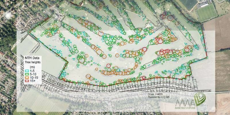
MWA Arboriculture uses Bluesky National Tree Map for Tree Condition Surveys
29th September 2021
MWA Arboriculture uses Bluesky National Tree Map for Tree Condition Surveys
Bluesky National Tree Map at the Root of Birmingham’s Urban Forest Master Plan
7th September 2021
Bluesky National Tree Map at the Root of Birmingham’s Urban Forest Master Plan
EAASI Elects Executive Committee to Promote Aerial Surveying in Europe
2nd September 2021
EAASI Elects Executive Committee to Promote Aerial Surveying in Europe
Bluesky Cyclomedia Partnership Combines Aerial and Mobile Mapped Data for Virtual City Models
25th August 2021
Bluesky Cyclomedia Partnership Combines Aerial and Mobile Mapped Data for Virtual City Models

Bluesky appoints Europa Technologies as reseller for National Tree Map
19th August 2021
Bluesky appoints Europa Technologies as reseller for National Tree Map
Boston University Uses Bluesky Aerial Photomaps to Research Climate Change
19th August 2021
Boston University Uses Bluesky Aerial Photomaps to Research Climate Change
Silicon Sensing Showcases New, Space-focused Inertial Measurement Products at Space-Com
19th August 2021
Silicon Sensing Showcases New, Space-focused Inertial Measurement Products at Space-Com
SimActive Software Used with both LiDAR and Imagery to Map Venice Beach
19th August 2021
SimActive Software Used with both LiDAR and Imagery to Map Venice Beach
Bluesky appoints Europa Technologies as reseller for National Tree Map
18th August 2021
Bluesky appoints Europa Technologies as reseller for National Tree Map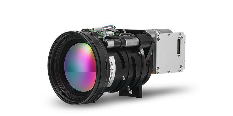
Teledyne FLIR Introduces Neutrino SX8 Mid-Wavelength Infrared Camera Module and Four Neutrino IS Series Models with Integrated Continuous Zoom Lenses
10th August 2021
Teledyne FLIR Introduces Neutrino SX8 Mid-Wavelength Infrared Camera Module and Four Neutrino IS Series Models with Integrated Continuous Zoom Lenses
Bluesky National Tree Map Shows Changing Face of Sevenoaks Historic Tree Cover
26th July 2021
Bluesky National Tree Map Shows Changing Face of Sevenoaks Historic Tree Cover
Bluesky and BlackSky Join Forces to Bring Satellite Imagery to the U.K.
14th July 2021
Bluesky and BlackSky Join Forces to Bring Satellite Imagery to the U.K.
PhaseOne - How Digital-Twins of Hydro-power Dams support Plant Operations
2nd July 2021
PhaseOne - How Digital-Twins of Hydro-power Dams support Plant Operations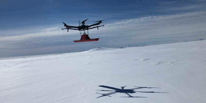
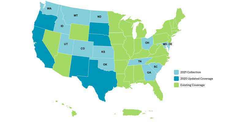
HxGN Content Program to collect new single-season aerial data of 14 U.S. states this year
1st July 2021
HxGN Content Program to collect new single-season aerial data of 14 U.S. states this year
Bluesky Models Transform Real Estate Marketing with Lunas 3D Visualisations
25th June 2021
Bluesky Models Transform Real Estate Marketing with Lunas 3D Visualisations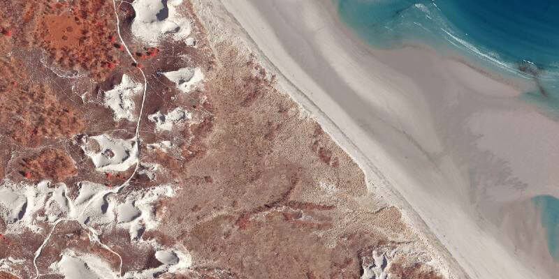
Boston University Uses Bluesky Aerial Photomaps to Research Climate Change
16th June 2021
Boston University Uses Bluesky Aerial Photomaps to Research Climate Change
Scottish Forestry Uses Bluesky Aerial Photomaps to Monitor Tree Health During Lockdown
27th May 2021
Scottish Forestry Uses Bluesky Aerial Photomaps to Monitor Tree Health During Lockdown
Bluesky 5cm Aerial Photography Reveals Hidden Parts of London
20th May 2021
Bluesky 5cm Aerial Photography Reveals Hidden Parts of London