Share
Nearmap’s high-resolution aerial imagery of major urban areas in the United States, Canada, Australia, and New Zealand will soon be available through UP42.
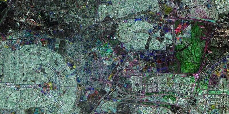
The initial offering will include the Nearmap vertical imagery, which is updated multiple times each year at 5.5- to 7.5-cm (2.2" to 3") spatial resolution for more over 1740 urban areas in the US and over 100 in Australia.
With global headquarters in Sydney, Australia, vertical imagery from Nearmap provides an orthogonal imagery base layer that offers consistent clarity, precision, and spatial detail for cities and their surrounding areas. In the United States alone, coverage includes more than 80% of its population with 308,000 unique square miles – including some of the most rapidly growing municipalities – surveyed each year.
The Nearmap Vertical imagery archive dates from 2011 in Australia and New Zealand, and 2014 in the US – with an annual refresh schedule of 3X to 6X per year. New imagery is orthorectified, georeferenced, and uploaded to the cloud for purchase within days of collection.
“Our partnership with Nearmap delivers value to UP42 customers by providing direct access to high-precision urban imagery of remarkable quality and detail,” said UP42 CEO Sean Wiid. “The extensive Nearmap archive and refresh rate combined with other geospatial data sets on the UP42 platform enable highly detailed monitoring applications related to asset management in the utility, construction, and local government sectors.”
UP42 is lowering the barrier to entry for customers to extract unique geographic insights and create scalable geospatial solutions. To this end, customers can integrate the Nearmap Vertical imagery with other data sets available from UP42. The marketplace currently contains over 160 products from more than 50 of the world’s leading geospatial organizations.
Subscribe to our newsletter
Stay updated on the latest technology, innovation product arrivals and exciting offers to your inbox.
Newsletter