Share
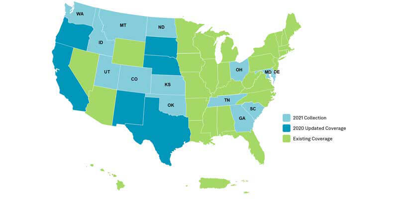
Hexagon’s Geosystems division announced that the HxGN Content Program, Hexagon’s aerial data program, will update 14 U.S. states in the 2021 collection season, including Tennessee, South Carolina, Oklahoma, Idaho, Maryland, Ohio, Delaware, Montana, Utah, Kansas, Washington, North Dakota, Georgia, and Colorado. Additional states will be added as the season progresses. The states will be refreshed at the program’s standard 12-inch state-wide updates, as well as select states enhanced to 6-in resolution state-wide. The acquisition adds 888,035 square miles of 4-band aerial imagery and digital elevation data to the program’s existing collection of over 9 million square miles across North America and Europe. The refreshed data will come online starting in Q3 as weather conditions allow. Availability of the 2021 data can be tracked through the HxGN Content Program’s coverage map. www.hexagon.com


