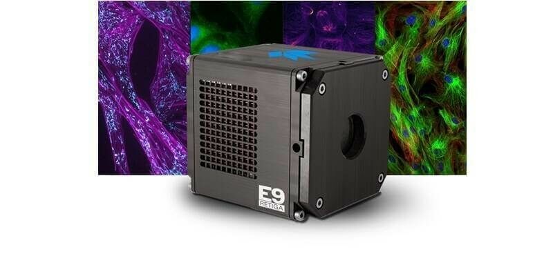
Teledyne to showcase new scientific imaging and machine vision solutions at SPIE’s Photonics West exhibition
26th January 2024
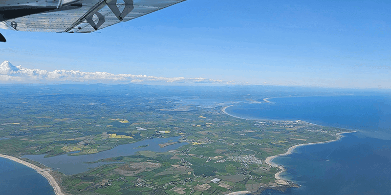
Teledyne to showcase new scientific imaging and machine vision solutions at SPIE’s Photonics West exhibitionAerial imaging is revolutionizing the way we capture, analyze, and utilize geospatial data. Using high-resolution aerial photography and remote sensing technologies, it provides accurate and detailed visual information essential for mapping, environmental monitoring, infrastructure planning, and disaster response.
Modern aerial imaging solutions include manned aircraft, UAVs (drones), and satellite-based systems equipped with advanced sensors such as LiDAR, multispectral, and hyperspectral cameras. These technologies enable high-precision mapping, 3D terrain modeling, change detection, and real-time geospatial analysis, supporting industries such as urban planning, agriculture, forestry, defense, and construction.
With cloud-based processing, AI-powered image analysis, and real-time data streaming, aerial imaging continues to advance, offering faster, more accurate, and scalable solutions for GIS professionals and decision-makers.
GeoConnexion provides the latest insights on aerial imaging trends, innovations, and applications, helping professionals leverage aerial data for better spatial intelligence and operational efficiency.
26th January 2024
Teledyne to showcase new scientific imaging and machine vision solutions at SPIE’s Photonics West exhibition
18th January 2024
Fototerra expands its fleet of airborne lidar mappers with an additional Optech Galaxy system
21st December 2023
Bluesky partners with Sensat providing data for new visualisation tool
18th December 2023
Cyberhawk Selects Phase One to Revolutionize Drone-based Industrial Inspection – Deliver More Value in Less Time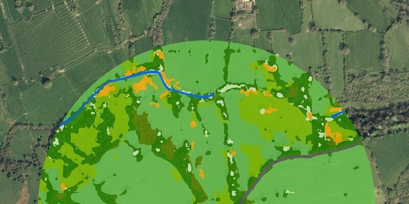
13th December 2023
Peak District Pioneers AI Landscape Mapping using Bluesky Aerial Images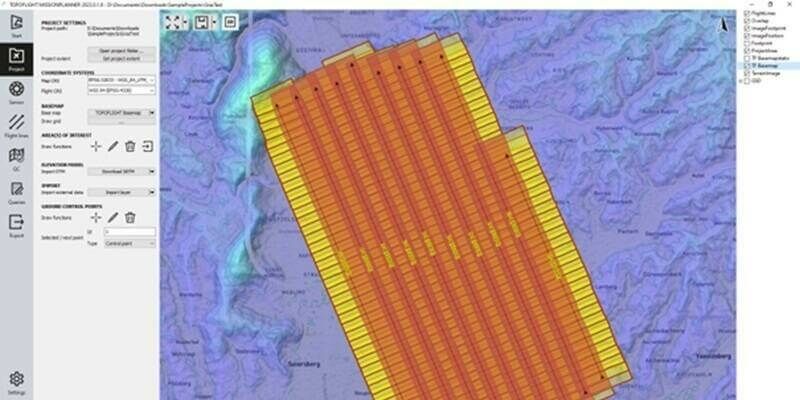
12th December 2023
Central Role of TatukGIS in TOPOFLIGHT's Aerial Survey Missions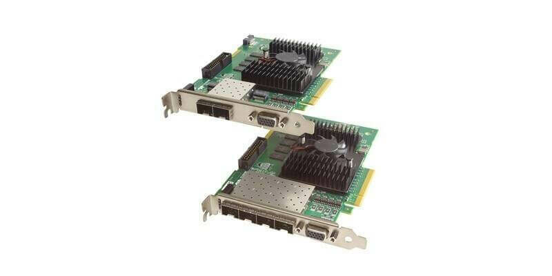
6th December 2023
New Xtium2 frame grabber from Teledyne supports high-speed GigE machine vision cameras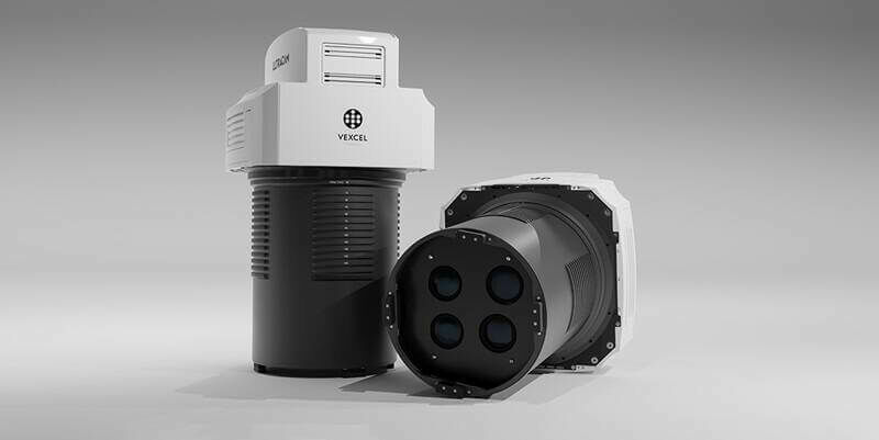
5th December 2023
Vexcel Imaging introduces new UltraCam Merlin 4.1 aerial camera system for elevated profitability and performance
5th December 2023
Vexcel Imaging announces the new UltraCam Dragon 4.1, a game-changing hybrid oblique imaging and LiDAR system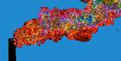
27th November 2023
AI detects methane plumes from space, could be powerful tool in combating climate change
2nd November 2023
Anglian Water Alliance Streams Bluesky Aerial Mapping for Web App
12th October 2023
Bluesky Aerial Maps Improve Efficiency for Forest Surveys
4th October 2023
Richard Evans Appointed to Role of Sales Consultant at Bluesky International
19th September 2023
MWH Treatment uses 3D Building Models from Bluesky to Drive Innovation in Water Sector
11th September 2023
Bluesky Made a Record-Breaking Start to the 2023 Mapping Flying Season
7th September 2023
Bluesky 3D Imagery Brings Global Warming Sea Level Rises to Life
1st September 2023
Bluesky Aerial Data Helps CGL Pinpoint Natural Hazards at Development Sites
30th August 2023
Teledyne FLIR Introduces Lepton 3.1R Radiometric Thermal Camera Module for Integrators
23rd August 2023
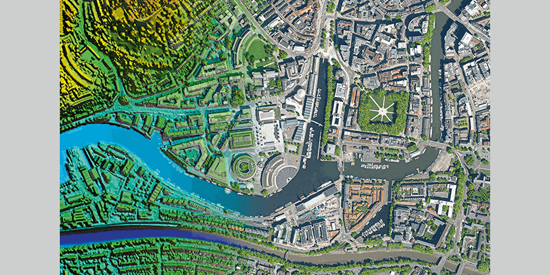
Hexagon announces refresh of Puerto Rico’s and U.S. Virgin Islands’ aerial imagery and elevation mapping data
9th August 2023
Webinar Topic: Cameras on Drones and Aircraft: Is Bigger Always Better?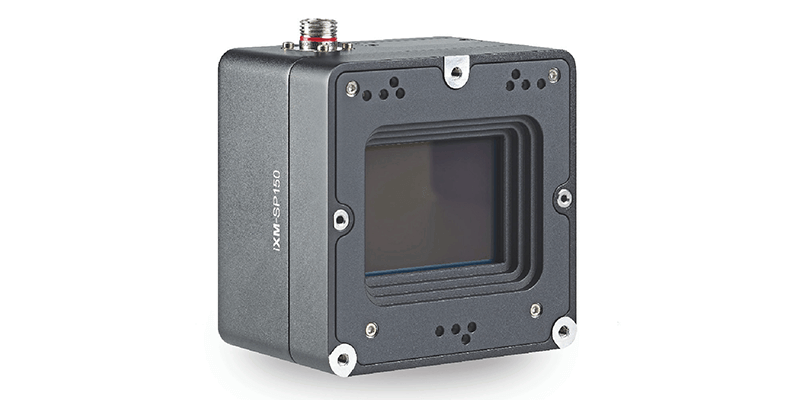
28th July 2023
Bluesky Partners with UP42 to Widen Access to Aerial Imagery and Geospatial Data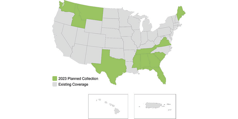
28th July 2023
Hexagon to update high-resolution geospatial data of twelve US states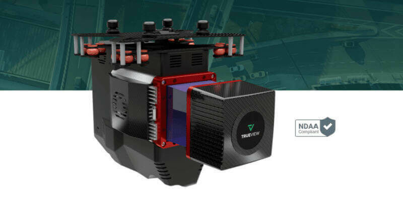
27th July 2023
GeoCue Unveils Three New, High-End, TrueView 3D Imaging Systems
19th July 2023
SimActive Announces New Pricing for Larger Drone Cameras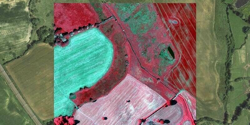
12th July 2023
Bluesky’s Airborne Sensors Help Developers Protect Wildlife Habitats
7th July 2023
Bluesky Building Models Aid Planning for World’s Largest Cultural Hub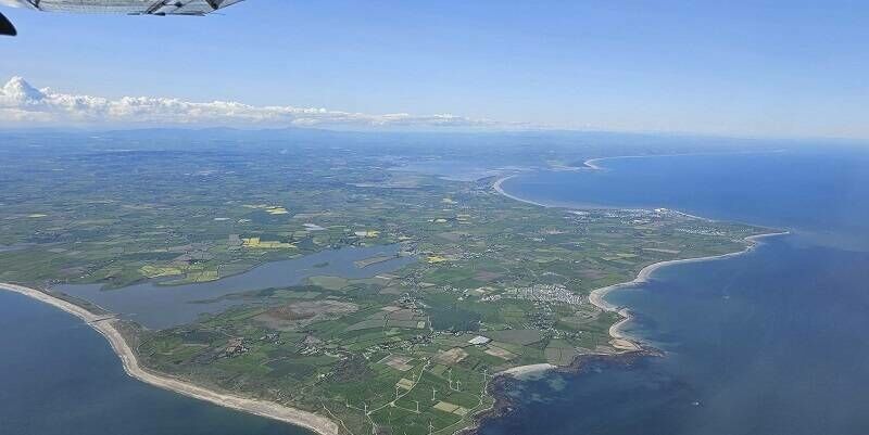
28th June 2023
Bluesky Makes a Record Breaking Start to the 2023 Mapping Flying Season
22nd June 2023
LexisNexis Improves Insurer Risk Assessment Portfolio with National Tree Map
16th June 2023
Phase One Announces New Calibration Lab and Geospatial Center of Excellence in Denver
16th June 2023
Bluesky Expands Commercial Team with Appointment of Bassett and Hoskins

4th June 2023
China monitors mountain glacier health with remote sensing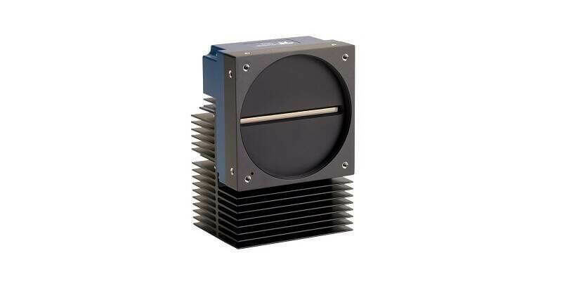
30th May 2023
Teledyne’s backside illuminated TDI camera delivers greater sensitivity for near ultraviolet and visible imaging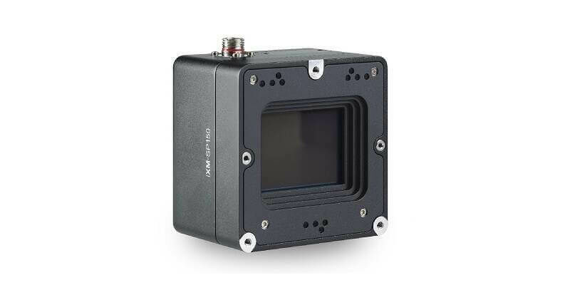
23rd May 2023
Phase One Announces iXM-SP150 at GEOINT - An Advanced 150 Megapixels Snapshot Matrix Camera for Earth Observation and Space Domain Awareness Applications
12th May 2023
EAASI leads discussions on the use of aerial surveying data at GWF 2023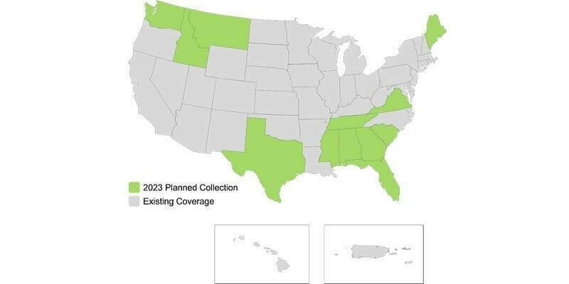
11th May 2023
Hexagon to update high-resolution geospatial data of twelve US states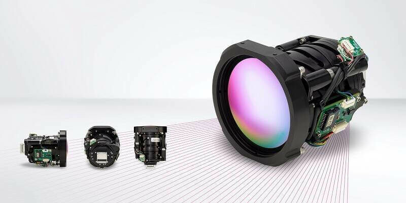
10th May 2023
Teledyne FLIR Boson+ Thermal Camera Now Available with Factory-Integrated Continuous Zoom Lens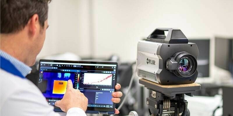
2nd May 2023
Teledyne FLIR Announces Version 3.0 Release of Research Studio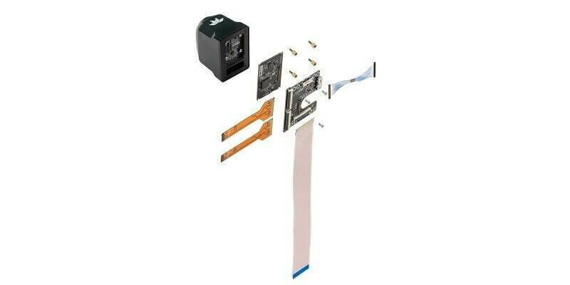
20th April 2023
Teledyne FLIR Adds Development Kits for Hadron 640R Dual Camera Module Integration for Qualcomm and NVIDIA Embedded Systems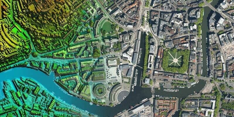
14th April 2023
Bluesky Partners with UP42 to Widen Access to Aerial Imagery and Geospatial Data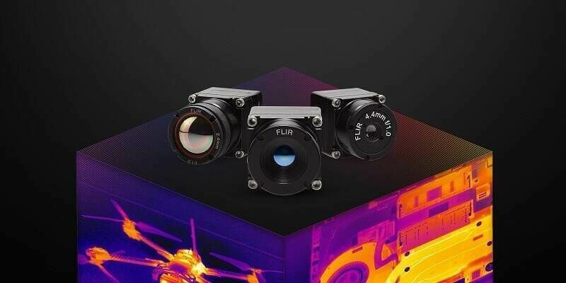
4th April 2023
Teledyne FLIR Adds New Boson+ Thermal Resolution Options, Radiometry, and MIPI Interface Simplifying Embedded System Integration
24th March 2023
Bluesky partners with SkyFi widens global access to aerial imagery
13th March 2023
Bluesky Aerial Imagery Reveals Tree Cover on the London Marathon Route
1st March 2023
Bluesky Geospatial Launches Metrovista 3D Aerial Mapping Program in U.S.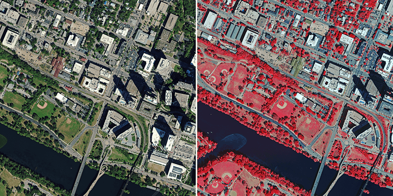
1st March 2023
Hexagon to Update Aerial Data of Eight U.S. States at Six-Inch Resolution in 2023 for the Hxgn Content Program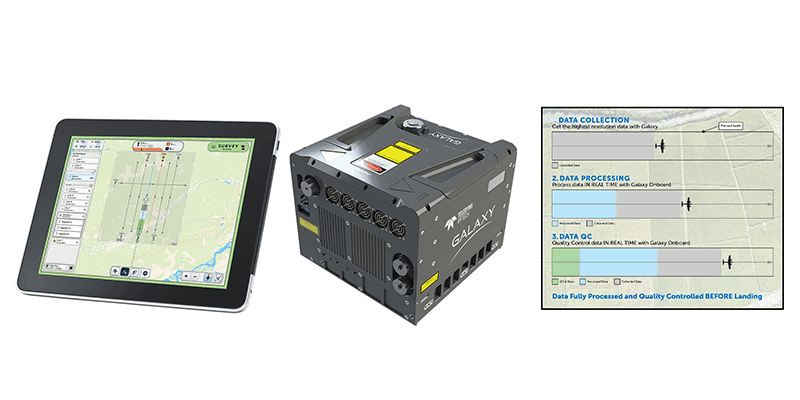
1st March 2023
Teledyne Geospatial revolutionizes airborne lidar ROI with Galaxy Onboard: a real-time workflow solution