Share
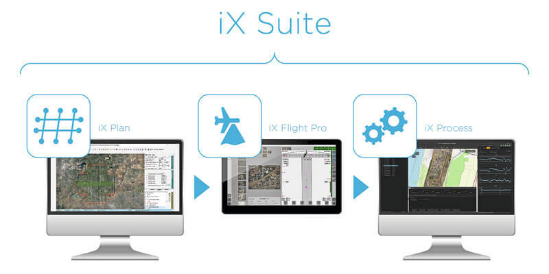
Phase One, a developer of digital imaging technologies, has announced its new iX Suite, a fully integrated software package for aerial mapping project management. Compatible with all Phase One PAS airborne systems, iX Suite handles mission planning, flight management, data acquisition, image selection and processing and in a common workflow. With the iX Suite, Phase One has taken a novel approach to managing aerial mapping projects by making quality control a key focus throughout the workflow to guarantee the generated image products meet end user specifications. A unique aspect of the iX Suite workflow is that imagery can be reviewed inflight and re-collected immediately if necessary, reducing the need for budget- and schedule-killing re-flights days or weeks later. www.phaseone.com


