Share
Stereoscopic 3D visualisation is the best way to examine digital subsurface models in the oil and gas industry, says Josef Schneider
To optimise the exploration and production of oil and gas fields, assess potential and increase yield, it is mandatory to understand all aspects of the geological subsurface situation. A higher level of understanding will lead to an earlier recognition of problems, reduce avoidable delays and associated substantial expenses. The optimal visualisation of 3D geo-datasets is the key for geologists and geophysicists to analyse and evaluate geological and geophysical information components with the highest degree of confidence.
In the oil and gas industry, stereo-capable software platforms, such as Petrel from Schlumberger, Halliburton GeoProbe or MapInfo Discover are used. These allow the professional user to integrate, display and analyse all relevant subsurface information components quickly and comprehensively, display variants and associated simulations, improve play understanding and ultimately support more accurate hydrocarbon recovery forecasts. The visualisation in 3D-stereo is an integral part of a ‘best-practice toolkit’, ensuring the success of the project.
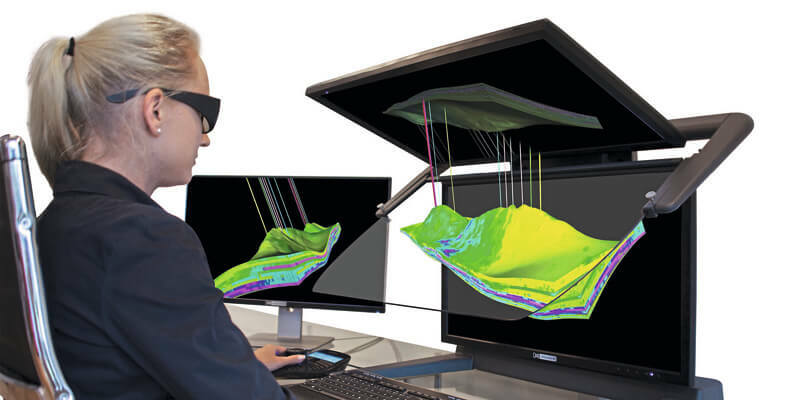
Petroleum engineers and geoscientists spend a substantial amount of time combining 2D and 3D data sets from multiple sources to create interpolated 3D digital subsurface models. These datasets are used extensively over longer periods of time by the oil and gas industry in a variety of formats, with varying resolutions and in very large volumes. The stereoscopic monitors of Schneider Digital’s 3D PluraView series offer the highest stereoscopic display quality at the workplace with their proven beam splitter technology. They are the decisive interface for the visualisation, for the creation and analysis of digital 3D ‘twins’. All recorded surface and subsurface structures, as well as dynamic processes that are relevant for the exploration and production of oil and gas fields, can be visualised on the stereoscopic 3D monitors. True stereoscopic visualisation not only makes it easier to interpret 3D data, it also dramatically improves collaboration between exploration and production team members. Several specialists can view, analyse and discuss a dataset simultaneously on a 3D PluraView. They benefit from the impressive, holographic representation of the geospatial data in a normal, not specially prepared or darkened office environment and a flexible viewing angle of almost 180º.
Optimum visualisation
The 3D PluraView monitors are ideally suited to display 3D subsurface reservoir models stereoscopically in 3D, together with detailed surface datasets. With two high-resolution screens, the stereoscopic image pairs for the left and the right eye are combined by the so-called ‘beam splitter’, a specially coated transflective mirror, to form a very bright and high-contrast holographic stereo image. Due to the different polarisation angle of the PluraView glasses, both stereo channels are separated for the left and the right eye, resulting in a perfect 3D-stereo display for the professional desktop.
The stereoscopic visualisation is an essential part of professional geology software, such as Schlumberger Petrel, Halliburton GeoProbe, Baker Hughes JewelSuite, the Dassault GEOVIA Modules or MapInfo Discover. Esri has implemented with ArcGIS Pro a fully stereoscopic 3D GIS environment. ArcGIS Pro also enables the mapping of stratigraphic and tectonic subsurface structures with 3D voxel elements.
The visualisation and especially the editing of spatial structures in 3D-stereo environment is a definitive key function. With a stereoscopic display, real spatial relationships can be understood immediately and intuitively and can be captured with great precision, compared to regular screens which can only display a flat 2D- perspective view, without any depth information.
Modern software environments for exploration and production are always three-dimensional and volumetric. Due to the high costs and risks involved, they must be as efficient as possible, reliable and optimised in terms of data processing. The ensuing field activities must meet all HSE standards and therefore the entire process chain must verifiably and fully correspond to the current state of the art and ‘best practice’.
Reliably authorise exploration results through 3D models
A comprehensive and accurate understanding of the available 3D geological and geophysical data is required to comprehend the stratigraphic and tectonic structures, as well as the rock properties of oil and gas reservoirs in relation to their production potential. Among other things, seismic 3D profiles are recorded for this assessment, to identify reflective horizons, structures and faults. Together with results from other data sources, such as existing well logs, aero-magnetics and electrical resistivity tomography, all information is merged to create the most competent 3D reservoir model possible. If the evaluation is positive, this preliminary model will then be expanded by additional geo-datasets to support justifiable decisions about the future number, positioning, direction and depth of additional exploration boreholes, or the drilling of the first production wells.
The representation of the reservoirs in “real” 3D is also ideal for creating comprehensive static and especially dynamic models in 4D time-lapse series for clearly simulating pressure drop and flow changes under various production scenarios. The best-possible combination, evaluation and interpretation of various 3D features is essential for the closest digital representation of the reservoir. This includes all major tectonic structures such as sealing or non-sealing faults and the modelling of stratigraphic layers. In particular, it includes as much information as possible about the source-, reservoir- and cap rock layers. Highly relevant are the accurate depth and structure of reflection horizons from geophysical exploration, combined with all physically present rock material from drill cuttings and core samples within the investigation area, as well as the determination of further petrophysical rock parameters by geophysical downhole probes. A “good” subsurface model shows the spatial relationships and properties of relevant features in sufficient detail and can therefore be used with acceptable accuracy to estimate the future behaviour of an oil and gas reservoir under different production scenarios.
With the stereoscopic visualisation technology from Schneider Digital, it is possible to perfectly visualise the correct spatial relationships of reservoir structures and their properties. This allows oil and gas engineers to evaluate potential reservoirs, estimate reserves, and predict reservoir properties and production behaviour. It enables them to further optimise production setup, complete projects on time and on budget, and ultimately increase the company’s competitiveness and profitability.
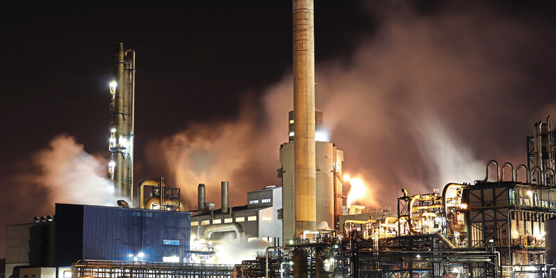
Especially at the transition point from exploration to production activities and associated surface installations, not only economic aspects are relevant, but strict environmental protection measures also have to be taken into account. Meeting associated requirements for official approval procedures are critical decision issues. Geospatial datasets that have been prepared on the desktop on 3D PluraView systems can be visualised just the same on large-format, stereoscopic projection systems and LED walls for larger groups of viewers – for instance, for the company decision makers and public officials – and thus presented in a much more easily understandable way.


