
Phase One announces iX suite for seamless aerial mapping workflow
12th April 2022
Phase One announces iX suite for seamless aerial mapping workflow
12th April 2022
Phase One announces iX suite for seamless aerial mapping workflow
17th February 2022
TerraGo Joins the Esri ArcGIS Marketplace with GeoPDF Publisher for ArcGIS Pro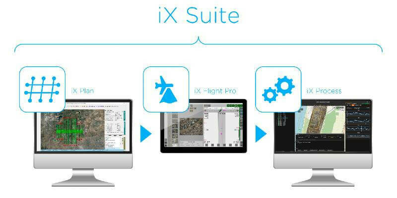
4th February 2022
Phase One Announces iX Suite for Seamless Aerial Mapping Workflow from Flight Planning to Image Delivery
25th January 2022
Join us for the 2022 FME World Tour in a city near you!
21st January 2022
1Spatial unveils new survey capabilities in 1Edit
19th November 2021
1Spatial adds support for GeoPackage and other data formats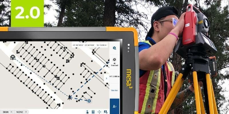
18th November 2021
The Most Affordable, Reliable, Innovative Android Data Collection Software On The Planet Just Got Better!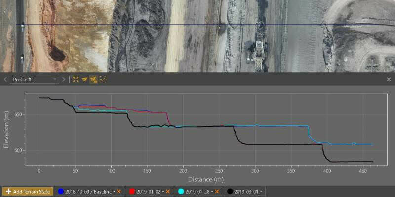
18th November 2021
Virtual Surveyor Provides Comprehensive Insights into Drone Survey Data with Addition of Profile View

19th August 2021
Creaform Announces the Release of VXelements 9.19th August 2021
Trimble Expands its Geospatial Automated Monitoring Portfolio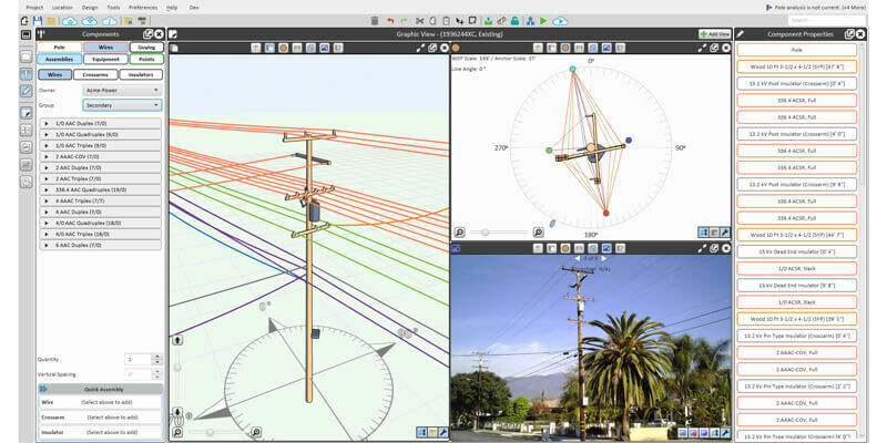
19th August 2021
Bentley Systems Announces Acquisition of SPIDA
19th August 2021
Delaware partners with VertiGIS to expand Geospatial Asset Management capabilities
19th August 2021
SPH Engineering announces the update of UgCS for UAV-based LIDAR mapping
4th August 2021
Bentley Systems Announces Seequent’s Acquisition of Imago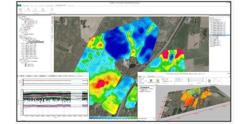
8th July 2021
Bentley Systems Announces Seequent’s Acquisition of Aarhus GeoSoftware1st July 2021
Ekinops and IEC Telecom Group deliver compact portable satellite communication solution
14th June 2021
Delaware partners with VertiGIS to expand Geospatial Asset Management capabilities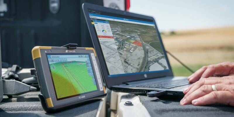
6th May 2021
Latest Topcon construction and survey software available now for compatible, comprehensive connectivity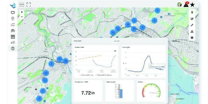
5th May 2021
Bentley Systems Announces Acquisitions of sensemetrics and Vista Data Vision, Leaders Respectively in Software for Infrastructure Instrumentation and Sensor Management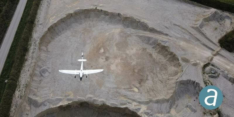
19th April 2021
Processing of Quantum-Systems Drone Data Integrated in SimActive Software
15th April 2021
Bentley Systems Announces Acquisition of Mobility Simulation Leader INRO
17th March 2021
Contractor invests in the Verity enterprise software solution for construction verification
16th March 2021
1Spatial announce the release of 1DataGateway 2.3.0
14th March 2021
1Spatial announce the release of 1Integrate 2.8.1
12th March 2021
The FME World Fair is Coming to a Screen Near You
2nd March 2021
SimActive Software Integrated in LiDAR Solution for Drones
2nd March 2021
Leica Geosystems introduces one app for all terrestrial laser scanning portfolio
2nd March 2021
1Spatial Awarded Safe Software’s Partner Award of Excellence
2nd March 2021
Eos Positioning Systems announces ability to consume Arrow GNSS location data in multiple Esri apps concurrently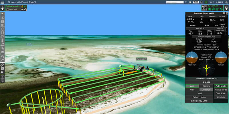
2nd March 2021
Parrot, UgCS partnership augments drone mission planning, mapping

4th February 2021
New Workability Options Enhance Carlson iCAD 2021
19th January 2021
Trimble Business Center Streamlines Point Cloud Workflows and Adds Vertical Applications Enabling Survey and Mapping Professionals to Maximize Productivity
18th January 2021
Real estate management during the COVID pandemic - Webinar
14th January 2021
Virtual Surveyor Introduces Curb & Gutter Mapping in New Version of Drone Surveying Software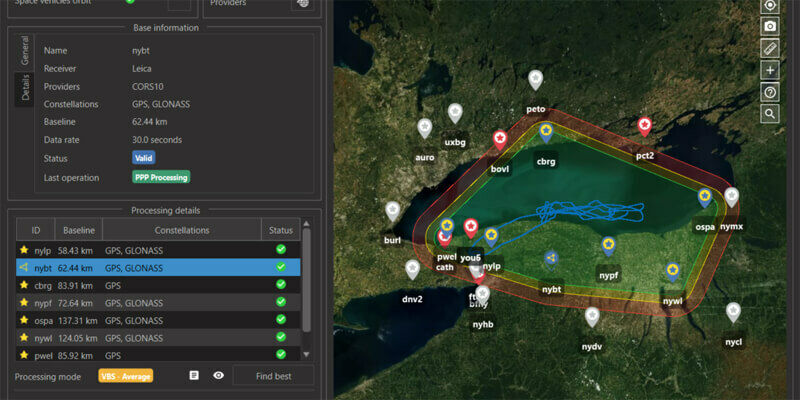
14th January 2021
SBG Systems to release the virtual base station feature in Qinertia, its in-house post-processing software
11th January 2021
Student's Space Archaeology start-up showcased at world’s biggest tech show
17th December 2020
Garmin announces exciting updates to the GTN Xi Series of navigators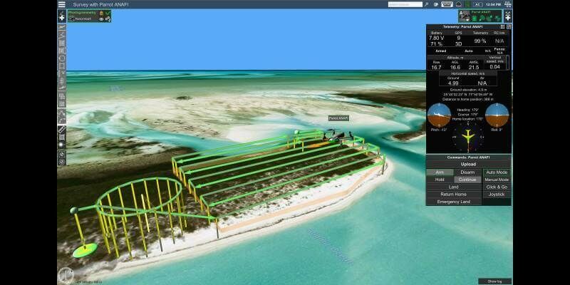
10th December 2020
Parrot, UgCS partnership augments drone mission planning, mapping
3rd December 2020
Garmin Announces G1000 Nxi Integration With Blackhawk Engine+ Upgrade For King Air 300 And King Air 350
17th November 2020
Vega Launches the Taranis Satellite to Explore Thunderstorm Lights: Double Reference for SPACEBEL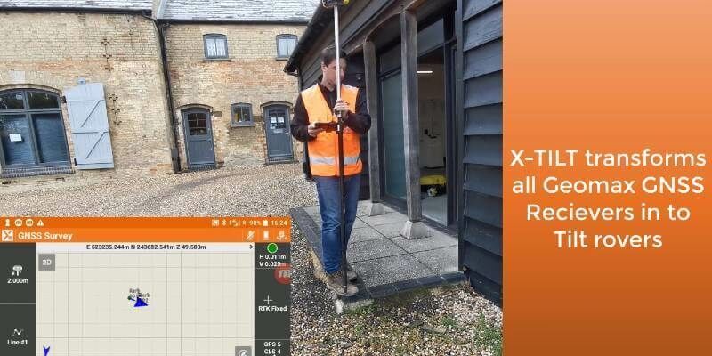
1st November 2020
GeoMax launches major update to X-PAD software
29th October 2020
Simplifying location data access and processing
29th October 2020
Hexagon Unveils HxGN Smart Census 2020 for Enhanced Citizen Data Collection29th October 2020
Teledyne DALSA releases powerful suite of image processing and artificial intelligence software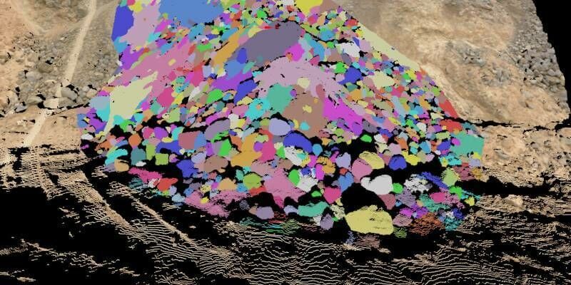
24th September 2020
Fragmentation analysis leads updates in Maptek PointStudio 2020