Share
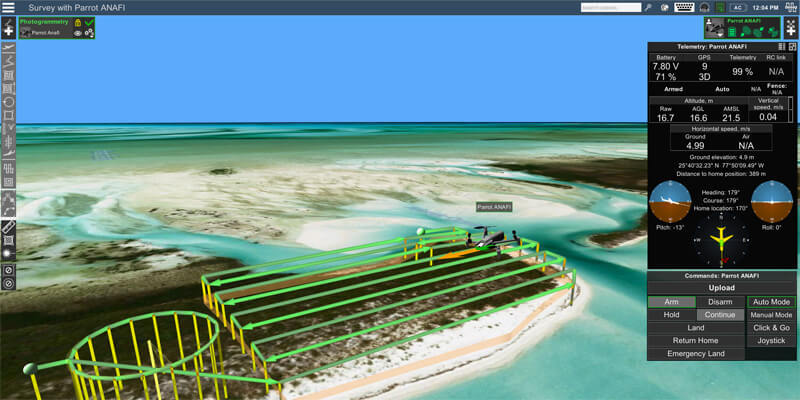
SPH Engineering, a premier UgCS software developer, announced that the Parrot ANAFI UAV platform is now compatible with UgCS. ANAFI users now have access to the program’s vast range of tools to enhance professional drone operations and streamline land surveying and mapping processes. The world’s premier UgCS (Universal ground Control Software) is a tool for enhanced UAV mission planning and data collection suitable for land surveying and industrial inspections. It is an industry-standard data acquisition instrument for professional drone pilots doing their job with a mixed multi-vendor drone fleet in large scale surveying projects. It allows to plan and fly drone survey missions to safely collect high-quality data, providing convenient technics for aerial and linear surveys and enabling direct drone control. www.ugcs.com


