
VertiGIS Announces Multinational Partnership with Esri to Enhance Service for Global Customers
17th July 2024
VertiGIS Announces Multinational Partnership with Esri to Enhance Service for Global Customers
17th July 2024
VertiGIS Announces Multinational Partnership with Esri to Enhance Service for Global Customers
16th July 2024
Esri’s ArcGIS Enterprise on Kubernetes Integrated with IBM Maximo Is Now Available
8th July 2024
Geospatial Business Management Software Firm Announces Ambitious Growth Plans
22nd April 2024
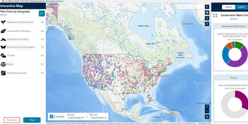
Biden-Harris Administration Launches Conservation.gov
12th April 2024
London Gatwick creates new geospatial platform with GIS from Esri UK
1st April 2024
Esri Releases New Book Designed to Improve Efficiency of Mobile Work
29th March 2024
Esri and the District of Columbia Partner to Launch DC’s AI-Powered ‘Compass’
20th March 2024
East Herts District Council selects Cadcorp for advancing digital planning service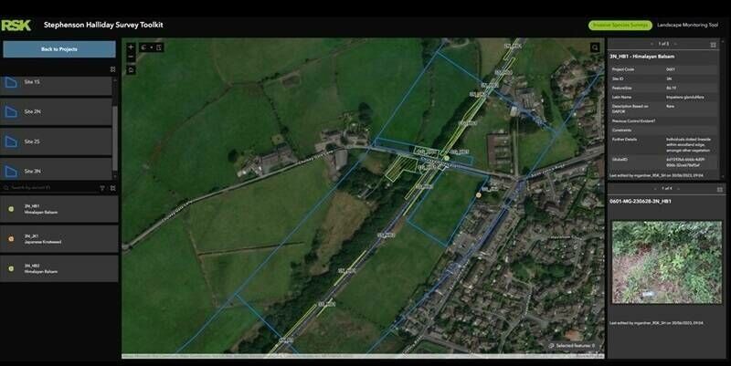
19th March 2024
RSK Group supports company growth with enterprise GIS from Esri UK
18th March 2024
Esri Recognizes Partners for Innovation and Excellence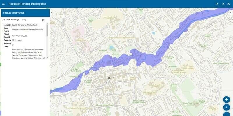
14th March 2024
Cadcorp cloud access to Environment Agency Real Time flood-monitoring
7th March 2024
Lost tombs and quarries rediscovered on British military base in Cyprus
6th March 2024
Esri UK launches new geospatial student scholarships to help diversify the industry
14th February 2024
PCS looks to the future with IQGeo’s Network Manager Telecom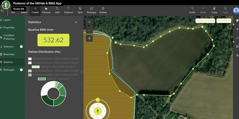
7th February 2024
New Esri UK partner Temple creates biodiversity net gain application
12th January 2024
KOREC Appoints John Cartledge as Mapping and GIS Business Manager
10th January 2024
1lntegrate 4.2 Leverages Inheritance for less taxing Rule Building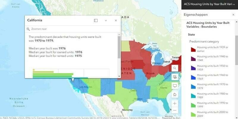
3rd January 2024
Esri Releases 2023 Update of Ready-to-Use US Census Bureau Data for ArcGIS Users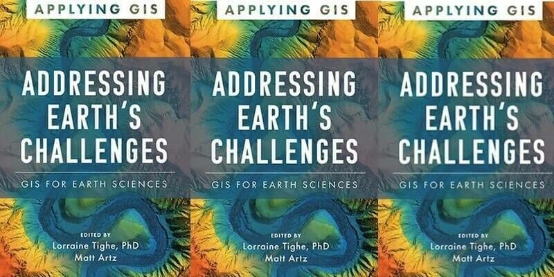
27th December 2023
Esri Book Shows How Earth Science Organizations Can Improve Decision-Making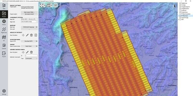
12th December 2023
Central Role of TatukGIS in TOPOFLIGHT's Aerial Survey Missions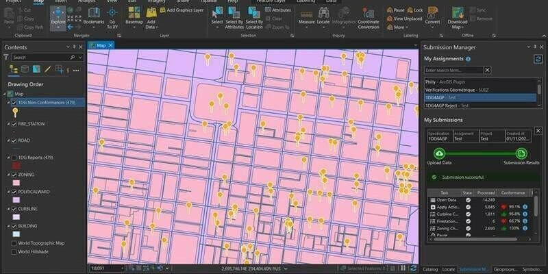
8th December 2023
1Spatial Launches 1Data Gateway For ArcGIS Pro, A Revolutionary Data Quality Add-In For Esri ArcGIS Pro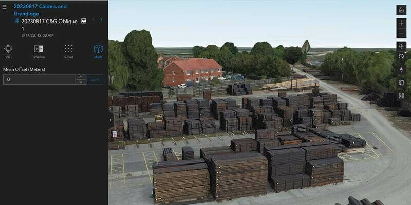
6th December 2023
Lincolnshire prepares for emergencies with digital twins and drones

20th November 2023
Esri and National Geographic Society Launch National Geographic MapMaker

15th November 2023
Esri Introduces ArcGIS Video Server, Brings New Video Capabilities to Users
14th November 2023
1Spatial assisting Hunter Water for Utility Network Migration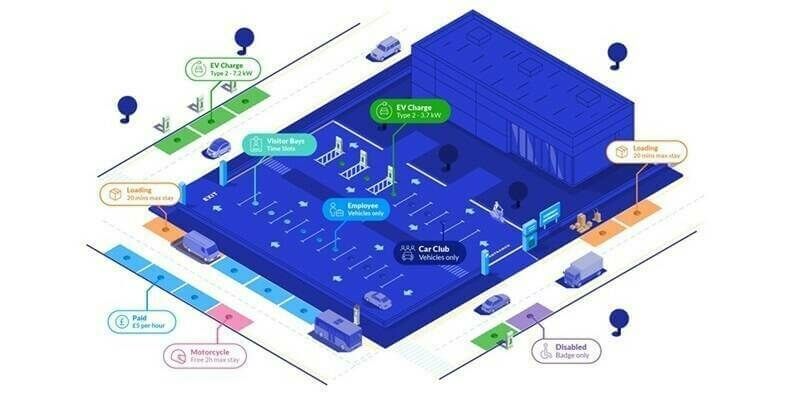
9th November 2023
New partnership helps local authorities plan active travel and low carbon initiatives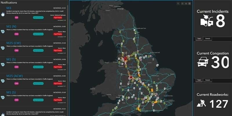
1st November 2023
National Highways recognised for geospatial innovation by Esri global award
31st October 2023
NCTech Appoints Neil Ackroyd as Chief Product Officer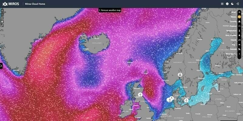
31st October 2023
Miros expands ocean insights offering to offshore sectors
13th October 2023
New head of EuroGeographics to focus on enabling access to high-value geospatial data from official national sources
13th October 2023
INTERGEO confirms its position for the geospatial industry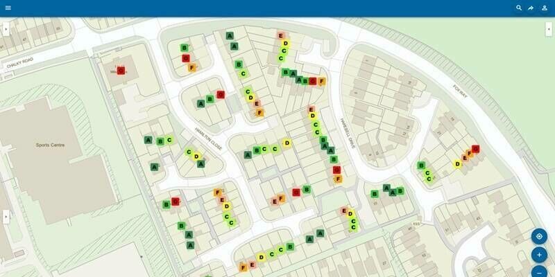
18th September 2023
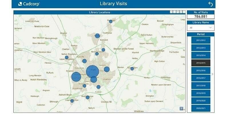
Cadcorp supports customers in gaining deeper insight from data


11th September 2023
GeoCom 23: Intelligent Geospatial for a Sustainable Future

11th September 2023
Schneider Electric and ROK Technologies Partner to Help Utilities Migrate ArcFM and ArcGIS Systems to the Cloud
11th September 2023
Torus gains clear and compelling insights with Cloud GIS and web mapping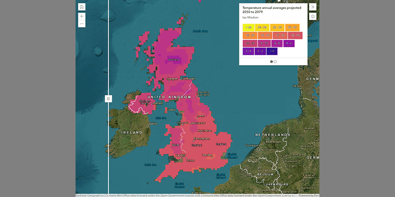
11th September 2023
Met Office makes climate data more accessible with Esri GIS
11th September 2023
Hexagon Releases Cloud Solution For Utilities And Telecoms Geospatial Asset Management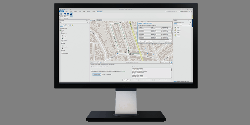
11th September 2023
New Trimble Terra Office Workflow Delivers Integration with Esri ArcGIS Pro
5th September 2023
GIS People Introduces Free Educational eBook: Open-Source GIS vs Commercial GIS
4th September 2023
Getech heads into Orbit as Planet partner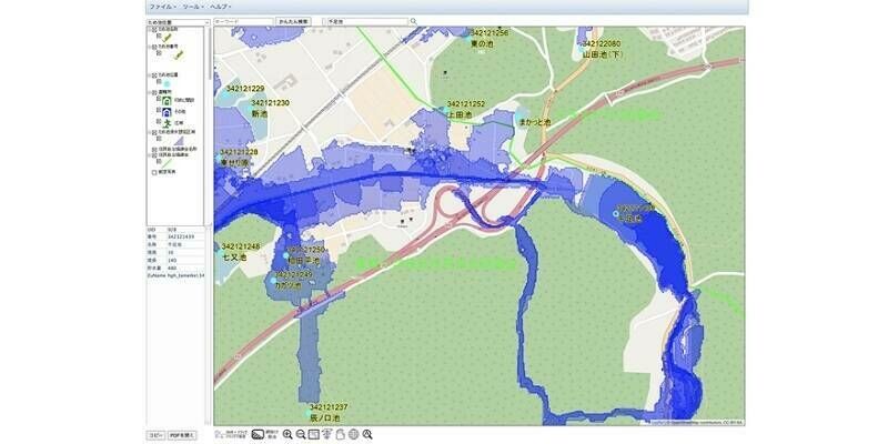
30th August 2023
Flood Hazard Web GIS in Japan Developed with TatukGIS SDK