Share
Latest addition to Cadcorp Data Service assists organisations in visualising flood-prone areas and mitigating flood-related challenges
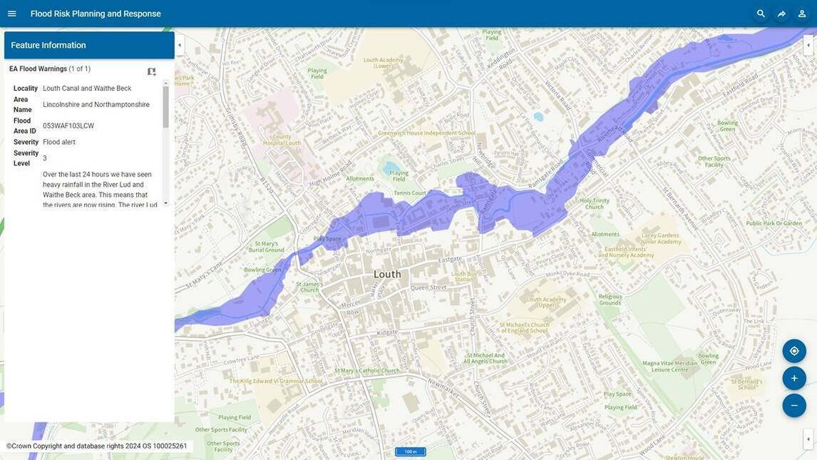
Cadcorp has expanded support for Environment Agency Real Time flood-monitoring within its desktop GIS and web mapping software. As part of the cloud hosted Cadcorp Data Service, users can now access regularly updated flood warnings.
Users can display flood warnings for a specific county, within a radius, and by severity (severe flood warning, flood warning, flood alert or warning no longer in force). Additional information can also be displayed, such as the locality, area name, and a detailed description of the warning.
The Flood Areas option indicates where the Environment Agency expects flooding to occur from rivers, sea and in some locations, groundwater. The data service can also be used to display historical flooding.
The Cadcorp Data Service is part of a range of cloud services available to customers who subscribe to Cadcorp SIS Desktop and Cadcorp SIS WebMap in the cloud, or as a separate licenced service for customers that still have an onsite installation. To learn more, visit this website.
Subscribe to our newsletter
Stay updated on the latest technology, innovation product arrivals and exciting offers to your inbox.
Newsletter

