Share
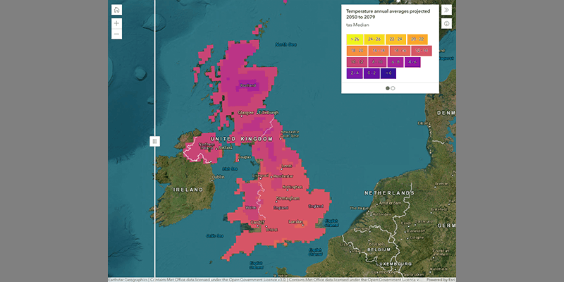
The Met Office’s Climate Data Portal has gone live, giving organizations improved access to climate data and other resources, allowing them to better understand and respond to climate change. Part of the Met Office’s wider strategy to maximise the benefits of its data, the portal contains 60 different data layers, as well as guidance and information.Built using geospatial technology from Esri UK, the portal makes it easier for businesses or government organisations to combine open climate data with their data and reveal the future impact of extreme conditions on their operations, including heatwaves, floods, or droughts. The project is part of the strategic partnership between the Met Office and Esri UK who have been working together for over 20 years. www.esriuk.com


