Cadcorp SIS 9.1 further expands spatial analysis capabilities in latest Service Release
12th May 2025
Cadcorp SIS 9.1 further expands spatial analysis capabilities in latest Service ReleaseAbout Cadcorp
Spatial insight
Cadcorp helps organisations derive meaningful and actionable intelligence from data. We do this with an extensive range of GIS software, spatial data and consultancy services designed to better inform decision-making. With our technical knowledge and expertise, we know how to support our customers in realising the benefits of location information.
https://www.geoconnexion.com/companies/cadcorp
+44 (0)1438 747996
Sterling Court, Norton Road, Stevenage, Hertfordshire, SG1 2JY, UK
1995
Crime Mapping
GIS
Cloud Computing
Interoperability & Open Standards
Location Intelligence
Emergency Services
Property
Central Government
Insurance
Crime Modelling
12th May 2025
Cadcorp SIS 9.1 further expands spatial analysis capabilities in latest Service Release
12th March 2025
Hampshire & Isle of Wight Fire and Rescue Service benefits from integrated GIS technology
26th February 2025
South Oxfordshire and Vale of White Horse District Councils accelerate digital transformation with Cadcorp cloud GIS
10th February 2025
Cadcorp provides GIS with integrated emergency services applications
22nd January 2025
Preston City Council embraces cloud GIS to fulfil compliance and accessibility requirements
20th January 2025
Croydon Council selects integrated corporate GIS to improve efficiencies
15th November 2024
Major updates to Cadcorp GIS software and cloud services in G-Cloud 14
23rd October 2024
Cloud GIS provides North Devon with easy access to streamlined service information
18th October 2024
Devon & Cornwall Police and Dorset Police award corporate GIS contract to Cadcorp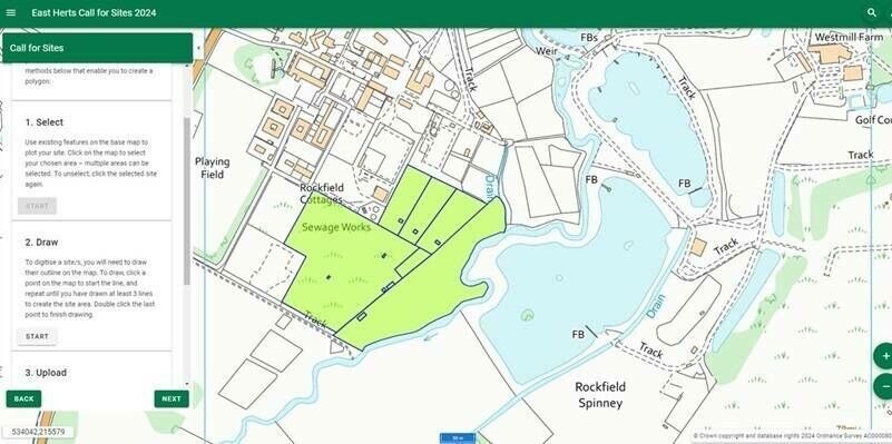
19th September 2024
Cadcorp launches new Call for Sites application
18th September 2024
Burnley Council appoints Cadcorp for cloud GIS and software integration services
4th September 2024
WDH improves homes and neighbourhoods with web mapping

20th March 2024
East Herts District Council selects Cadcorp for advancing digital planning service
14th March 2024
Cadcorp cloud access to Environment Agency Real Time flood-monitoring
12th January 2024
Affinity Water selects Cadcorp to fulfil digital mapping requirements
18th September 2023
Cadcorp supports customers in gaining deeper insight from data
25th July 2023
Torus gains clear and compelling insights with Cloud GIS and web mapping
31st May 2023
Havebury Housing introduces GIS to meet corporate strategy objectives

9th February 2023
Integrated GIS, web mapping and spatial data for Peel L&P
16th January 2023
Northern Ireland Fire & Rescue Service awards contract to Cadcorp
6th December 2022
Web mapping to support the National Forest’s 25-year vision
24th November 2022
Angus Council selects Cadcorp cloud hosted web GIS
17th October 2022
Cadcorp expands cloud options for desktop GIS, web mapping and spatial data in G-Cloud 13
7th June 2022
Bedfordshire Fire and Rescue Service select Cadcorp GIS for customer insight project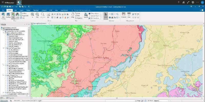

15th March 2022
Stevenage Borough Council and East Herts District Council ICT Partnership move to Cadcorp corporate GIS in the cloud
4th March 2022
Cadcorp SIS 9 service release provides additional benefits to users
1st February 2022
Oxfordshire Fire and Rescue Service invests in independently performed Risk Modelling

9th December 2021
Torus appoints Cadcorp as cloud GIS supplier
8th December 2021
Teign Housing appoints Cadcorp as cloud GIS supplier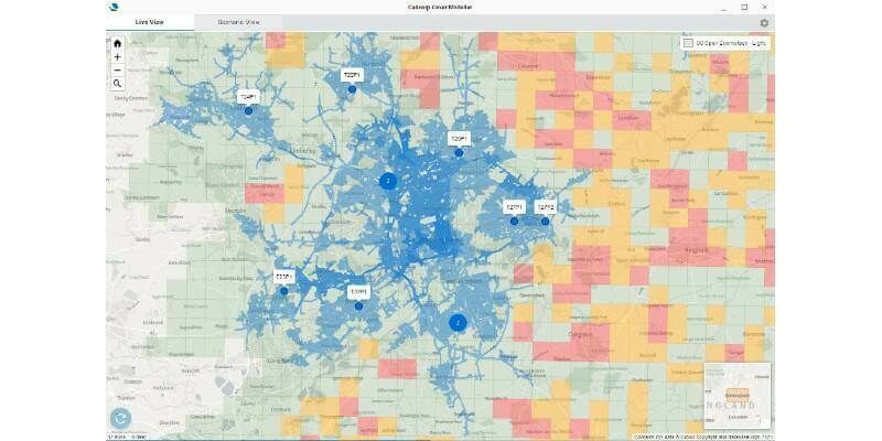
23rd November 2021
Cadcorp launches dynamic cover application for Emergency Services
25th October 2021
Staffordshire County Council awards contract to Cadcorp for corporate GIS in the cloud
1st October 2021
Cadcorp expands fire service modelling expertise
19th August 2021
Gemma Polmear appointed to provide fire service modelling consultancy at Cadcorp
29th June 2021
Staffordshire Fire and Rescue Service combines GIS with workload modelling and risk analysis22nd June 2021
Babergh and Mid Suffolk District Councils move to cloud GIS
15th June 2021
Northamptonshire Fire and Rescue Service adopts GIS software for risk analysis
21st May 2021
Devon and Somerset Fire and Rescue Service purchase GIS modelling software and services from Cadcorp
16th March 2021
Cadcorp SIS 9 service release widens access to addressing
11th February 2021
Leicestershire Fire and Rescue Service introduces FireMap to share incident, water and risk information
28th September 2020
Cadcorp offers substantial additions to online GIS and web mapping capability in G-Cloud 12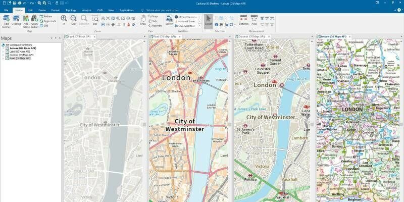
3rd August 2020
Cadcorp SIS 9 service release enables direct link to Ordnance Survey Data Hub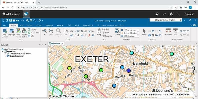
2nd July 2020
Cloud migration path for Cadcorp SIS Desktop
8th May 2020
Cadcorp launches desktop GIS capability in the cloud