Share
Geographical Information Systems (GIS) software, Cadcorp SIS, is continuing support for Ordnance Survey (OS) data products.
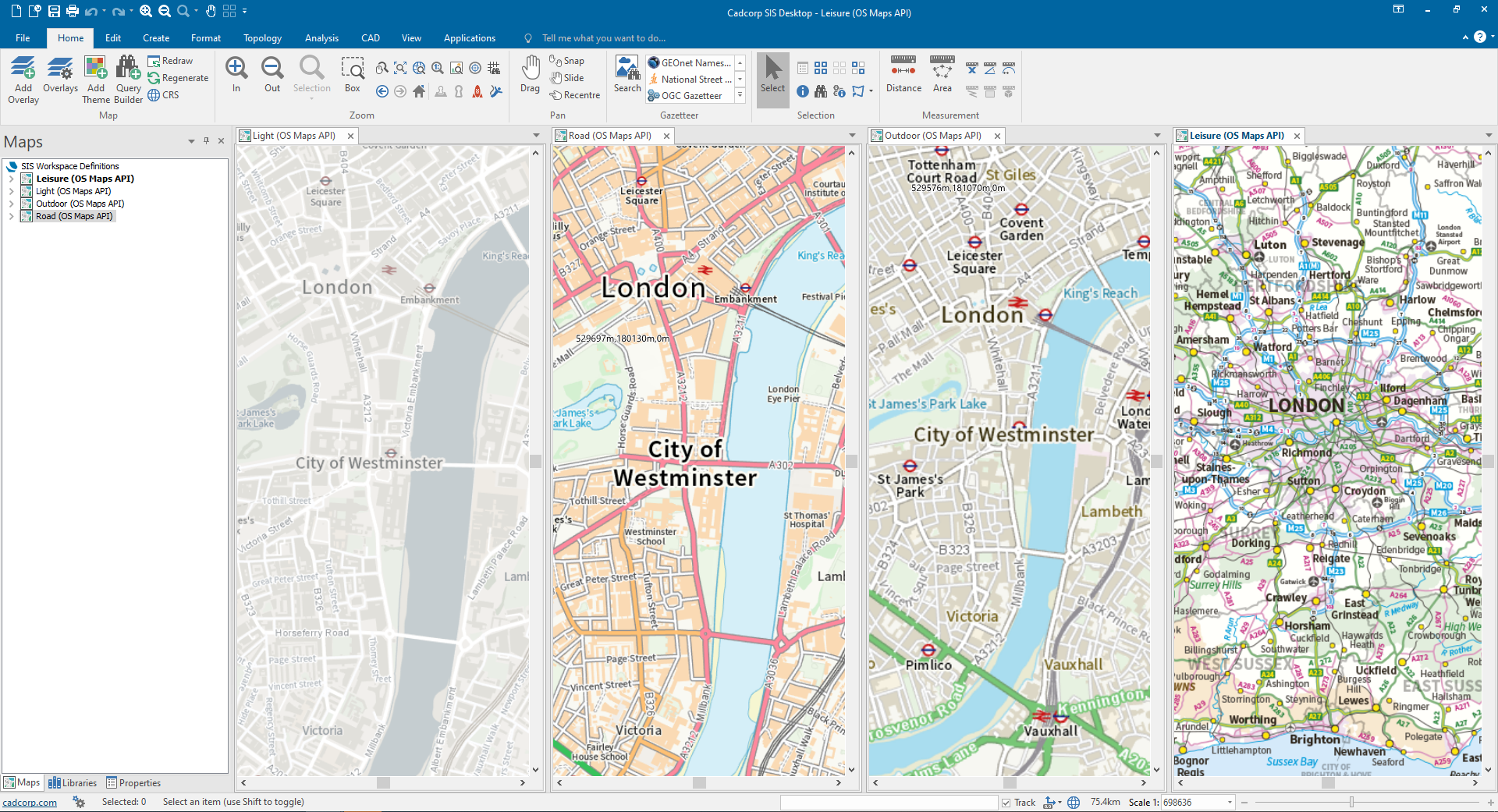
In its latest service release, Cadcorp SIS Desktop now connects directly to the newly released Ordnance Survey Data Hub. It has dedicated wizards for connecting to the OS Features API, the OS Maps API and the OS Vector Tile API. Both the OS Maps API and OS Vector Tile API are available in British National Grid and ‘Web Mercator’ coordinate reference systems. These features are also available in SIS Desktop in the cloud, which can be run on Windows Virtual Desktop or via a browser.
Martin Daly, technical director at Cadcorp commented: “The new OS APIs are a great way to connect to its authoritative geospatial data. The simplest possible access to Ordnance Survey mapping, with the best possible experience whichever way it is served, is important to us and to our users. We’re delighted to offer this new capability as standard within Cadcorp SIS.”
The service release also includes improved performance of PostGIS and Microsoft SQL Server database connections, with faster exports to Microsoft SQL Server a notable benefit.
The off-the-shelf web mapping application, Cadcorp SIS WebMap, has been updated to support the OS Maps API as a basemap layer. The Aligned Assets SinglePoint address search engine can now be added to Quick Search. For Administrators, a number of user led enhancements have been made to SIS WebMap. The ‘Allow Embedded Map’ option has been added giving administrators control over which maps are available to be embedded in standard web pages. Updated zoom controls, layer switcher and key map styling in the embedded map, with individual layer controls are also included. Starting SIS WebMap using a URL has been both speeded up and enhanced to provide more control over which layers are displayed. Other options allow the Administrator to define the version of HTTP being used, whilst the underlying framework has been updated to support TLS 1.3.
Cadcorp SIS WebMap for Power BI, which is used to embed an interactive map into Microsoft Power BI, now supports filtering from the map to other associated visuals. Extra options in MapTips such as changing order and including a prefix provide additional customisation.
As always, the service release incorporates a number of bug fixes, software updates and performance enhancements to improve customer experience. For more information, visit this link.
Subscribe to our newsletter
Stay updated on the latest technology, innovation product arrivals and exciting offers to your inbox.
Newsletter

