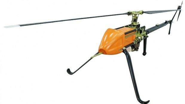
UAVOS Introduces UVH-25EL LiDAR Mapping UAV
30th October 2019
UAVOS Introduces UVH-25EL LiDAR Mapping UAVTerrestrial and airborne laser (LiDAR) scanners for the collection of 3D point cloud data; software for processing and visualising point clouds and creating 3D models, and use cases for laser scanning
This topic covers the science, the hardware, and the software used to capture, process and apply 3D point cloud data. As well as airborne and terrestrial (tripod-based, vehicle-mounted and handheld) laser (LiDAR) scanners, the topic includes the proprietary and Open Source software employed to process point clouds and create 3D models. It also covers the many and varied uses for 3D laser scanning: topographic mapping, bathymetric mapping, utility mapping, engineering surveying, agriculture, forestry, geology, architecture, industrial facilities, cultural heritage, asset management and construction, collision avoidance in autonomous and semi-autonomous vehicles, and environmental modelling
30th October 2019
UAVOS Introduces UVH-25EL LiDAR Mapping UAV
29th October 2019
Routescene UAV LiDAR system used to reconstruct WWII concentration camp
29th October 2019
Riegl announces new Colombian Distributor
15th October 2019
Pointfuse New Scan 2 BIM Workflow at Digital Construction Week
15th October 2019
Bluesky Expands International Ops with New Production Centre
15th October 2019
Orbit GT and Viametris, France, sign Reseller Agreement
14th October 2019
Riegl welcomes the miniVUX-2UAV to the unmanned family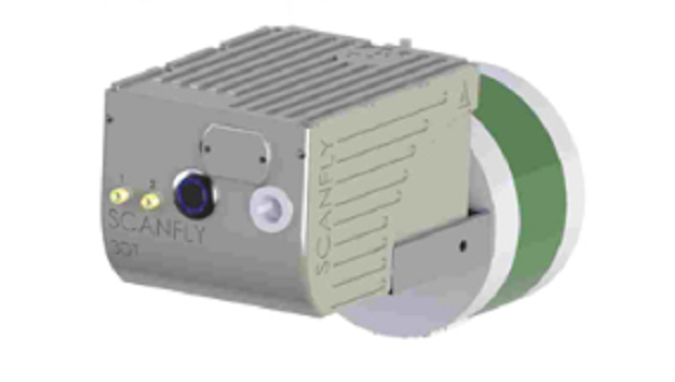
9th October 2019
SCANFLY HD2 increases the longitudinal resolution at higher speed
8th October 2019
Riegl to attend and exhibit at Americas Geospatial Forum 2019
7th October 2019
International SCADA SECURITY Conference, PRAGUE, Czech Republic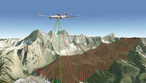
7th October 2019
First North American Customer for the new Riegl VQ-1560II
4th October 2019
Ground Penetrating Radar: The Unlikely New Hero of Autonomous Vehicles
3rd October 2019
Riegl announces VQ-780 II waveform processing airborne laser scanner
25th September 2019
Bluesky Appoints Jamieson to Drive Innovation in Aerial Mapping
24th September 2019
Intergeo 2019 Announcement: GeoSLAM's new addition to the ZEB family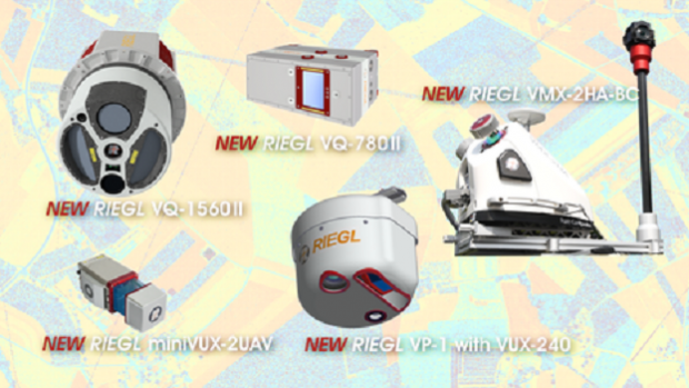
17th September 2019
Leica Geosystems announces major efficiency improvement to airborne urban mapping solution
16th September 2019
Bluesky Launches International MetroVista City Mapping Service at Intergeo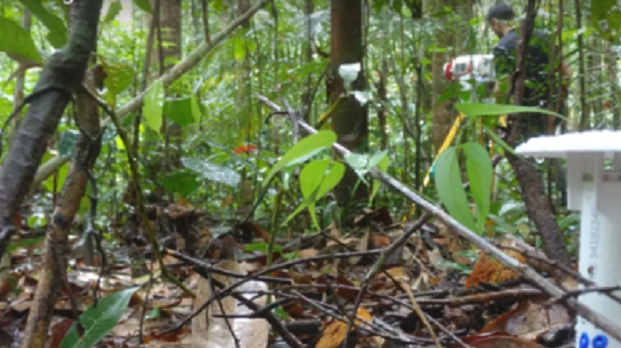
16th September 2019
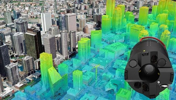
Riegl VZ-400i used to detect deforestation in the Amazon rainforest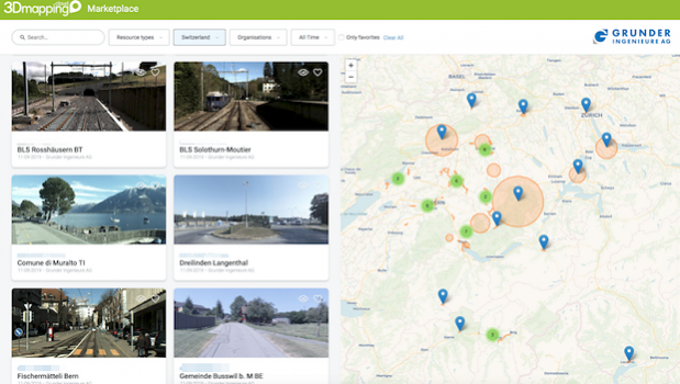
16th September 2019
Orbit GT launches Marketplace for 3D Mapping Content at INTERGEO, Stuttgart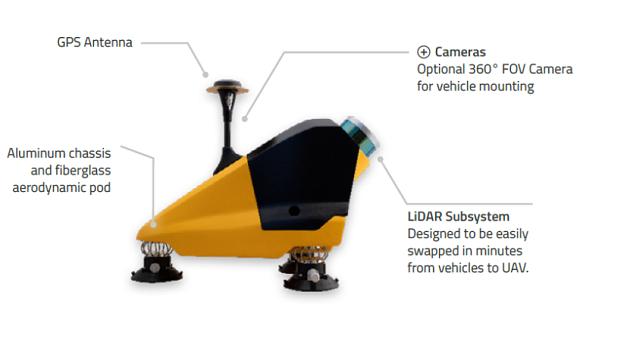
11th September 2019
Another way to explore the world – Fly & Drive
9th September 2019
Orbit GT and eagle eye technologies, sign Reseller Agreement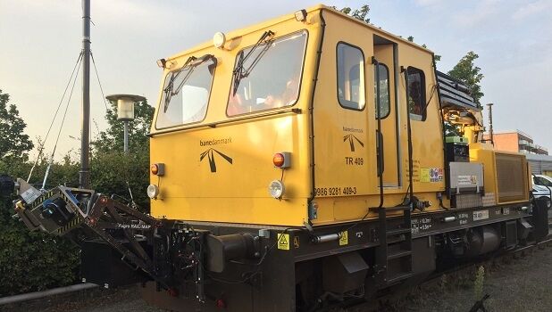
9th September 2019
Banedanmark chooses Fugro’s RILA system to survey the Danish rail network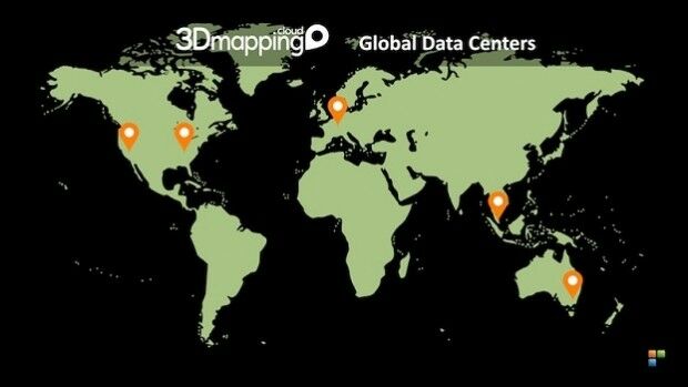
3rd September 2019
Orbit GT opens additional Data Center in western USA
2nd September 2019
G-Core Labs introduced a unique cloud object storage service integrated with CDN
27th August 2019
Orbit GT to exhibit and showcase v20 at INTERGEO, Stuttgart, Germany
22nd August 2019
Pointfuse Laser Scanning Software Transforms Digital Construction Workflows
22nd August 2019
Bluesky LiDAR Survey Helps Dublin Airport Reduce Risk of Flooding
21st August 2019
Orbit GT and Harmony Instruments, Hong Kong, sign Reseller Agreement
19th August 2019
LIDAR AND BVLOS UAVS: ENABLING THE ULTIMATE SOLUTION FOR HIGHLY EFFICIENT MAPPING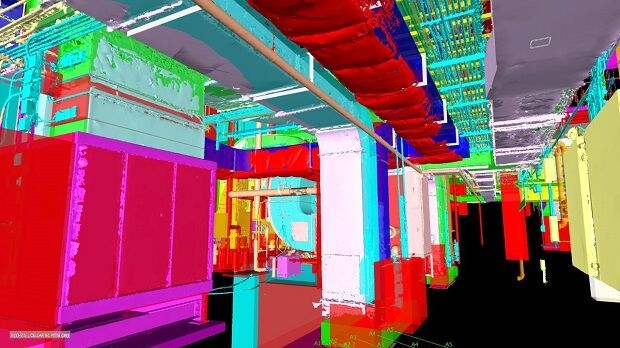
15th August 2019
Pointfuse Laser Scanning Software Transforms Digital Construction Workflows
14th August 2019
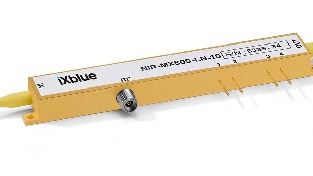
Laser Components releases new near-infra-red modulators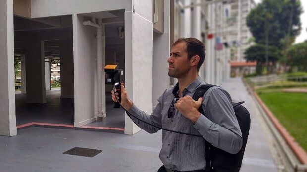

23rd July 2019
QuickSwitch® Recognised for Excellence in Sensors Innovation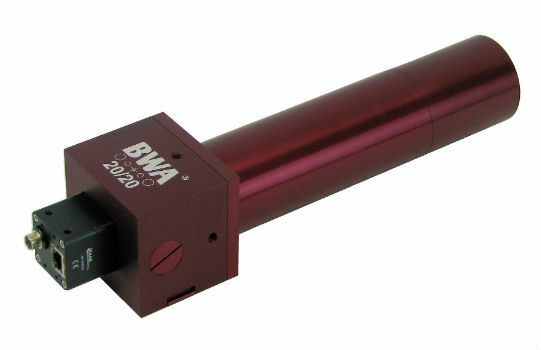
19th July 2019
BWA-CAM 20/20 - The World‘s First ‘Plug-and-Play‘ Solution
13th July 2019
GSSI Receives Presidential Award for Exports11th July 2019
Save the Date ! Webinar July 18 at 6 PM CET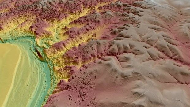
8th July 2019
Virtual Surveyor Enhances LiDAR Point Cloud Handling

1st July 2019
Viametris is launching the second-generation version of the vMS30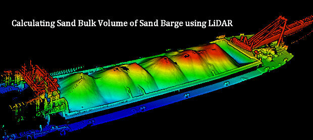
1st July 2019
Calculating Sand Bulk Volume of Sand Barge using LiDAR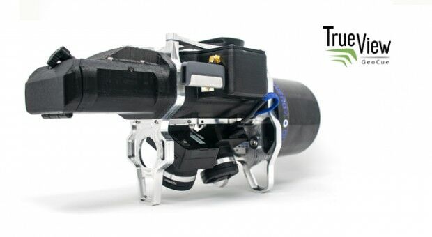
28th June 2019
Geocue introduces industry’s first drone lidar/imagery fusion sensor
27th June 2019
Geospatial solutions company Getmapping announces its new partnership with Hexagon’s Geospatial divi
18th June 2019
Undet for Revit – forget the loading of heavy RCP / RCS point cloud files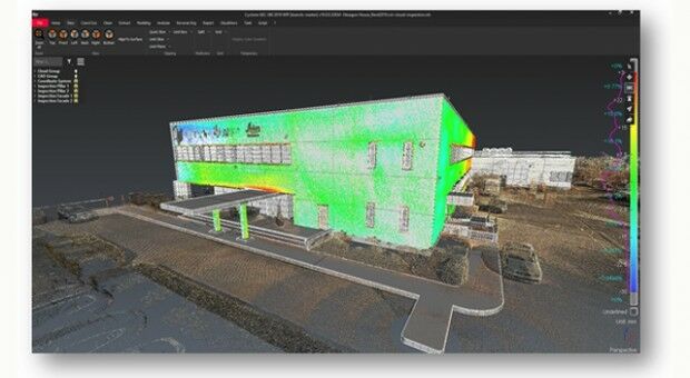
18th June 2019
New domain-centric reality capture software from Leica Geosystems