
Bentley Systems Announces Finalists for the 2021 Going Digital Awards in Infrastructure
21st September 2021
Bentley Systems Announces Finalists for the 2021 Going Digital Awards in InfrastructureComputer-based tools and techniques for the storage, processing, querying and visualisation of geographic data, most notably in the form of maps, charts and atlases
This topic covers the software systems and services– both desktop, mobile and cloud-based - that are used across the public, private and consumer sectors to store, process and display geographic data, most notably in the form of maps, charts and atlases. It also covers the tools provided by such software and cloud-based services to manipulate, analyse and query that data, as well as to integrate a variety of non-spatial datasets. See also Geographic Information Systems (GIS)
21st September 2021
Bentley Systems Announces Finalists for the 2021 Going Digital Awards in Infrastructure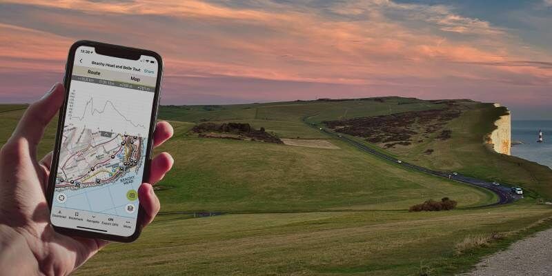
9th September 2021
Outdooractive UK expands its cartography team ahead of satellite tech advances12th August 2021
Fraunhofer IPM awarded for development of AI tool that creates smart planning maps
11th August 2021
Agisoft Metashape Pro and 3D PluraView monitors enable 3D-stereo photogrammetry at its best16th July 2021
Esri Releases New Predictive 2050 Global Land Cover Map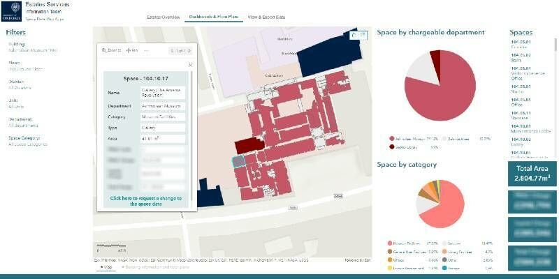
14th July 2021
University of Oxford improves efficiency of estate management with indoor mapping
1st July 2021
Septentrio announces partnership with XenomatiX21st June 2021
NTIA Creates First Interactive Map to Help Public See the Digital Divide Across the Country17th June 2021
RYA Coastal Atlas update to improve protection of recreational boating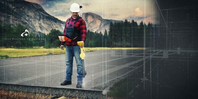
14th April 2021
Underground Utility Mapping Workshop with Eos Locate™ for ArcGIS Field Maps12th March 2021
Property Consultancy Addresses COVID Challenges using thinkWhere Web Mapping Technology
5th March 2021
Ecopia AI and Airbus partnership will provide next-generation digital maps on a global scale
19th February 2021
National Energy System Map contract awarded to 1Spatial and Ordnance Survey by The Energy Networks Association4th February 2021
Bluesky Takes to the Air to Create First Ever 3D Map of Northern Ireland’s Coastline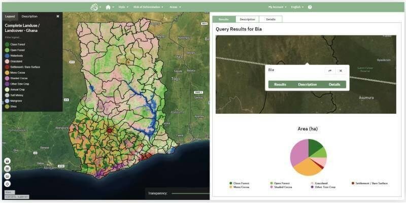
2nd February 2021
Ghana launches National Map of Forests and Land Use
27th January 2021
L3Harris - You're Invited to Spectral Sessions!
14th January 2021
Esri Ireland partners with Bluesky to enhance its digital mapping offering in Ireland
13th January 2021
Ordnance Survey appoints Carly Morris as Head of Geovation
2nd December 2020
The 3D PluraView stereo monitor family – Meeting the highest requirements for Geospatial applications30th November 2020
Mutoh EMEA Launch Heavy Duty Automated Feed & Take-Up System for XpertJet Roll-to-Roll Printers
26th November 2020
Bluesky 3D Maps Enhance Ambiental’s Future Climate Change Flood Risk Model16th November 2020
Scottish Government extends viaEuropa web services agreement12th November 2020
Ordnance Survey appoints Carly Morris as Head of Geovation
6th November 2020
Road Pavement Analysis with the RIEGL VMX-2HA Mobile Mapping System23rd October 2020
Esri Ireland partners with Bluesky to enhance its digital mapping offering in Ireland20th October 2020
CGG Launches Walker Ridge Reimaging Program in the Gulf of Mexico1st October 2020
Bluesky Creates National Tree Map for Ireland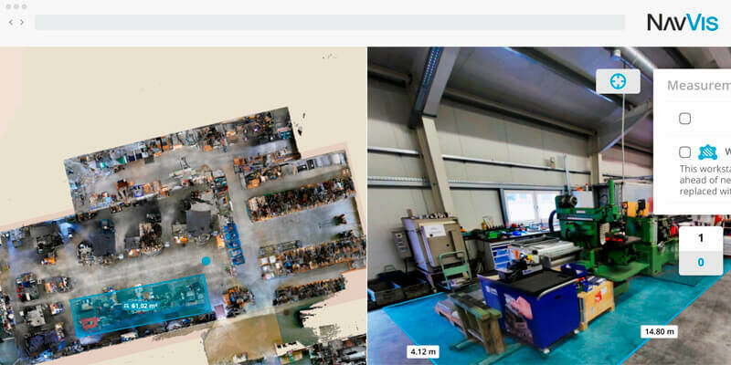

16th September 2020
MGISS Reveals Underground Highway Assets for Sir Robert McAlpine15th September 2020
Wildfire Webinar: A Platform to Help Save Lives and Nature8th September 2020
Global Trends in the Mapping Industry during the Pandemic7th September 2020
GSSI Updates to StructureScan Mini XT GPR Kit and Palm XT Antenna3rd September 2020
Buccleuch Improves Property and Land Asset Management with thinkWhere31st August 2020
How to Improve the Quality of Drone Mapping Projects Webinar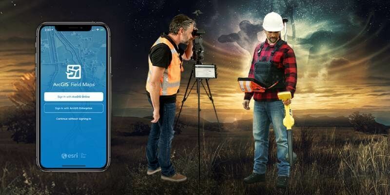
28th August 2020
ArcGIS Field Maps Beta supports Eos Locate (underground mapping) and Eos Laser Mapping

11th August 2020
TDI-Brooks Maps the Liberty Ship Reef Site George Vancouver9th August 2020
CGG Multi-Physics Updates LCT Software with Innovations for Imaging Potential Field Data6th August 2020
Esri and United Nations Create COVID-19 Population Vulnerability Dashboard4th August 2020
Covid-19 – a catalyst for doing things differently
23rd July 2020
Online directory points way to national map, land registration and cadastral data from official sources17th July 2020
Bluesky Thermal Mapping Technology Helps Target Government Green Home Grants16th July 2020
4 Earth Intelligence and Ordnance Survey Partner to Reveal the World from Satellites15th July 2020
Esri and Facebook Collaborate to Release New OpenStreetMap-Ready Datasets14th July 2020
Spatial unlocks the key to joined-up government