
FOSS4G NA 2024: The Premier Open Source Geospatial Conference Returns to St. Louis, September 9-11
14th August 2024
FOSS4G NA 2024: The Premier Open Source Geospatial Conference Returns to St. Louis, September 9-11Computer-based tools and techniques for the storage, processing, querying and visualisation of geographic data, most notably in the form of maps, charts and atlases
This topic covers the software systems and services– both desktop, mobile and cloud-based - that are used across the public, private and consumer sectors to store, process and display geographic data, most notably in the form of maps, charts and atlases. It also covers the tools provided by such software and cloud-based services to manipulate, analyse and query that data, as well as to integrate a variety of non-spatial datasets. See also Geographic Information Systems (GIS)
14th August 2024
FOSS4G NA 2024: The Premier Open Source Geospatial Conference Returns to St. Louis, September 9-11
7th August 2024
Association for Geographic Information Launches Earth Observation Network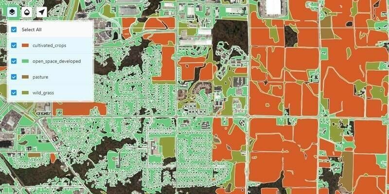
14th July 2024
Ecopia AI Launches New Agricultural Land Use Data Layers
10th July 2024
Pan-European geospatial datasets from official national sources updated to meet user requirements
26th June 2024
Association for Geographic Information Presents Awards for Geospatial Excellence
6th June 2024
Ordnance Survey expands into new territory with British Geological Survey
3rd May 2024
Mapping Hilly Terrains With Drones: Is It Possible?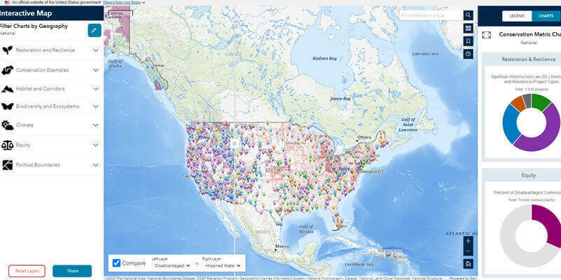
22nd April 2024
Biden-Harris Administration Launches Conservation.gov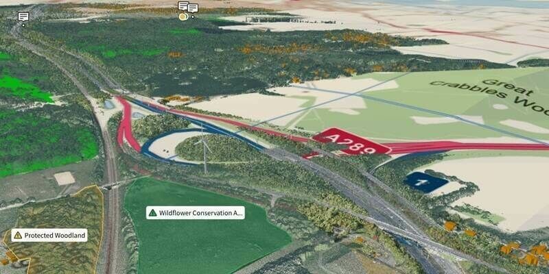
18th April 2024
Ordnance Survey And Sensat Collaboration Will Redefine Standards Of Data Visualisation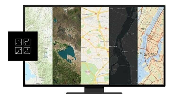
8th April 2024
Esri’s ArcGIS Basemaps Integrated into Autodesk Civil 3D and AutoCAD
28th March 2024
Woolpert Acquires Ireland-Based Murphy Geospatial
18th March 2024
Esri Recognizes Partners for Innovation and Excellence
15th March 2024
Bluesky National Tree Map Helps Protect Galway City’s Biodiversity
13th March 2024
Tetra Tech purchases Teledyne’s CZMIL SuperNova to successfully complete NOAA's Great Lakes Coastal Mapping project
27th February 2024
UK Power Networks selects 1Streetworks software to revolutionise streetworks planning
19th February 2024
Esh Construction introduces industry-changing National Underground Asset Register on site with Northumbrian Water
16th January 2024
Living Map elevates visitor experience at King’s Cross with innovative digital wayfinding map
15th January 2024
Existing ADAS Cars Just Got Smarter at CES 2024 with Mapbox Autopilot Services
12th January 2024
Affinity Water selects Cadcorp to fulfil digital mapping requirements
11th January 2024
TomTom Orbis Maps sets new standard for mapmaking with unprecedented coverage and visualization
21st December 2023
Bluesky partners with Sensat providing data for new visualisation tool
21st December 2023
TomTom joins forces with Microsoft to bring Generative AI into the vehicle
15th December 2023
HERE HD Live Map powers BMW Personal Pilot Level 3 highly automated driving function
8th December 2023
1Spatial Launches 1Data Gateway For ArcGIS Pro, A Revolutionary Data Quality Add-In For Esri ArcGIS Pro
8th December 2023
Swietokrzyskie Province selects Hexagon for digitisation project with potential to expand to regional investment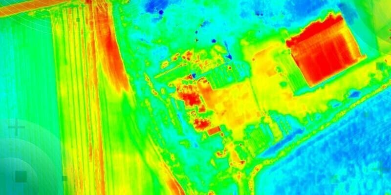
7th December 2023
TOPODRONE-AGROWING collaboration aims at advancing drone thermal mapping
1st December 2023
Pitkin County 911 To Modernise Dispatch, Emergency Communications With Hexagon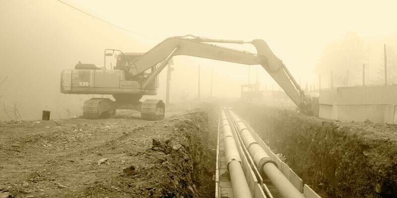
27th November 2023
New digital map of underground pipes and cables expected to grow economy by £5 billion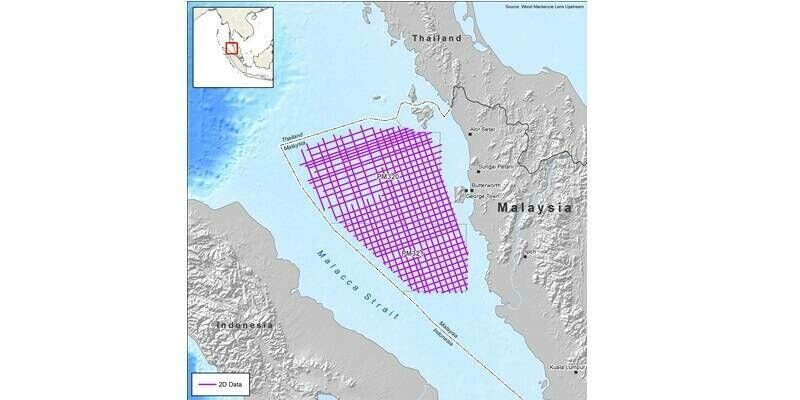
20th November 2023
CGG to Acquire 8,000 km of Multi-Client Data Offshore Malaysia
20th November 2023
Esri and National Geographic Society Launch National Geographic MapMaker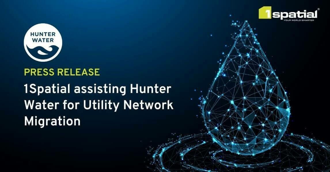
14th November 2023
1Spatial assisting Hunter Water for Utility Network Migration
2nd November 2023
Anglian Water Alliance Streams Bluesky Aerial Mapping for Web App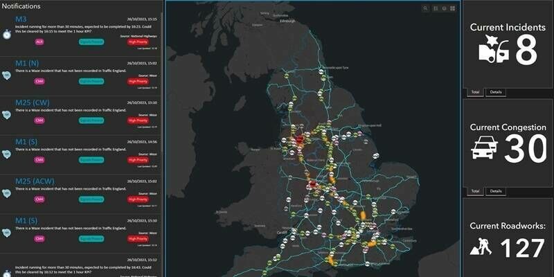
1st November 2023
National Highways recognised for geospatial innovation by Esri global award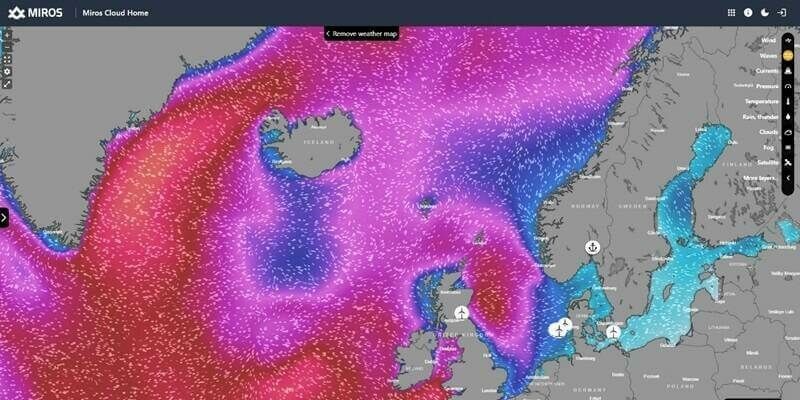
31st October 2023
Miros expands ocean insights offering to offshore sectors
19th October 2023
Ordnance Survey launches significant buildings and transport enhancements
4th October 2023
Trimble receives Merit Award for Technology Innovation
27th September 2023
Mappedin Empowers Communities to Map Every Building With Game-Changing App
25th September 2023
Fugro supports coastal resilience in Florida with new seafloor mapping contract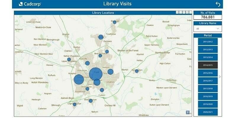
18th September 2023
Cadcorp supports customers in gaining deeper insight from data
5th September 2023
GIS People Introduces Free Educational eBook: Open-Source GIS vs Commercial GIS
1st September 2023
EuroGeographics and International Cartographic Association agree collaboration to unlock power of location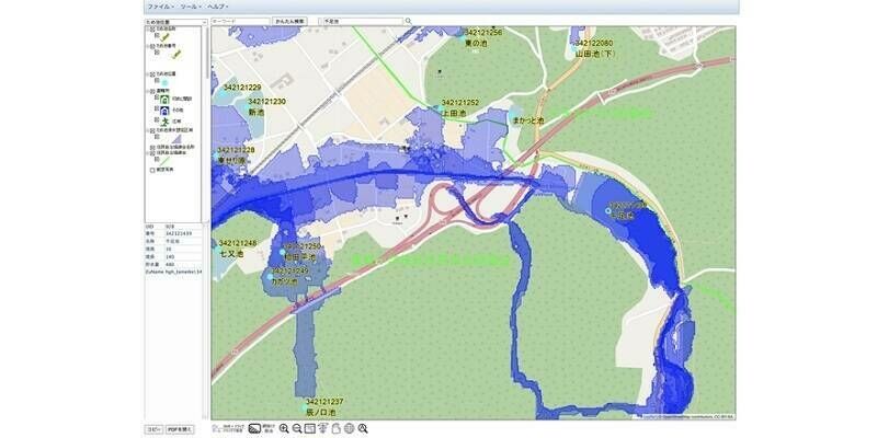
30th August 2023
Flood Hazard Web GIS in Japan Developed with TatukGIS SDK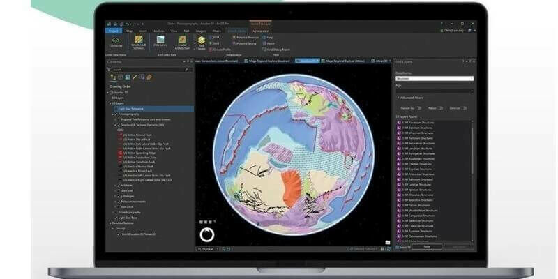
25th August 2023
Getech Releases Globe 2023 with New Capabilities for Resource Exploration
24th August 2023
STRYDE launches integrated in-field data processing service for faster decision-making

25th July 2023
Torus gains clear and compelling insights with Cloud GIS and web mapping