Share
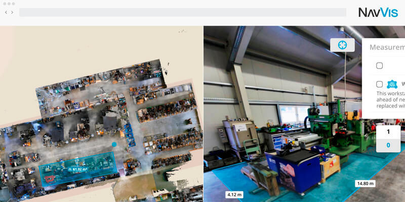
NavVis, the global provider of indoor spatial intelligence technology and enterprise solutions, announced the release of NavVis IndoorViewer 2.7. With this major software release users can look forward to a number of additional features to the measurement tool including the ability to annotate measurements as well as being able to export and share them as PDF documents. NavVis IndoorViewer is an innovative web-based deliverable that, in just a few clicks, turns laser scan data into basic building models displayed as 360° realistic digital buildings, point clouds and customizable floorplans. The next generation software, which is also available as a cloud-based SaaS solution – NavVis Cloud – can be set up on-demand without the need for added IT infrastructure and maintenance.
www.navvis.com


