Share
1Spatial, a provider of Location Master Data Management (LMDM) software and solutions has worked with Geomni UK in creating a traffic light system to determine pavement width to support social distancing during the COVID-19 pandemic.
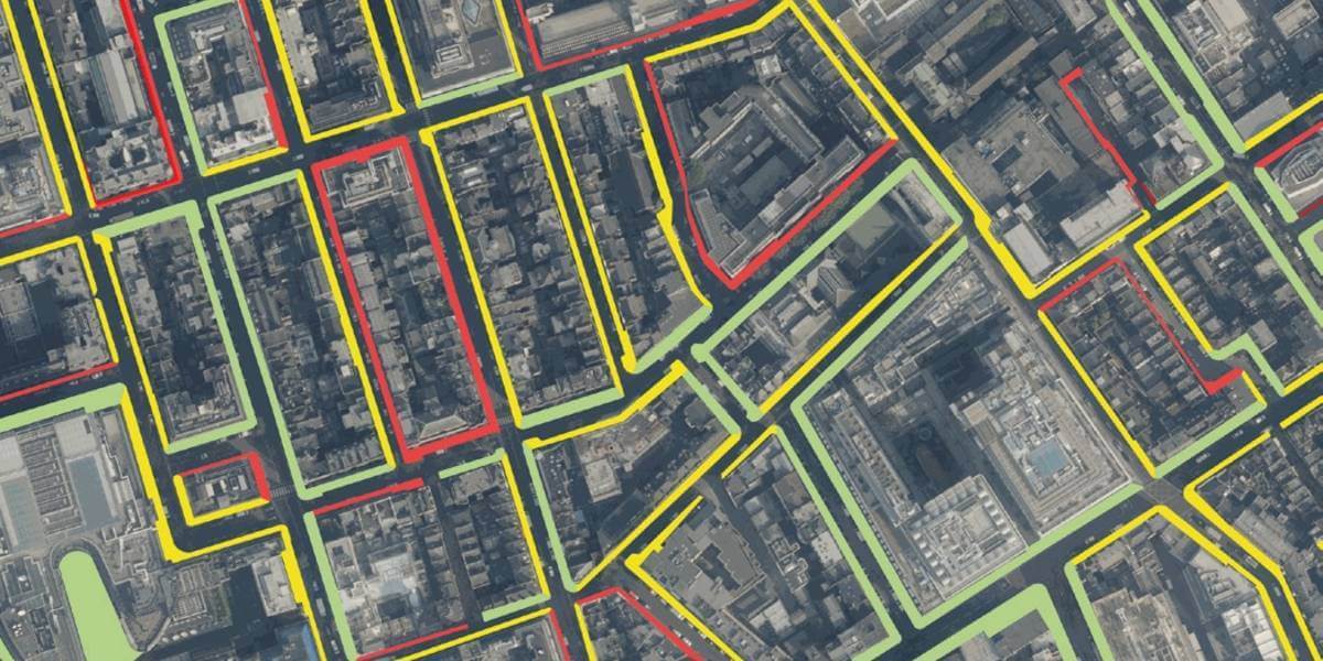
To help organisations planning and implementing social distancing measures in Greater London, Geomni UK has derived pavement widths to add to its feature-rich UKMap database. The addition of the valuable new attribution, created in response to an initial customer request, was developed using FME Desktop with help provided by 1Spatial as part of its unlimited technical support service.
Using FME Desktop and supported by 1Spatial, a member of Geomni UK’s team was able to analyse and calculate the average width of pavements, and quickly supply the data as a value-add to UKMap.
Users can clearly and quickly identify the space available thanks to a colour-coded traffic light system: Green being a width of more than three metres; yellow showing pavements of between two and three metres; and red indicating an average width of less than two metres.
As it is not always evident where pavements start or end, Geomni UK tapped into 1Spatial’s FME expertise to help finalise the last step in the solution. The speed at which FME enabled the two organisations to work together – from initial concept to data delivery – was pivotal to their success which was reliant on the analysis of 250,000 polygons and 4.2 million width calculations.
Tom Timms, Managing Director, Geomni UK said:
“Responding to Covid-19 has been a catalyst for doing things differently, driving innovation by using existing tools to rapidly react to new challenges to deliver unambiguous, easy-to-use data.”
David Eagle, FME Division Manager, 1Spatial commented:
“Speed is of the essence when responding to an emergency. Covid-19 has been no different and we are pleased to play a part in this solution, which will help keep people safe as social distancing evolves to reflect the ever-changing risks. Being able to deliver from concept through to prototype and then the rapid delivery of the dataset has shown the fantastic capability of FME.”
Public services and research organisations responding to Covid-19 can benefit from free access to Geomni UK data and, through 1Spatial, free access to FME until at least the end of September 2020.
To read the full case study please click here.
Subscribe to our newsletter
Stay updated on the latest technology, innovation product arrivals and exciting offers to your inbox.
Newsletter

