EuroGeographics selected as friend of the EU Mission Adaptation to Climate Change
3rd October 2022
EuroGeographics selected as friend of the EU Mission Adaptation to Climate ChangeComputer-based tools and techniques for the storage, processing, querying and visualisation of geographic data, most notably in the form of maps, charts and atlases
This topic covers the software systems and services– both desktop, mobile and cloud-based - that are used across the public, private and consumer sectors to store, process and display geographic data, most notably in the form of maps, charts and atlases. It also covers the tools provided by such software and cloud-based services to manipulate, analyse and query that data, as well as to integrate a variety of non-spatial datasets. See also Geographic Information Systems (GIS)
3rd October 2022
EuroGeographics selected as friend of the EU Mission Adaptation to Climate Change
28th September 2022
Esri UK announces new Teach with GIS resources
21st September 2022
HEAVY.AI Launches Industry’s First Digital Twin for Telco Network Planning, Building and Operations, Leveraging the NVIDIA Omniverse Platform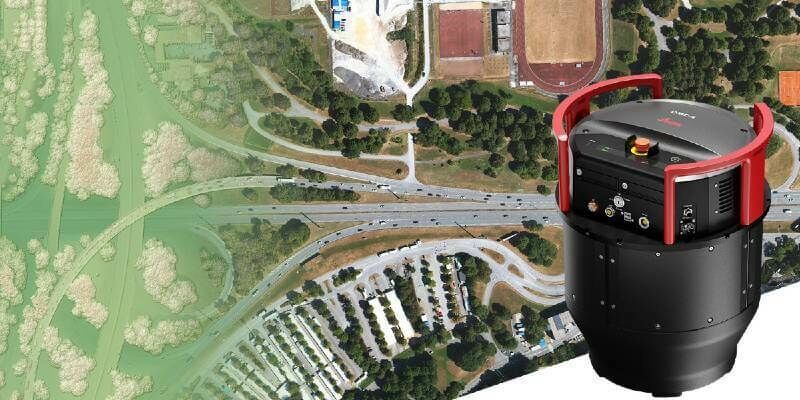
9th September 2022
Leica Geosystems announces new Leica DMC-4 airborne imaging sensor delivering superior image fidelity
1st September 2022
1Spatial Awarded VertiGIS Products Call-Off Contract with Defra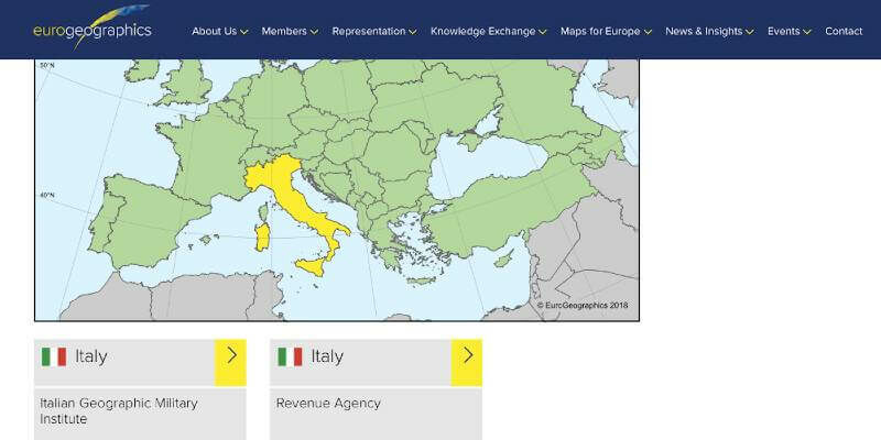
24th August 2022
EuroGeographics welcomes strengthened UN-GGIM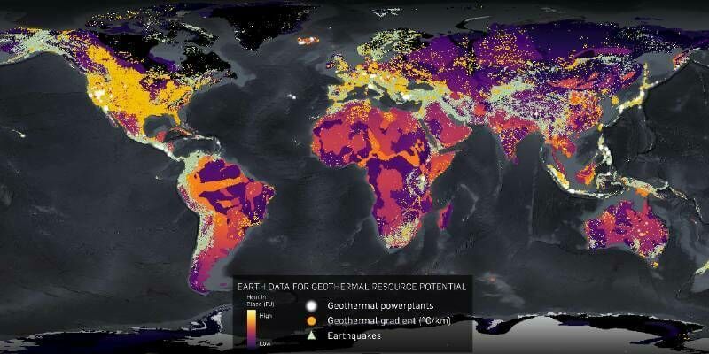
2nd August 2022
CGG Licenses Geothermal Multi-Client Studies Supporting Energy Transition to US Energy Company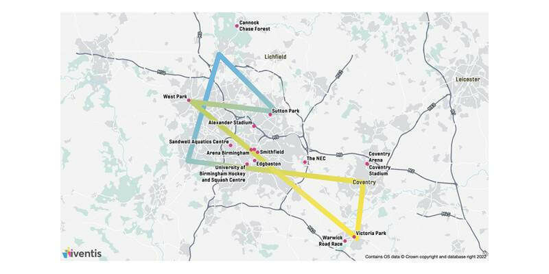
26th July 2022
Birmingham 2022 Commonwealth Games selects Iventis as official technology supplier
18th July 2022
BASEMAP Announces £3.2 Million PSGA Contract with Ordnance Survey11th July 2022
VinFast integrates Intelligent Speed Assistance from HERE Technologies into VF 8 and VF 9
28th June 2022
Surrey Heath Improves Public Engagement with XMAP Mapping Portal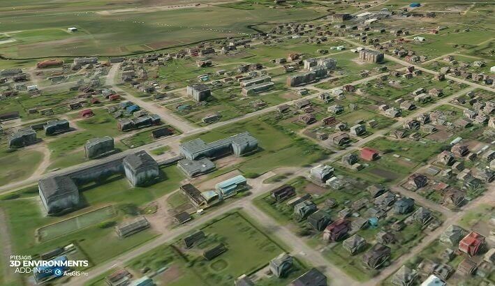
27th June 2022
Presagis Extends 3D Tiles Next Workflow into Esri ArcGIS Pro15th June 2022
Parish Online Maps a Route to Better Mental Health with Walk N Talk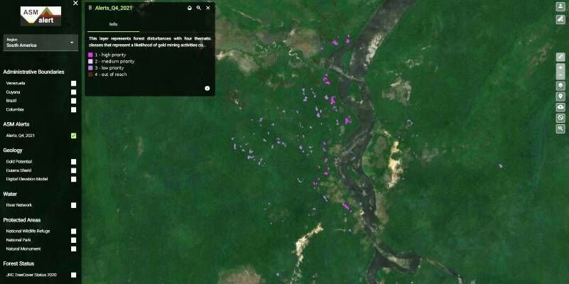
18th May 2022
Satellite data help to detect artisanal mining - GAF AG develops the “ASM Alert” web platform16th May 2022
iXblue introduces a new commercial quantum sensor for accurate underground mapping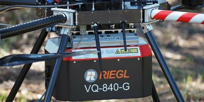
16th May 2022
Riegl Australia: Successful Integration Of The VQ-840-G Into Heavy-Lift Industrial Drone11th May 2022
Petrobras Extends CGG Geovation Seismic Imaging Software Licensing Agreement for Five Years
10th May 2022
Europa Technologies looks back with viaEuropa “Time Machine”
9th May 2022
Ecopia AI and Airbus Expand Partnership to Enable Global 3D Vector Mapping5th May 2022
IDS GeoRadar launches cloud-based AI solution AiMaps
3rd May 2022
Digital Twin pioneer Cityzenith highlighted in pivotal Ernst & Young report on Metaverse opportunities2nd May 2022
NOAA showcases new mapping tool for marine species19th April 2022
CHC Navigation introduces the AlphaAir 1400 and AlphaAir 2400 Airborne LiDAR Series
14th April 2022
Esri UK's annual conference returns to London's QEII Centre after two virtual years
12th April 2022
Esri releases updated land-cover map with new sets of global data31st March 2022
Announcing NVIDIA DRIVE Map: Scalable, Multi-Modal Mapping Engine Accelerates Deployment of Level 3 and Level 4 Autonomy30th March 2022
CGG Delivers New Multi-Client Screening Study for Lithium Brines28th March 2022
PlanetObserver Releases the most Beautiful 10m Global Imagery Basemap14th March 2022
Esri Releases Updated Land-Cover Map with New Sets of Global Data
9th March 2022
Bentley Systems Announces Availability of Life Cycle Assessment and Embodied Carbon Calculation Capabilities for Infrastructure Digital Twins9th March 2022
CGG Delivers New Multi-Client Study for Screening Geothermal Resources8th March 2022
XMAP GIS Tool Aids UK Government’s £2 Billion Active Travel Schemes
25th February 2022
CSA and BOEM to Publish Online Open-Access Atlas of US Submarine Canyons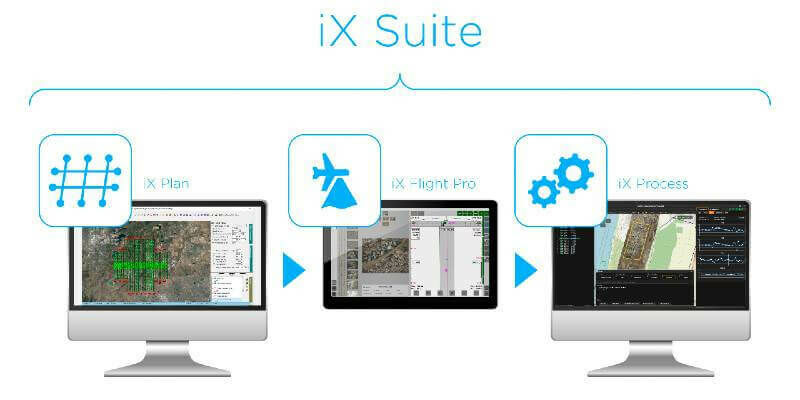
4th February 2022
Phase One Announces iX Suite for Seamless Aerial Mapping Workflow from Flight Planning to Image Delivery
1st February 2022
Oxfordshire Fire and Rescue Service invests in independently performed Risk Modelling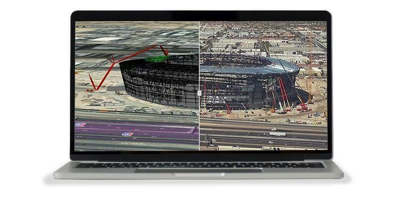
27th January 2022
EarthCam 4D Brings Construction Digital Twins to Life18th January 2022
viaEuropa extends premium maps and imagery access to Northern Ireland25th November 2021
CGG Delivers New Multi-Client Screening Study for CO2 Storage Sites in UK and Norway Northern North Sea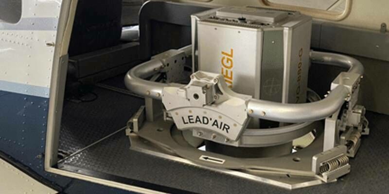
24th November 2021
RIEGL USA Signs New OEM Partner Agreement
19th November 2021
3D PluraView – stereoscopic desktop monitors for military use – shielded and zoned according to NATO standards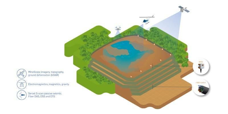
9th November 2021
CGG Launches TailingsPulse Monitoring Solution for Tailings Storage Facilities
8th November 2021
OGC seeks public comment on revision to the OGC Two Dimensional Tile Matrix Set and Tile Set Metadata Standard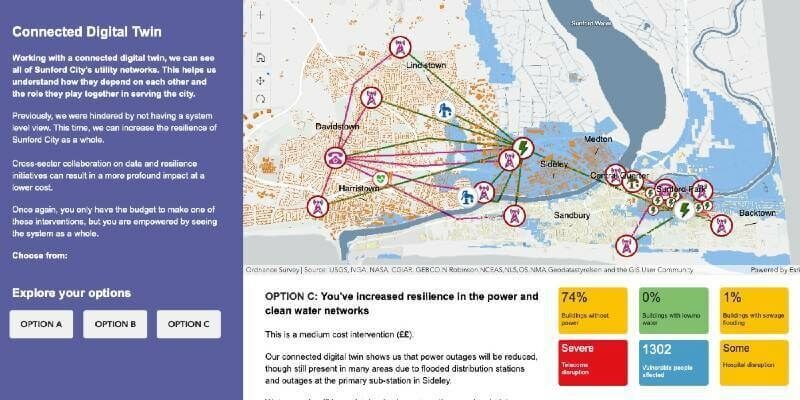
3rd November 2021
National Digital Twin programme launches interactive app and film at COP26
26th October 2021
HERE launches Intelligent Speed Assistance map for automakers to comply with EU regulation
22nd September 2021
HxGN Content Program introduces digital twins of major cities