
Predictions 2026 - Manish Jethwa, CTO, Ordnance Survey
12th December 2025
Predictions 2026 - Manish Jethwa, CTO, Ordnance SurveyComputer-based tools and techniques for the storage, processing, querying and visualisation of geographic data, most notably in the form of maps, charts and atlases
This topic covers the software systems and services– both desktop, mobile and cloud-based - that are used across the public, private and consumer sectors to store, process and display geographic data, most notably in the form of maps, charts and atlases. It also covers the tools provided by such software and cloud-based services to manipulate, analyse and query that data, as well as to integrate a variety of non-spatial datasets. See also Geographic Information Systems (GIS)
12th December 2025
Predictions 2026 - Manish Jethwa, CTO, Ordnance Survey
1st December 2025
Mapping Trends for 2026: Speed and Reliability Take the Lead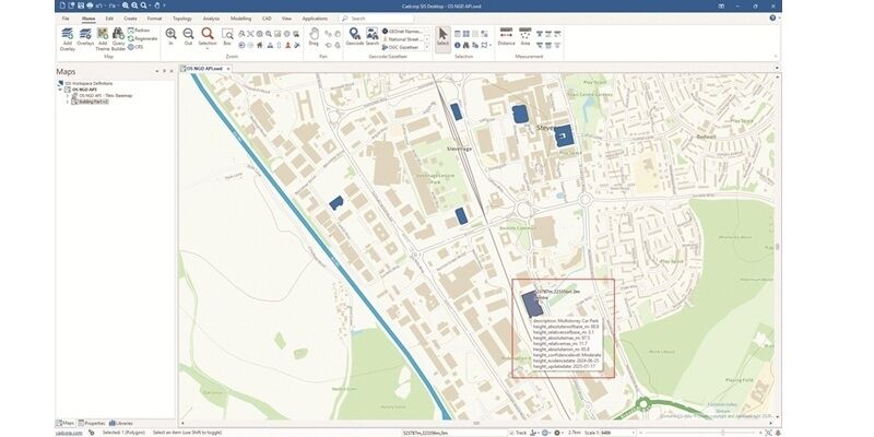
25th November 2025
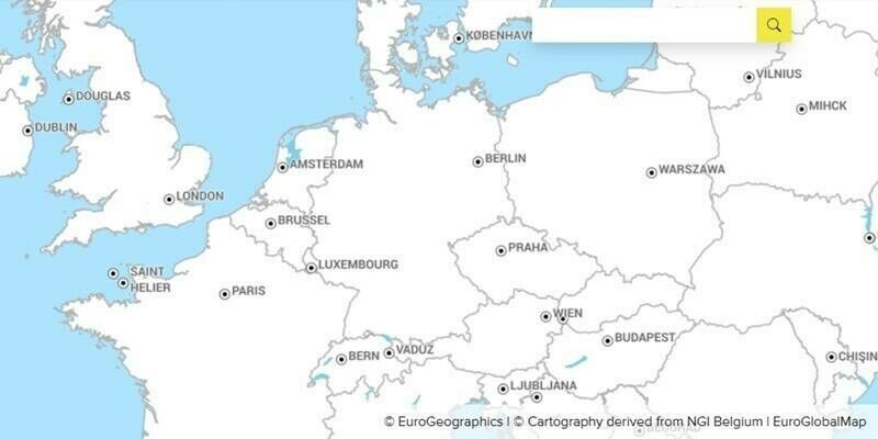
OME2 unlocks pan-European high-value data and calls for EU commitment to long-term funding
12th November 2025
Collaboration between EuroGeographics and European Environment Agency increases number of official national geospatial datasets available via CORDA7th October 2025
NSG Geospatial Services Launches “NeoMaps” as the National Platform for Geospatial Services
17th September 2025
How two innovative startups are using Ordnance Survey data to help the emergency services save lives8th September 2025
Tina Kennedy appointed Chief Customer Officer at Ordnance Survey
6th August 2025
Esri, Microsoft, and Space42 Join to Launch “Map Africa Initiative”
31st July 2025
Stream wins global Esri award for geospatial innovation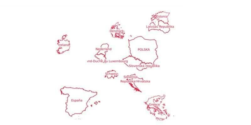
29th July 2025
OME2 adds five new countries to final release of Open Cadastral Map21st July 2025
New mapping system helped target emergency aid after Hurricane Helene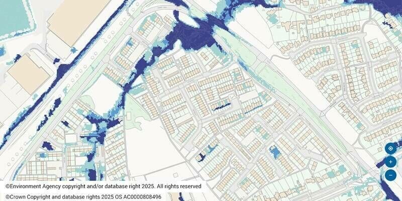
17th July 2025
Futures Housing Group employs spatial analysis for flood risk project
16th July 2025
Esri’s ArcGIS Basemaps Power Dataminr First Alert for Enhanced Real-Time Event Detection and Awareness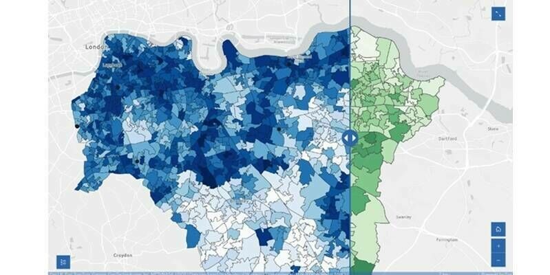
26th June 2025
Spatial analysis helps locate new women’s and girls’ health hubs in south east London12th June 2025
EuroGeographics marks 25th anniversary with record-breaking gathering of geospatial leaders
10th June 2025
SFL Missions Included on Team Awarded Moon Mapping Study Contract by European Space Agency (ESA)9th June 2025
Aligning INSPIRE with other EU legislation is highly valuable but national investments in implementation must be respected says EuroGeographics
14th May 2025
Pix4D and Vision Aerial partner to deliver drone mapping solutions13th May 2025
National Trust exceeds conservation targets with help from Esri GIS
14th April 2025
RIEGL VZ-4000i-25: The Ultimate Long Range Scanner for Topography, Mining & Monitoring19th March 2025
Ordnance Survey data now accessible on Snowflake Marketplace
18th March 2025
SimActive Used for Corridor Mapping Along Coasts7th March 2025
Fifty years of songbird maps take flight in new hands5th March 2025
Precisely launches Data Link, enabling seamless integration of datasets from data providers
19th February 2025
New model maps animal farms to tackle environmental challenges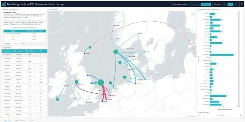
29th January 2025
Xodus-developed online dashboard providing insights on the costs of transporting CO2 across Europe
9th January 2025
Togg partners with HERE to deliver AI-powered, personalized driving with intelligent navigation and safety features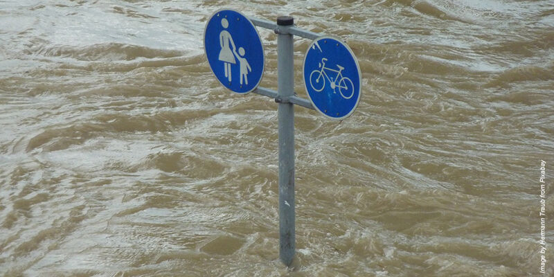

6th December 2024
Frontier Agriculture partners with Esri UK to bring location intelligence to farming industry
5th December 2024
AI helps researchers dig through old maps to find lost oil and gas wells
14th November 2024
Enhanced Security, Modernised Platforms, and New Features
8th November 2024
Trafford Centre Introduces Living Map’s dynamic, digital mapping to keep shoppers on the move
7th November 2024
Using UK location data to measure travel times and access to amenities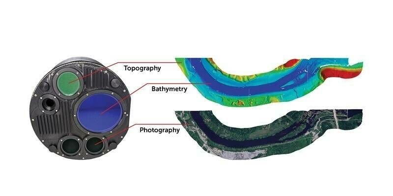
31st October 2024
Teledyne Geospatial to present an exclusive preview of its new coastal mapping solution at HYDRO 2024
31st October 2024
Blyncsy Publishes Map of U.S. Interstate Highways Showing Roadway Assets to Enhance Safety, Maintenance, and Accelerate the Digital Infrastructure Movement Nationally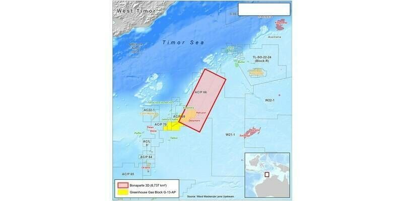
25th October 2024
Viridien and SLB complete the data acquisition for a multi-client survey in Bonaparte Basin, offshore Australia18th October 2024
Dubai to host GeoWorld, the first-ever event in MEASA showcasing geospatial advancements
9th October 2024
SimActive Used for Mapping Construction Projects7th October 2024
Schools map more than 2 million square metres of habitats
4th October 2024
Fugro extends role in Norway’s 2024 MAREANO programme for seabed mapping with eDNA service1st October 2024
Blue Marble Geographics Releases Global Mapper v26.0 with New Deep Learning Image Analysis in the Global Mapper Insight and Learning Engine (Beta)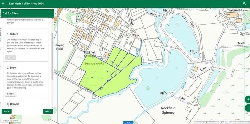
19th September 2024
Cadcorp launches new Call for Sites application12th September 2024
Golden Software Enhances Surfer Mapping and 3D Visualization Package with Map Templates and Online Image Access5th September 2024
IP Telecom chooses Hexagon solutions to manage fiber network
4th September 2024
WDH improves homes and neighbourhoods with web mapping