Share
Greentalk, a London based ecotech start-up, is offering a map of trees from Bluesky International within its online urban forest engagement platform.
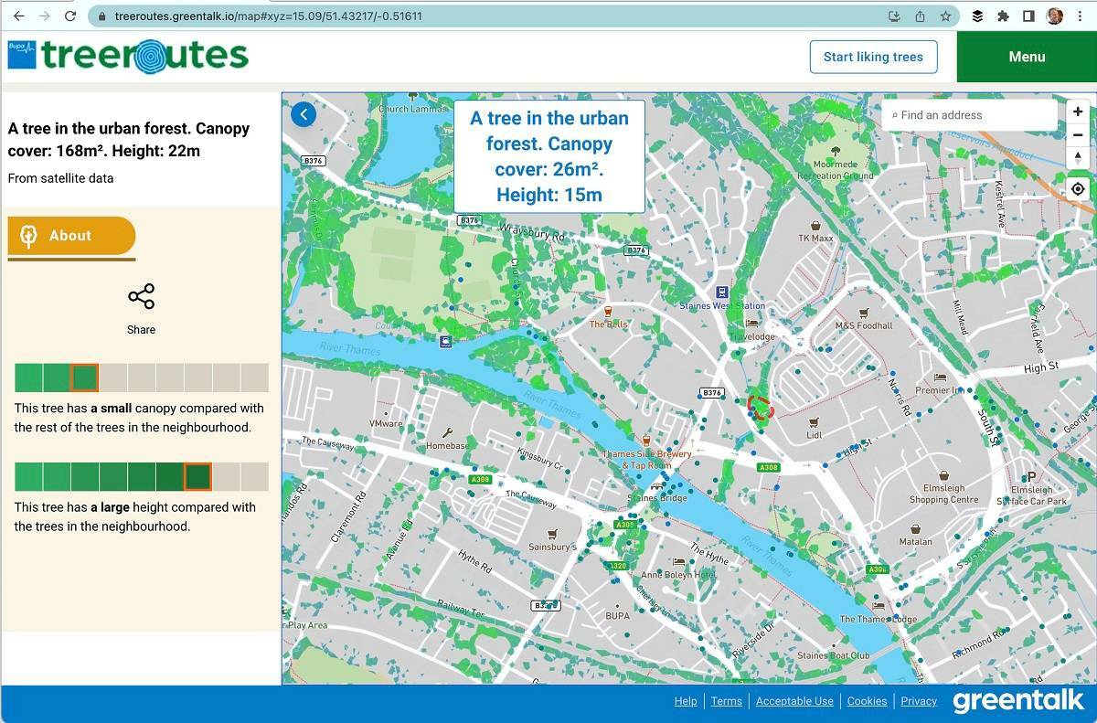
Incorporating Bluesky’s National Tree Map data, Greentalk will be able to provide accurate height, location and canopy coverage data for trees 3 metres and taller across the UK. Greentalk’s platform has already been deployed by London’s Hounslow Council, and is designed to encourage greater interaction with the outdoors. It can also support corporate wellness programmes, assist social prescribing initiatives, help identify new tree planting locations and facilitate climate action plans.
“At the heart of Greentalk’s solutions is mapping of the urban environment, connecting day to day lives with the green and blue infrastructure that fills our towns and cities but is often unnoticed and ignored,” commented Paul Wood, Director and co-founder of Greentalk. “However, existing maps of this type of infrastructure are limited. Individual organisations or landowners may know what trees they have responsibility for and where they are located, but that is often where this knowledge stops.
“Created from up-to-date, nationwide aerial photography, Bluesky’s National Tree Map data has no boundaries,” he continued. “It is not restricted by ownership or location; it simply details every significant tree. As trees have impact regardless of whether we can physically touch them, this intelligence is fundamental for the solutions we are creating.”
Bluesky’s National Tree Map data sits within a Mapbox environment, which includes base mapping of the urban landscape providing context for all the green and blue data presented by the Greentalk platform. Options available from Greentalk include solutions to involve communities in the care and growth of urban forests, engage with residents on climate action plans, help citizens understand the value of trees and promote health, wellbeing, active travel and nature connection. Additional detail and functionality can be added to the Greentalk solutions including crowd-sourced photographs, local points of interest, tree species databases, and walking trail generator widgets.
“We cannot underestimate the value of trees to the environment and our own well-being,” added Ralph Coleman, Sales Director at Leicestershire-based Bluesky International. “So, if we can help Greentalk to inspire individuals to get out and explore their locality, encourage residents to engage with the urban forest and even provide tools for community action, through the use of the National Tree Map, then we are proud to be part of a greener future.”
The National Tree Map, which is unique to Bluesky, was launched over 11 years ago, initially to address the impact of building subsidence for the risk insurance sector. It is created using innovative algorithms and image processing techniques, using the most up-to-date aerial photography and terrain data for the whole of Great Britain and Ireland. It provides a detailed reference as to the location, canopy cover and height of trees 3m and taller which can be applied alongside other data to establish ownership, proximity to other features or assets, and relationships between demographic, economic or social data.
National Tree Map data is widely used by a number of different market sectors, for example local authorities, energy companies, property developers and academic and research organisations, investigating the role of trees and green spaces and their impact on health, environment and infrastructure.
Subscribe to our newsletter
Stay updated on the latest technology, innovation product arrivals and exciting offers to your inbox.
Newsletter

