Share
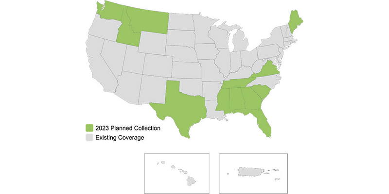
Hexagon’s Geosystems division announced that the HxGN Content Program will refresh aerial data of twelve U.S. states at 6-inch (15-centimeter) resolution for the 2023 collection season, namely Georgia, Mississippi, Alabama, Tennessee, Texas, Washington, Florida, South Carolina, Virginia, Maine, Montana, and Idaho. Approximately 996,532 square miles (2,392,008 square kilometers) of updated high-resolution ortho imagery, stereo imagery and digital surface models will be added to the program. The four-band ortho imagery will be available through a streaming subscription using standard mapping APIs or via pixel download on the Hexagon Digital Reality (HxDR) Data Store, the new online store for purchasing aerial data from the HxGN Content Program. www.hexagon.com


