Share
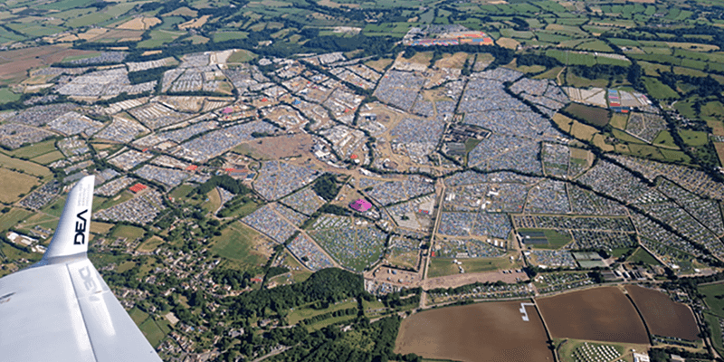
Photographing this iconic event is a key priority for event organizers where more than 200,000 people gather to enjoy music across multiple stages at Worthy Farm in Somerset. Capturing aerial imagery is important for the organizers, as these images are used to review the staging positioning, and to plan future festivals across the vast, iconic area where Glastonbury is hosted each year. DEA Aviation, a technology-led provider of specialized aerial data acquisition services had its high-efficiency Diamond DA-42 aircraft fitted with a Phase One PAS150 compact aerial camera system with an RS-50mm lens. The DEA experts chose Phase One imaging technology because it was “just right.” The system could both capture and efficiently process the requisite high-quality aerial images and offer superior flexibility and ease of installation. www.geospatial.phaseone.com


