Share
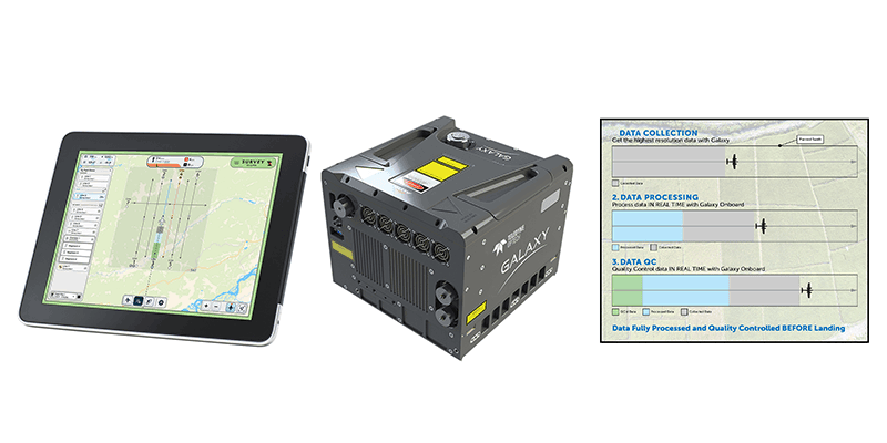
Teledyne Geospatial announced the release of the Galaxy Onboard, a workflow-focused solution that enables airborne surveyors to deliver quality-controlled processed data in real time. With Galaxy Onboard, Teledyne Geospatial has lowered the barrier of entry for organizations venturing into airborne mapping with a solution that does not require expertise or months of training. Galaxy Onboard will also offer exceptional value to airborne surveyors allowing them to explore additional applications. Through real-time quality control during acquisition, Galaxy Onboard enables faster than ever turnaround time for governmental wide area programs and engineering-grade corridor applications. In addition, life-threatening applications such as hurricanes, storms, power outages and floods will now have the benefit of Galaxy Onboard’s ability to process 3D data in real-time, making it available for recovery, rescue, and restoration deployment while the plane is still in the air. www.teledyneoptech.com


