Share
Using airborne and ground remote sensing instruments, Chinese scientists have obtained the world's first effective multi-source detection dataset during an ongoing experiment to study the condition of the Bayi Glacier in Haibei Tibetan Autonomous Prefecture
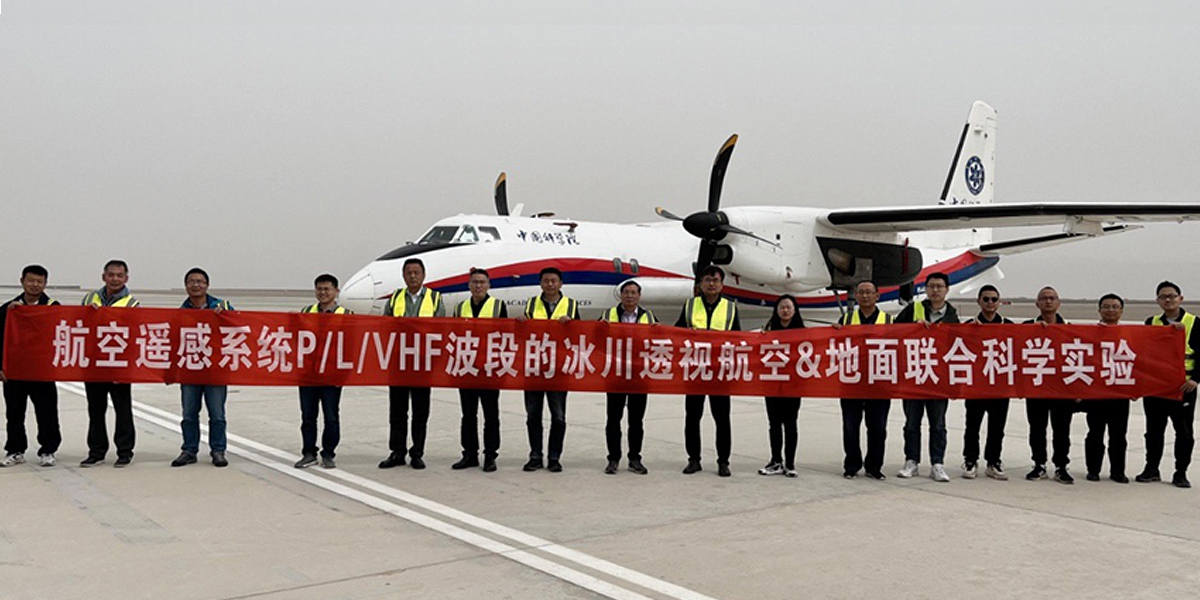
According to the Aerospace Information Research Institute (AIR) of the Chinese Academy of Sciences (CAS), it is the first time internationally that a combined P-band, L-band, and VHF-band radar glacier detection experiment has been conducted using an airborne platform.
As part of China’s Second Comprehensive Scientific Expedition to the Qinghai-Tibet Plateau and the scientific demonstration program of the P-band Synthetic Aperture Radar (SAR) satellite, the experiment is being jointly conducted by the Institute of Qinghai-Tibet Plateau Research, the Aerospace Information Research Institute, the Northwest Institute of Eco-Environment and Resources, and the Innovation Academy for Precision Measurement Science and Technology, together with the Chinese Academy of Sciences and Wuhan University.
The experiment started on 20 March and is scheduled to end this month (May). To date, a total of 11 airborne remote sensing flights have been conducted, including seven flights for P/L-band tomographic and interferometric imaging and four flights for VHF-band fluoroscopic imaging. Some 4.6 TB of valid data have so far been acquired.
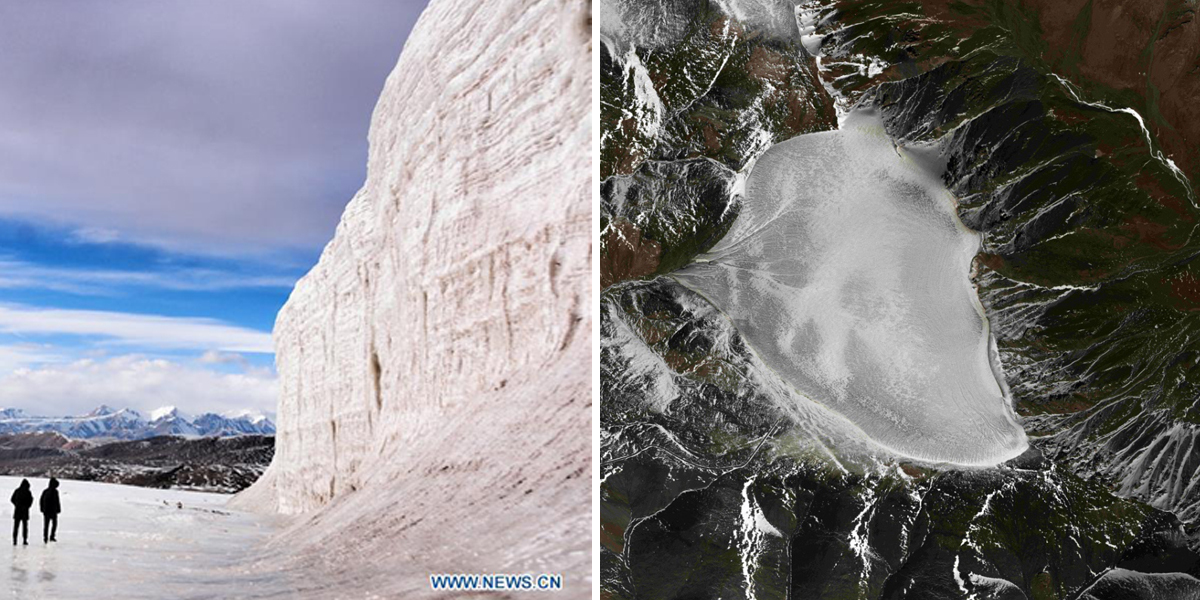
The experiment has carried out simultaneous optical and LiDAR observations of the ice surface, as well as onboard instrument calibration of the ice surface, Ground Penetrating Radar to measure glacier thickness, and ultra-long-range 3D laser point cloud imaging.
First results
Preliminary data analysis shows that the 3D reconstruction results of P-band and L-band SAR images can reflect the changing trend of glacier surface elevation, which is basically consistent with the results of airborne 3D LiDAR and ground survey.
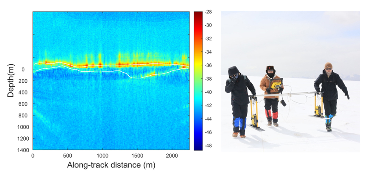
The VHF data provides a clear glacier profile, which can clearly reflect the interface line of atmosphere, ice surface, and bedrock, as well as the artificially placed electrical anomalies located at 80m depth of the ice core borehole. The depth of the profile interpretation is basically consistent with the ground-sounding results.
The preliminary results show that the experiment has validated the comprehensive observation technique of glacier characteristics and obtained valid data, and verified the feasibility of the P/L/VHF bands joint experiment.
In the future, the data obtained from the experiment will be made available by the National Tibetan Plateau Science Data Center to promote the further development of remote sensing inversion methods for glacier thickness and internal structure.
Prof. WU Yirong, Director-general of AIR, noted that the airborne VHF band radar is China’s first domestic aerial glacier detection payload independently developed by AIR. “It is also the first time a domestic remote sensing aircraft has flown above 4,500 meters in the mountain region”, he added.
Next generation technology
This experiment showcases the capability of using aerial remote sensing to monitor glacier thickness and estimate ice reserve, marking the development of the next-generation cryosphere remote sensing technology.
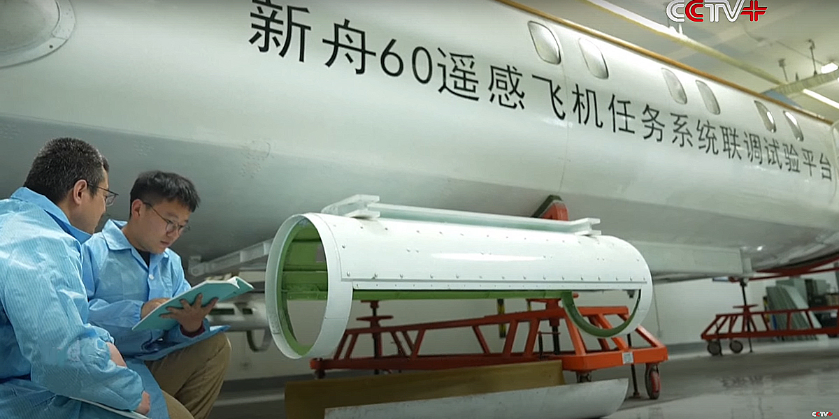
As a national major science and technology infrastructure hosted by AIR, the airborne remote sensing system was officially put into operation in July 2021. Featuring the most comprehensive aerial remote sensing platform and scientific experiment platform in China, it has undertaken various scientific research tasks such as comprehensive, large-scale remote sensing scientific experiments, new remote sensing payload calibration, disaster and environmental monitoring, and has acquired a large volume of valuable scientific data in the process.
Subscribe to our newsletter
Stay updated on the latest technology, innovation product arrivals and exciting offers to your inbox.
Newsletter

