
Aero-Graphics Purchases Two 4th Generation UltraCam Eagle 4.1 Aerial Cameras
15th February 2023
Aero-Graphics Purchases Two 4th Generation UltraCam Eagle 4.1 Aerial Cameras
15th February 2023
Aero-Graphics Purchases Two 4th Generation UltraCam Eagle 4.1 Aerial Cameras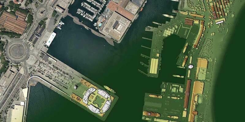
18th January 2023
Navigate new waters with UltraMap version 6.0 for professional aerial data production
20th December 2022
EAASI Summit brings together the aerial surveying industry in Europe
7th December 2022
Coastal concerns: how data can help us understand the pressure of climate change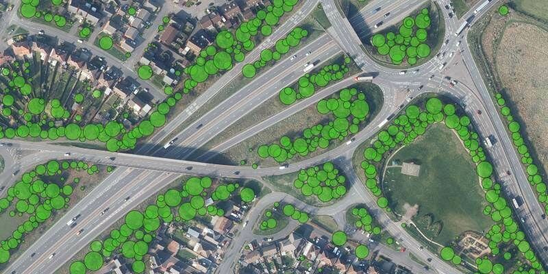
30th November 2022
Bluesky Tree Map Protects Leicestershire Highways from Falling Trees21st November 2022
Research Reveals How Trees Cover London’s Most Desirable Areas
4th November 2022
Hexagon to update aerial data of eight U.S. states at six-inch resolution in 2023 for the HxGN Content Program
2nd November 2022
New Vexcel partner Beijing GuoCe opens flagship store in China
2nd November 2022
Teledyne announces next generation 5GigE area scan camera platform
19th October 2022
Bluesky International announced as supplier for new Ordnance Survey framework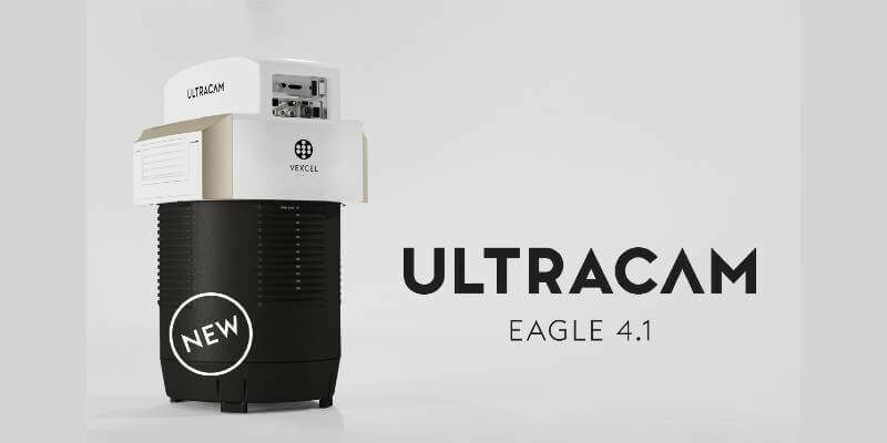
19th October 2022
Vexcel introduces new UltraCam Eagle 4.1 photogrammetric aerial camera
18th October 2022
Vexcel Imaging unveils its new UltraNav version 7 including a new partnership with TopoFlight14th October 2022
Phase One Will Unveil Their Patent Pending Technology, Fusion Shutter, at the 2022 InterGeo
26th September 2022
SimActive Software Used for Sensor Calibration and Validation
22nd September 2022
Bluesky Takes to the Skies to Capture More Oblique Views of UK Cities
16th August 2022
Bluesky Wins Extension to Multi Million Pound UK Government Mapping Contract
27th July 2022
Choosing the right camera for drone mapping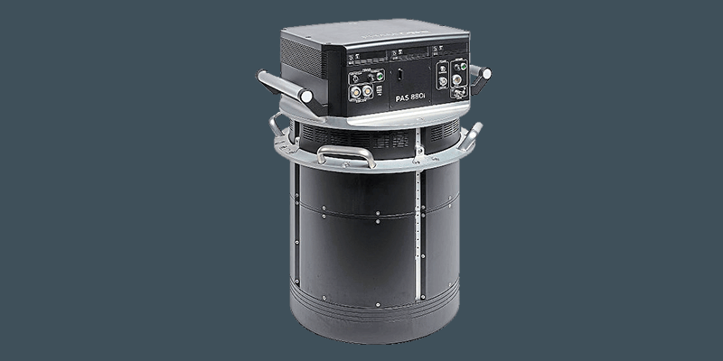
19th July 2022
Phase One announces next-generation aerial solutions enhanced with near infrared capabilities16th June 2022
Bluesky LiDAR and Aerial Photography Bring Build Projects to Life for Dublin Design Studio
19th May 2022
Dual aerial sensors yield impressive results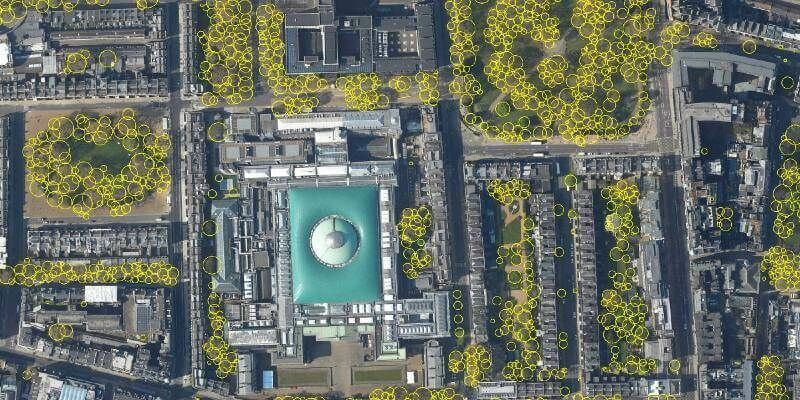
16th May 2022
Bluesky’s National Tree Map Helps Improve Biodiversity in London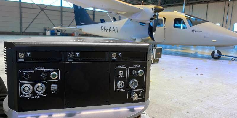
13th May 2022
Kavel 10 Aerial Mapping pioneers from the Netherlands chose Phase One PAS 880 system to improve productivity
12th May 2022
Interface between Vexcel's Adaptive Motion Compensation (AMC) and IGI’s AEROcontrol GNSS/IMU systems introduced
28th April 2022
Bluesky International Excited for 2022 Flying Season12th April 2022
Phase One unveils wide-area, 120MP aerial camera with global shutter sensor technology12th April 2022
EAASI summit highlights role of aerial survey in technological response to global challenges12th April 2022
UP42 partners with near space labs to offer very high-resolution imagery using zero-emission balloons12th April 2022
Teledyne FLIR introduces Neutrino SX12 ISR1200 MWIR camera with zoom lens for Ground ISR31st March 2022
Immervision launches low-light UAV navigation camera module21st March 2022
Teledyne FLIR Introduces Neutrino SX12 ISR1200 MWIR Camera with Zoom Lens for Ground ISR
11th March 2022
Pix4D Germany wins a competitive tender for Deutsche Bahn to monitor railway infrastructure maintenance and construction in Germany24th February 2022
UP42 Partners with Near Space Labs to Offer Very High-Resolution Imagery using Zero-Emission Balloons3rd February 2022
Bluesky Aerial Photography Helps Derby Homes Boost Solar Energy Output and Reduce Carbon Emissions28th January 2022
Teledyne FLIR Introduces X858x and X698x Families of High-Speed, High-Resolution Thermal Science Cameras20th January 2022
EAASI Summit Highlights Role of Aerial Survey in Technological Response to Global Challenges18th January 2022
Phase One Unveils Wide-Area, 120MP Aerial Camera with Global Shutter Sensor Technology12th January 2022
High Performance, Reliable LWIR Thermal Imaging with Teledyne FLIR Tau 2 Series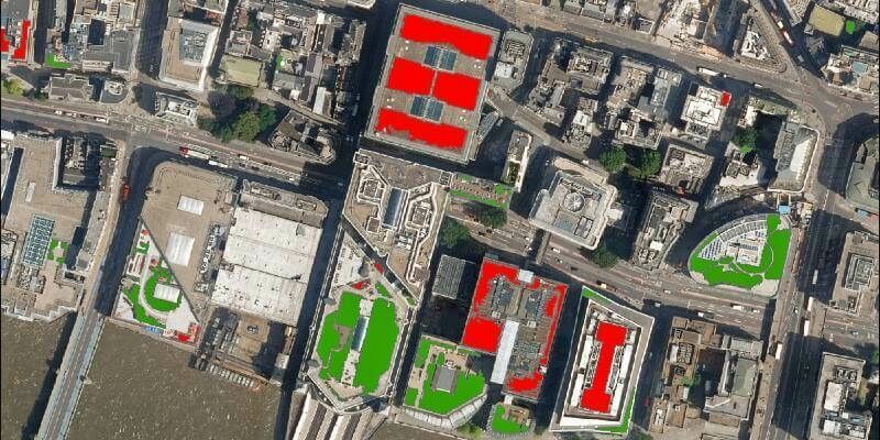
3rd December 2021
Bluesky Aerial Photography used to Map Green Roofs
10th November 2021
Our P3 Payload exceeds Gresco's expectations for cellphone tower inspection15th October 2021
Hexagon Streams Bluesky GB Aerial Photography via HxGN Content Program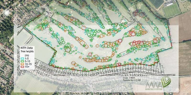
29th September 2021
MWA Arboriculture uses Bluesky National Tree Map for Tree Condition Surveys
2nd September 2021
Bluesky Aerial Photomaps Feature in International Arts Festival19th August 2021
Bluesky appoints Europa Technologies as reseller for National Tree Map26th July 2021
Bluesky National Tree Map Shows Changing Face of Sevenoaks Historic Tree Cover
9th June 2021
Aerial Mapping Company Bluesky Sets Out Plans for 2021 Flying Season