Share
A partnership between Bluesky International and Hexagon’s Geosystems division will see the most up-to-date aerial imagery of England, Scotland and Wales added to the largest, online library of orthophotography for Europe and North America.
“We are delighted to partner with Hexagon on their HxGN Content Program enabling users around the world to access and stream Bluesky aerial imagery directly into their geospatial applications,” commented Rachel Tidmarsh, Managing Director of Bluesky International.
“Bluesky is a long-standing, trusted partner of Hexagon, and we’re excited to integrate its high-quality aerial imagery into the HxGN Content Program,” commented John Welter, President, Geospatial Content Solutions at Hexagon. “Through this partnership, Hexagon customers can gain real-world insights of Great Britain for confident analysis and decision-making. The initiative is an excellent example of how we enable our partners to participate in our global program while they serve their local customers.”
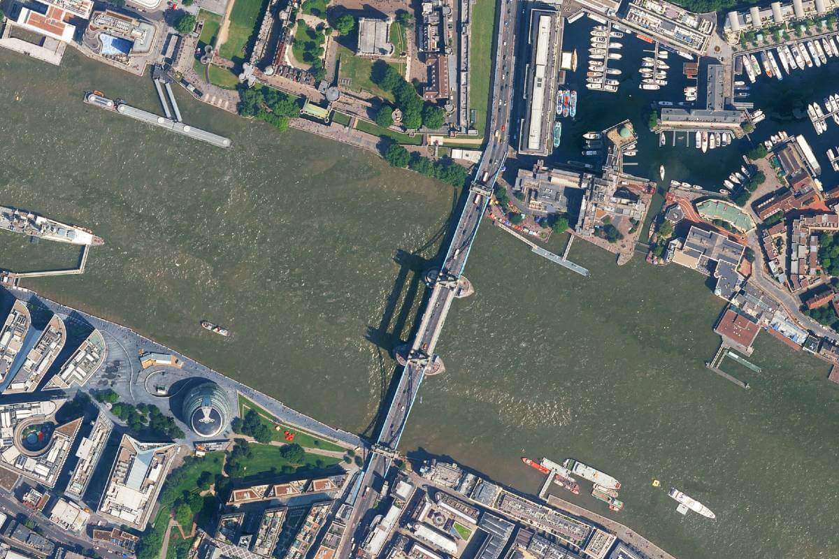
Approximately 229,040 square kilometres of Bluesky data has been added to the program and is now available through the HxGN Content Program’s Data Store for pixel download and streaming via OGC-compliant WMS/WMTS, SOAP and REST protocols. The new data includes complete, current coverage of England, Scotland and Wales, at resolutions of up to 12.5 centimetres, as well as additional national datasets, going back to 2006, that are available for custom orders.
The HxGN Content Program offers the largest library of high-resolution 4-band aerial imagery and elevation data across Europe and North America. The data is orthorectified, accurate and available at multiple resolutions. The program follows rigorous acquisition and processing standards to offer high positional accuracy for a variety of applications. The data consistency over large areas enables automatic feature extraction and analytics with AI and machine learning. Flexible data use terms allow users to create derived products.
Bluesky is the only organisation to have current, high-resolution, full coverage of the Republic of Ireland, England, Scotland and Wales, which it maintains on a rolling, three-year update cycle. Bluesky has also upgraded its national flying programme to a minimum 12.5 centimetre resolution with urban areas now being captured at 5cm resolution simultaneously with LiDAR and oblique imagery.
Subscribe to our newsletter
Stay updated on the latest technology, innovation product arrivals and exciting offers to your inbox.
Newsletter

