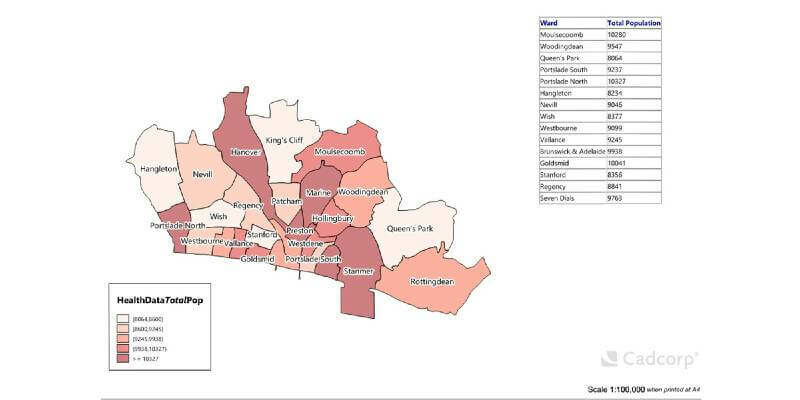
Cadcorp launches desktop GIS capability in the cloud
8th May 2020
Cadcorp launches desktop GIS capability in the cloud
13th May 2020
Simactive - How to Perform Aerial Triangulation with Correlator3D
8th May 2020
Cadcorp launches desktop GIS capability in the cloud
7th May 2020
Registration Opens for 6th Annual Power Week Asia in Singapore7th May 2020
Join the 3rd Annual Power Week Africa in Johannesburg, South Africa6th May 2020
BARSC Members Enjoy an Awesome Virtual Cuddle
5th May 2020
Introducing the Phase One 280MP Aerial Solution
29th April 2020
Juniper Systems Announces New Windows 10 Rugged Tablet: Mesa 2™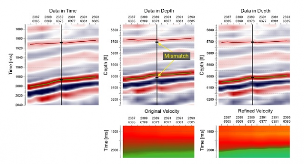
24th April 2020
CGG GeoSoftware releases Cloud-Ready Reservoir Characterization Applications
17th April 2020
Esri Publishes The International Geodesign Collaboration
8th April 2020
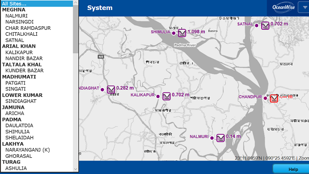
Bangladesh Inland Waterways Benefit from UK Environmental Monitoring Data Platform

2nd April 2020
Leica - Titcomb Associates: How to run a successful surveying firm

1st April 2020
Lovell Johns Unveils GIS Consultancy Service - gi Perspective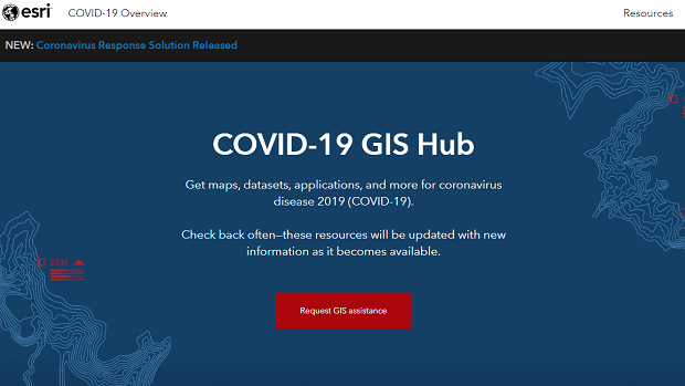
20th March 2020
Esri Provides Free Mapping Software for Organizations Fighting COVID-19


27th February 2020
New environmental monitoring systems at two key Ghana ports25th February 2020
New Power BI custom visual for embedding interactive maps24th February 2020
1Spatial forms strategic partnership with Neueda23rd February 2020
Envitia appoints new Chief Technology Officer to Board of Directors
14th February 2020
Cadcorp SIS 9 service release optimises user experience13th February 2020
Esri Partners with Saint Louis University
13th February 2020
Landmark launches Premium Layers subscription for Promap5th February 2020
Cadcorp launches GIS data management tool31st January 2020
USGIF Accredits Two New Universities’ GEOINT Programs
30th January 2020
Europa Technologies celebrates 30th anniversary
29th January 2020
MAPPS Presents the 2019 Geospatial Excellence Awards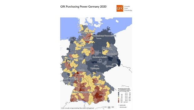
28th January 2020
Map of the Month: GfK Purchasing Power, Germany 2020
23rd January 2020
Herd Owners Deploy Globalstar Satellite IoT Collars
15th January 2020
MGISS and vGIS Take a Geospatial View of Augmented Reality14th January 2020
Welwyn Hatfield Borough Council ‘Think Digital’ with Web GIS12th January 2020
Esri provides yearlong access to the ArcGIS platform for new IAAO members12th January 2020
thinkWhere Launches 2020 Training Calendar
9th January 2020
Esri to Launch New Spatial Data Science MOOC
29th December 2019
Esri Enters Into Licensing Agreement with European Commission18th December 2019
Presentation Proposals Invited for GIS-Pro 2020 in Baltimore
16th December 2019
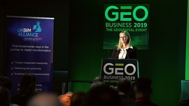
GEO Business 2020: Call for speakers launched
8th December 2019
DigEplan Integrates Electronic Plan Review to Cityworks Platform