
1.jpg)
Ecometrica Manager wins BusinessGreen Leaders Award
11th July 2019
Ecometrica Manager wins BusinessGreen Leaders Award
OGC announces the creation of a new Domain Working Group
11th July 2019
OGC announces the creation of a new Domain Working Group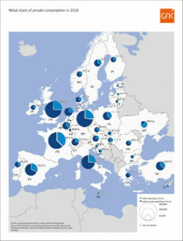
Retail share of private consumption, Europe 2018
11th July 2019
Retail share of private consumption, Europe 2018
Cesium launches with $5 million investment
10th July 2019
Cesium launches with $5 million investment
Ordnance Survey creates ‘win-win’ for construction and geospatial industries
9th July 2019
Ordnance Survey creates ‘win-win’ for construction and geospatial industries
Bluesky 3D Model Helps AECOM Create Blueprint for Yorkshire Town Redevelopment
8th July 2019
Bluesky 3D Model Helps AECOM Create Blueprint for Yorkshire Town Redevelopment
OceanWise technical expertise boosts iCoast re-launch
8th July 2019
OceanWise technical expertise boosts iCoast re-launch
Barry Wellar, C.M., GISP Announced as Closing Speaker
6th July 2019
Barry Wellar, C.M., GISP Announced as Closing Speaker
New in G-Cloud 11 - Data Vault from Europa Technologies
4th July 2019
New in G-Cloud 11 - Data Vault from Europa Technologies
GeoCalc SDK 7.5 Released with an Expanded Geodetic Database
3rd July 2019
GeoCalc SDK 7.5 Released with an Expanded Geodetic Database
Cadcorp introduces Spatial Database Service in G-Cloud 11
3rd July 2019
Cadcorp introduces Spatial Database Service in G-Cloud 11
thinkWhere Scoops Double Awards for Geographic Cloud Solutions
2nd July 2019
thinkWhere Scoops Double Awards for Geographic Cloud Solutions
Geospatial solutions company Getmapping announces its new partnership with Hexagon’s Geospatial divi
27th June 2019
Geospatial solutions company Getmapping announces its new partnership with Hexagon’s Geospatial divi
Geospatially Optimized Digital Asset Management Solution
26th June 2019
Geospatially Optimized Digital Asset Management Solution
AECOM Uses Bluesky Tree Map to Assess Risks to Infrastructure
20th June 2019
AECOM Uses Bluesky Tree Map to Assess Risks to Infrastructure
thinkWhere Brings International GIS Knowledge to the Uni of the Highlands & Islands
18th June 2019
thinkWhere Brings International GIS Knowledge to the Uni of the Highlands & Islands
Hexagon’s Geospatial Division Unveils M.App Enterprise 2019
13th June 2019
Hexagon’s Geospatial Division Unveils M.App Enterprise 2019
thinkWhere Map Portal for Open European Geographic Data Services Launched
12th June 2019
thinkWhere Map Portal for Open European Geographic Data Services Launched
Silent Auction to Benefit URISA's GISCorps Announced
11th June 2019
Silent Auction to Benefit URISA's GISCorps Announced
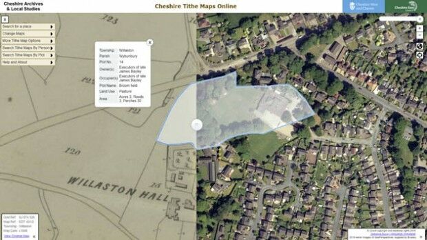
Aerial Photographs Bring to Life Early Tax Maps of Cheshire
5th June 2019
Aerial Photographs Bring to Life Early Tax Maps of Cheshire
SimActive Releases Version 8.2 for Processing of Multispectral Imagery
4th June 2019
SimActive Releases Version 8.2 for Processing of Multispectral Imagery
UK Hydrographic Office appoints Chief Executive
31st May 2019
UK Hydrographic Office appoints Chief Executive
Envitia Selected by US Army Geospatial Center
31st May 2019
Envitia Selected by US Army Geospatial Center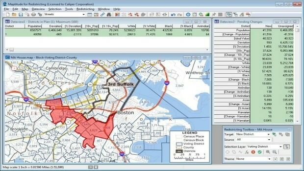
Learn More About Maptitude for Redistricting at the NCSL
31st May 2019
Learn More About Maptitude for Redistricting at the NCSL
HERE Technologies Joins the MuleSoft Technology Partner Program
29th May 2019
HERE Technologies Joins the MuleSoft Technology Partner Program
Nortek opens Australian office to build on regional demand
29th May 2019
Nortek opens Australian office to build on regional demand
Leica Geosystems opens nominations for Carl Pulfrich Award 2019
29th May 2019
Leica Geosystems opens nominations for Carl Pulfrich Award 2019
CGG GeoSoftware Donates Geoscience Software Suite
29th May 2019
CGG GeoSoftware Donates Geoscience Software Suite
Sercel Delivers Five 508XT Acquisition Systems to ONGC in India
28th May 2019
Sercel Delivers Five 508XT Acquisition Systems to ONGC in India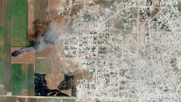
Satellite Imagery: Syrian Government Offensive in Idlib Province, Syria
28th May 2019
Satellite Imagery: Syrian Government Offensive in Idlib Province, Syria
HERE Technologies joins the Uptane Alliance
28th May 2019
HERE Technologies joins the Uptane Alliance
Extensis to Cameo Digital Asset Management Solution
24th May 2019
Extensis to Cameo Digital Asset Management Solution
u-blox announces Markus Schaefer as new Executive Director
23rd May 2019
u-blox announces Markus Schaefer as new Executive Director
GIS-Pro 2019 Student and Young Professional Opportunities Announced
23rd May 2019
GIS-Pro 2019 Student and Young Professional Opportunities Announced
Topcon announces advanced Bentley integration
23rd May 2019
Topcon announces advanced Bentley integration
Descartes Labs to Demonstrate Global-Scale Predictive Intelligence
23rd May 2019
Descartes Labs to Demonstrate Global-Scale Predictive Intelligence
thinkWhere Online Mapping Tool Helps Falkirk Residents Access Essential Services
23rd May 2019
thinkWhere Online Mapping Tool Helps Falkirk Residents Access Essential Services
Industry Players Announce London Geospatial Week for 2020
22nd May 2019
Industry Players Announce London Geospatial Week for 2020
Mapillary announces the world's first demand-driven marketplace for map data
22nd May 2019
Mapillary announces the world's first demand-driven marketplace for map data
Trimble Releases Next-Generation Integrated Smartphone and GIS Data Collector
21st May 2019
Trimble Releases Next-Generation Integrated Smartphone and GIS Data Collector
public comment on major revision to OGC Abstract SpecificationTopic 0
21st May 2019
public comment on major revision to OGC Abstract SpecificationTopic 0
Gaist’s mapping solution could boost efficiency for utilities market
21st May 2019
Gaist’s mapping solution could boost efficiency for utilities market
Sonardyne acquires maritime survey software and construction specialist EIVA
21st May 2019
Sonardyne acquires maritime survey software and construction specialist EIVA