MGISS Appoints Mike Cooper to Expand Geospatial Business
4th December 2019
MGISS Appoints Mike Cooper to Expand Geospatial Business
4th December 2019
MGISS Appoints Mike Cooper to Expand Geospatial Business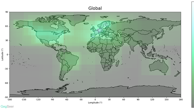
28th November 2019
GeoSeer Releases Licensed Database of Spatial Web Services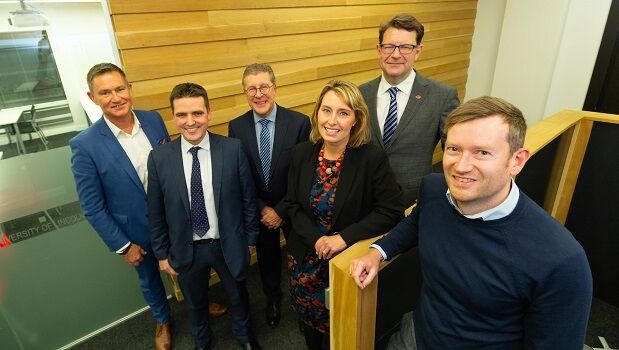
27th November 2019
Entrepreneur raises £250k for GIS platform inspired by Olympics
22nd November 2019
New Powerful, Feature-Filled Release of ArcFM Designer XI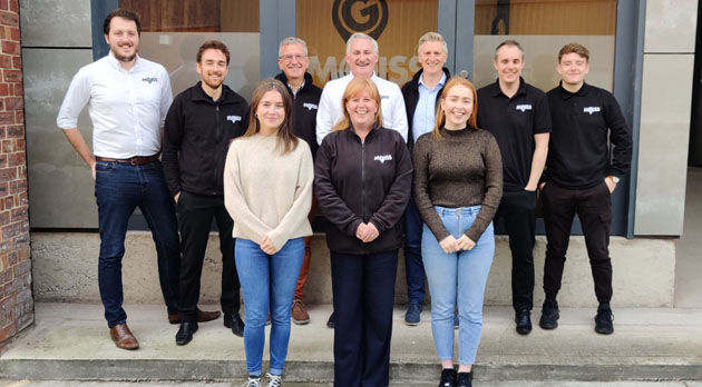
21st November 2019
MGISS Ranked Fourth in North West Tech 50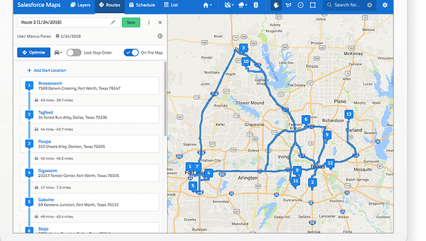
21st November 2019
Salesforce Selects Esri as Key Geospatial Partner
19th November 2019
Assetino Cloud Based Cemetery Mapping & Management Tool Launched12th November 2019
Geospatial Information Technologies at the AAG Annual Meeting
6th November 2019
Verified Photomontages Achieves Best Accuracy with Spectra Geospatial SP80
5th November 2019
Top Survey Application, “GIS Surveyor” Going Premium1st November 2019
Schneider Electric Announces ArcFM Editor 11.1.1
30th October 2019
T-MAPY User Conference Attracts Record Numbers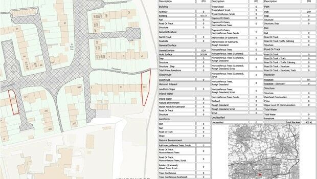
28th October 2019
Setting out weed control tender made easier with geospatial data analysis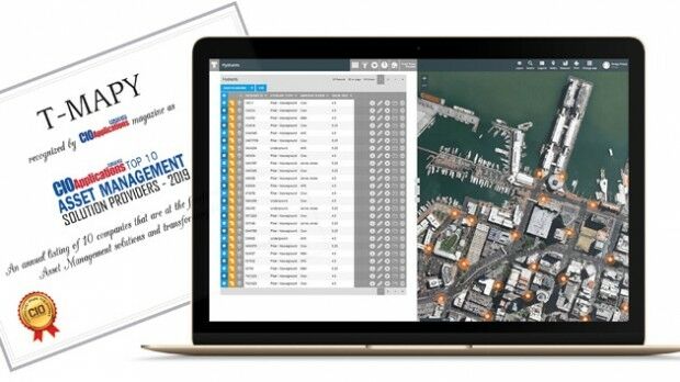
22nd October 2019
Assetino Asset Management Platform Scoops Top European Award16th October 2019
Duquesne Light Company Shares Journey to Move to New Utility Network10th October 2019
8th International Conference of Cartography and GIS
9th October 2019
thinkWhere Appointed Government Digital Specialist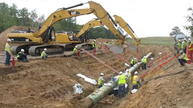
2nd October 2019
1Spatial and Northern Gas Networks recognised for smart software
27th September 2019
Streetwise Services Improve Traffic Surveys with thinkWhere’s Online Maps
16th September 2019
Bluesky Launches International MetroVista City Mapping Service at Intergeo10th September 2019
Cadcorp announces 2020 dates for Local Government Conferences
5th September 2019
thinkWhere Supports Scottish Government Planning Process

20th August 2019
RIEGL’S JAMES VAN RENS ATTENDS MEETING OF THE UN GLOBAL GEOGRAPHIC INFORMATION MANAGEMENT19th August 2019
Key Case Studies will be Presented at SMi’s Benelux Infrastructure Forum 2019 in Amsterdam
19th August 2019
Delta State University Earns USGIF Collegiate Accreditation
15th August 2019
Hydropower development projects in the Balkans5th August 2019
World Water-Tech North America summit announces move to Los Angeles for October 201929th July 2019
Geocortex “Extending Esri ArcGIS® to improve your productivity” Day25th July 2019
SoundHound Inc. Integrates HERE Mapping and Location Data i
25th July 2019
Orbit GT launches 3D Mapping portfolio v19.7 with new website25th July 2019
2019 URISA Exemplary Systems in Government Award Recipients Announced
23rd July 2019
Master Class 4: Vertical Mobility in Urban Environments23rd July 2019
OGC and RTCA Announce Signing of Memorandum of Understanding22nd July 2019
Wheeler Financial from Pitney Bowes Helps Ghilotti Bros Inc
22nd July 2019
Pitney Bowes Named to Forbes Magazine List of America's Best Employers22nd July 2019
Cadcorp SIS WebMap offers access to what3words addressing20th July 2019
2019 EuroSDR Award for the best PhD thesis
19th July 2019
GeoIgnite’s inaugural ‘Diversity in Leadership’ award17th July 2019
Planners Can Earn Ample CM Credits at GIS-Pro 201917th July 2019
Safety Management Systems within the Pipeline & Utilities Industries
15th July 2019
Europa Technologies strikes gold with two awards at Esri User Conference