
The 2020 Recipient of the Arthur C. Lundahl-Thomas C. Finnie Lifetime Achievement Award
26th August 2020
The 2020 Recipient of the Arthur C. Lundahl-Thomas C. Finnie Lifetime Achievement AwardSchneider Electric Announces The New Geodatabase Manager Xi
26th August 2020
Schneider Electric Announces The New Geodatabase Manager Xi
Global forest restoration and the importance of empowering local communities
25th August 2020
Global forest restoration and the importance of empowering local communities
Landmark announces 'More Mapping for Less' following launch of OS' geospatial data platform
11th August 2020
Landmark announces 'More Mapping for Less' following launch of OS' geospatial data platform
Recursos Técnicos Madrid, S.L. And Aec Solutions Engineers S.A.C. have signed a Collaboration Agreement
11th August 2020
Recursos Técnicos Madrid, S.L. And Aec Solutions Engineers S.A.C. have signed a Collaboration Agreement
Geo-localized data collection now made easy with new OnPOZ Collect app for Android
9th August 2020
Geo-localized data collection now made easy with new OnPOZ Collect app for Android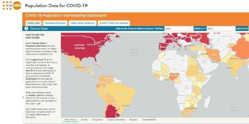
Esri and United Nations Create COVID-19 Population Vulnerability Dashboard
6th August 2020
Esri and United Nations Create COVID-19 Population Vulnerability Dashboard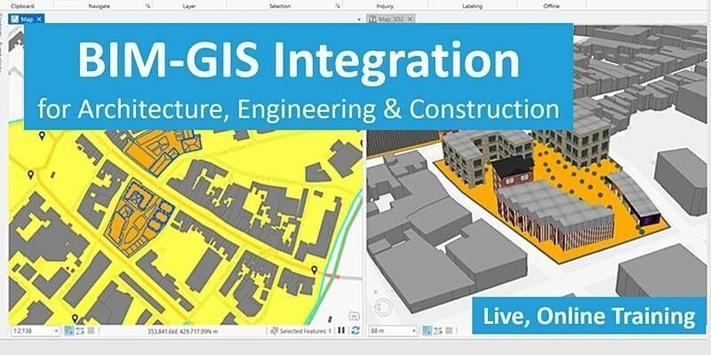
BIM-GIS Integration for Architecture, Engineering & Construction
4th August 2020
BIM-GIS Integration for Architecture, Engineering & Construction
1Spatial releases new webinars and training courses
3rd August 2020
1Spatial releases new webinars and training courses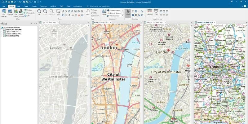
Cadcorp SIS 9 service release enables direct link to Ordnance Survey Data Hub
3rd August 2020
Cadcorp SIS 9 service release enables direct link to Ordnance Survey Data Hub

How to Generate a DSM and Point Cloud with Correlator3D
27th July 2020
How to Generate a DSM and Point Cloud with Correlator3D
UK MoD selects Esri UK as its Strategic Geospatial Partner
24th July 2020
UK MoD selects Esri UK as its Strategic Geospatial Partner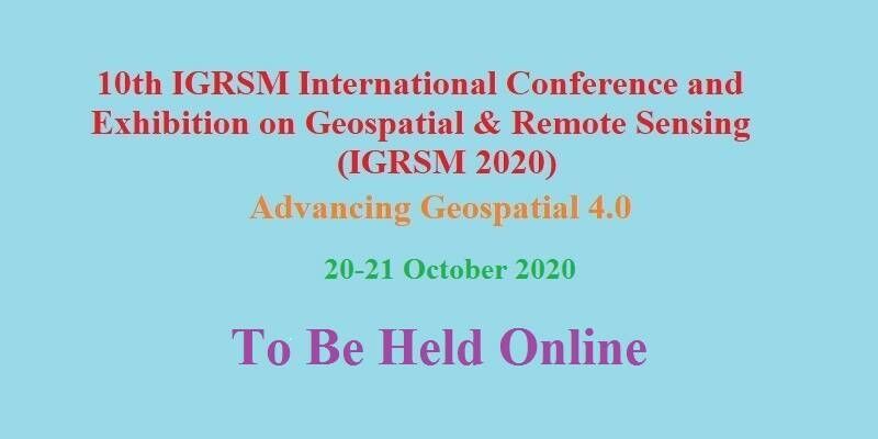
10th IGRSM International Conference and Exhibition on Geospatial & Remote Sensing (IGRSM 2020)
22nd July 2020
10th IGRSM International Conference and Exhibition on Geospatial & Remote Sensing (IGRSM 2020)
Esri Named a Leader in Climate Risk Analytics Report by Independent Research Firm
19th July 2020
Esri Named a Leader in Climate Risk Analytics Report by Independent Research Firm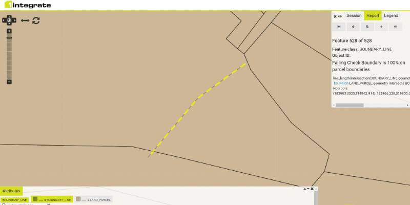
1Spatial announce the release of 1Integrate v2.7
10th July 2020
1Spatial announce the release of 1Integrate v2.7Schneider Electric Announces ArcFM Designer 11.2.3
8th July 2020
Schneider Electric Announces ArcFM Designer 11.2.3Spatial analysis examines UK beach capacity ahead of holiday season
3rd July 2020
Spatial analysis examines UK beach capacity ahead of holiday season
Covid-19 creates steep learning curve and significant opportunities – what have we learnt so far?
3rd July 2020
Covid-19 creates steep learning curve and significant opportunities – what have we learnt so far?Schneider Electric Announces The New Geodatabase Manager XI
3rd July 2020
Schneider Electric Announces The New Geodatabase Manager XI
Cadcorp launches desktop GIS capability in the cloud
2nd July 2020
Cadcorp launches desktop GIS capability in the cloud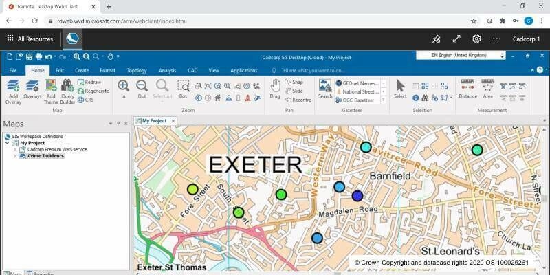
Cloud migration path for Cadcorp SIS Desktop
2nd July 2020
Cloud migration path for Cadcorp SIS Desktop
NGA and Maxar Work Together to Expand Government Adoption of NOME
1st July 2020
NGA and Maxar Work Together to Expand Government Adoption of NOME
OGC and buildingSMART International publish discussion paper on integrating BIM and GIS
1st July 2020
OGC and buildingSMART International publish discussion paper on integrating BIM and GIS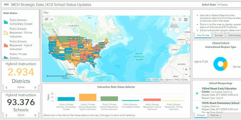
Esri partners with MCH Strategic Data to Provide Information on US Education Affected by COVID-19
1st July 2020
Esri partners with MCH Strategic Data to Provide Information on US Education Affected by COVID-19
Estonian Railways selects Hexagon to automate and digitize operations
1st July 2020
Estonian Railways selects Hexagon to automate and digitize operations
Environment Agency Application Build and Managed Service Win
26th June 2020
Environment Agency Application Build and Managed Service Win
Geo Connect Asia announces 2021 return to Singapore
23rd June 2020
Geo Connect Asia announces 2021 return to Singapore
1Spatial reveals new and exciting webinars and training courses
19th June 2020
1Spatial reveals new and exciting webinars and training courses
Esri users gain access to international public transport data from TravelTime
18th June 2020
Esri users gain access to international public transport data from TravelTime
GeoIgnite Online 2020: Canada’s National Virtual Geospatial Event
18th June 2020
GeoIgnite Online 2020: Canada’s National Virtual Geospatial Event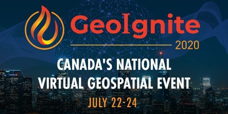
GeoIgnite: Leadership in Times of Disruption
17th June 2020
GeoIgnite: Leadership in Times of Disruption

1Spatial releases FY20 Results; Revenue up 33% to £23.4M; EBITDA up 167% to £3.2M
15th June 2020
1Spatial releases FY20 Results; Revenue up 33% to £23.4M; EBITDA up 167% to £3.2M
Bentley Systems’ Year in Infrastructure 2020 Conference is Going Digital
10th June 2020
Bentley Systems’ Year in Infrastructure 2020 Conference is Going Digital
TDC Joins Trimble’s GIS Business Partner Program to Empower Mobile GPS Workflows
9th June 2020
TDC Joins Trimble’s GIS Business Partner Program to Empower Mobile GPS Workflows
Online training: Learn how to add easy-to-use SAR processing to your remote sensing applications
8th June 2020
Online training: Learn how to add easy-to-use SAR processing to your remote sensing applications
Map of pavement widths helps local authorities with social distancing plans
8th June 2020
Map of pavement widths helps local authorities with social distancing plans
MGISS Helps Highways Sector Adopt New Highways England Standards
4th June 2020
MGISS Helps Highways Sector Adopt New Highways England Standards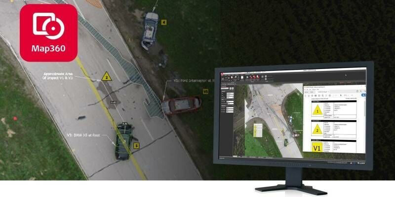
Leica Geosystems announces latest version of public safety software
3rd June 2020
Leica Geosystems announces latest version of public safety software

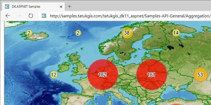
TatukGIS Developer Kernel 11 for ASP.NET Web Forms
20th May 2020
TatukGIS Developer Kernel 11 for ASP.NET Web Forms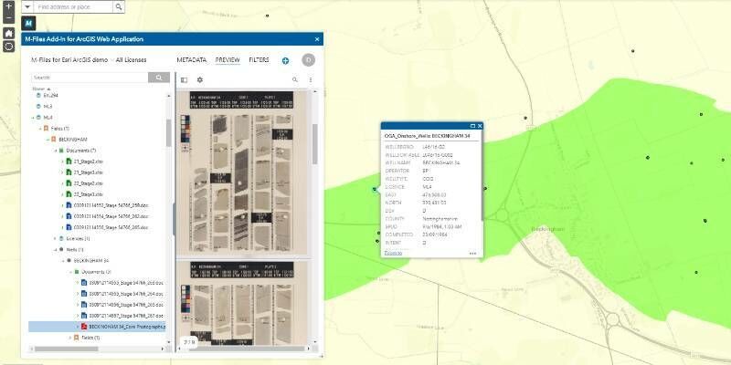
M-Files and Esri integrate solutions to connect maps and geodata with related documents to boost efficiency
15th May 2020
M-Files and Esri integrate solutions to connect maps and geodata with related documents to boost efficiency