Share
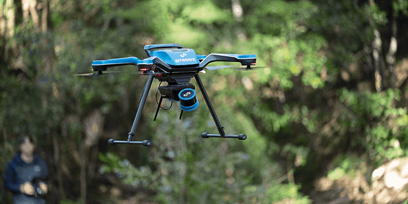
Emesent, a provider of drone autonomy, LiDAR mapping, and data analytics launched three new products, which will help geospatial professionals save time while capturing accurate data for digital twins and BIM applications. The products include Hovermap ST-X, a newHovermap variant with a sensing range of 300 meters and improved accuracy, a Long Range Radio add-on which increases the communication range with Hovermap up to 20 times further, and Emesent’s Aura platform which offers an integrated SLAMprocessing and point cloud visualization environment for Hovermap users. www.emesent.com


