SimActive Announces New Pricing for Larger Drone Cameras
19th July 2023
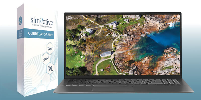
SimActive Announces New Pricing for Larger Drone CamerasSimActive is the developer of Correlator3D™ software, a patented end-to-end photogrammetry solution for the generation of high-quality geospatial data from satellite and aerial imagery, including drones.
Correlator3D™ performs aerial triangulation (AT) and produces dense digital surface models (DSM), digital terrain models (DTM), point clouds, orthomosaics, 3D models and vectorized 3D features. Powered by GPU technology and multi-core CPUs, Correlator3D™ ensures matchless processing speed to support rapid production of large datasets.
SimActive has been selling Correlator3D™ to leading mapping firms and government organizations around the world, offering cutting-edge photogrammetry software backed by exceptional customer support.
+1 514 288-2666
465 St-Jean, Suite 701 Montreal, Quebec H2Y 2R6 Canada
2003
Satellite Imaging
Image Processing / Analysis
DEM/DTM/DSM
Unmanned Aerial Vehicles
Photogrammetry
Engineering
Exploration & Production (Mining & Minerals)
Mining
Forestry
Agriculture
19th July 2023
SimActive Announces New Pricing for Larger Drone Cameras10th July 2023
Webinar Topic: Mining Site Monitoring Using Drones
24th May 2023
SimActive Software Used for Meeting Accuracy Standards15th May 2023
How To Meet Photogrammetric Accuracy Standards27th April 2023
SimActive Releases Correlator3D Version 10 with High Density Point Cloud Generation22nd March 2023
SimActive Software Used to Accelerate Corridor Mapping22nd February 2023
SimActive Software Used to Colorize Lidar26th October 2022
Malaysian Government's JUPEM Selects SimActive's Correlator3D Software for Data Processing26th September 2022
SimActive Software Used for Sensor Calibration and Validation21st June 2022
SimActive Releases Version 9.2 with Phase One IIQ Integration28th April 2022
Medium Format Cameras Used with SimActive Software to Minimize Mapping Costs30th March 2022
SimActive Releases Correlator3D Version 9.1 with Productivity Enhancements4th March 2022
SurvTech Using SimActive Software for Energy Infrastructure Projects8th December 2021
Extreme Aerial Monitoring One of the Largest Construction Projects in the Desert Southwest with SimActive Software11th November 2021
SimActive Software Used with Skydio Drones for Land Development Projects15th October 2021
SimActive Releases Version 9.0 with Distributed Processing6th October 2021
SimActive Releases Version 9.0 with Distributed Processing8th September 2021
SimActive Develops Workflow for New DJI L1 LiDAR System3rd August 2021
SimActive Software Used with both LiDAR and Imagery to Map Venice Beach, California during the Pandemic26th May 2021
SimActive Software Used for Agricultural Resource Monitoring19th April 2021
Processing of Quantum-Systems Drone Data Integrated in SimActive Software26th March 2021
SimActive Increases Drone Productivity with New Tools17th February 2021
Speeding Up Drone Mapping Projects Webinar28th January 2021
SimActive Used to Determine Solar Potential from Satellite Imagery24th January 2021
SimActive Software Used with AI to Determine Land Use8th December 2020
SimActive Software Integrated in LiDAR Solution for Drones1st December 2020
'How to Accurately Merge Imagery with LiDAR' Webinar10th November 2020
SimActive Releases Version 8.6 of Correlator3D4th November 2020
Improving your Photogrammetric Workflow with New Version 8.613th October 2020
SimActive Develops New Workflow for Faster Processing of Large Projects29th September 2020
How to Quickly Generate High-Quality Orthomosaics Webinar8th September 2020
Global Trends in the Mapping Industry during the Pandemic31st August 2020
How to Improve the Quality of Drone Mapping Projects Webinar27th July 2020
SimActive announces “How to Manage Photogrammetric Production During Peak Season” webinar7th July 2020
SimActive Software Used for Oil and Gas Seismic Exploration9th June 2020
SimActive Introduces Cloud Sharing and Reflectance Calibration with New Version 8.52nd June 2020
Simactive announces Webinar on How to Calibrate and Process Multispectral Imagery1st June 2020
How to Share and Visualize Drone Projects in the Cloud11th May 2020
SimActive Webinar on 'How to Efficiently Process Satellite Imagery'9th April 2020
SimActive Used to Determine Solar Potential from Satellite Imagery31st March 2020
Speeding Up Processing of Large Drone Projects9th March 2020
SimActive Announces Online Training Session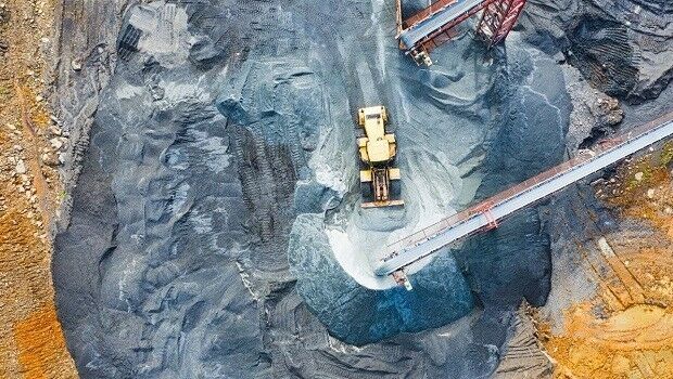
3rd March 2020
SimActive Speeds Up Stockpile Measurements with Drones9th February 2020
How to Optimize Accuracy of Drone Mapping Projects'
28th August 2020
How to Generate a 3D Model with Correlator3D
27th July 2020
How to Generate a DSM and Point Cloud with Correlator3D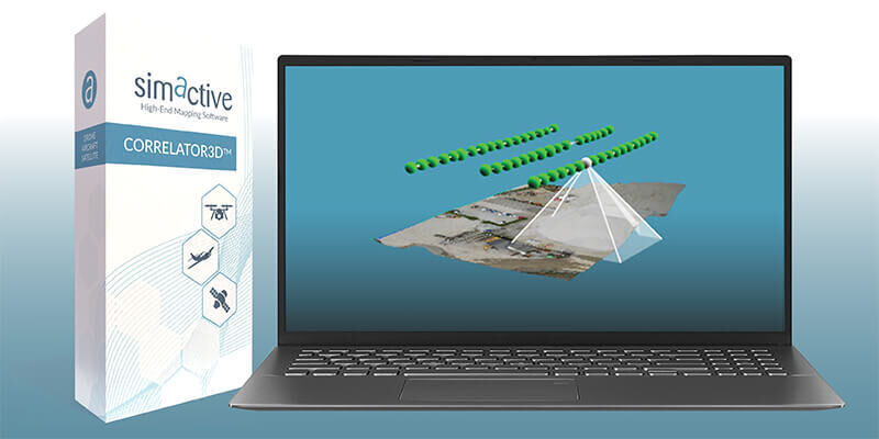
13th May 2020
Simactive - How to Perform Aerial Triangulation with Correlator3D