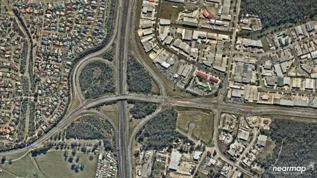
Mobile Mapping System Helps Australia’s Northgroup
6th July 2018
Mobile Mapping System Helps Australia’s Northgroup
6th July 2018
Mobile Mapping System Helps Australia’s Northgroup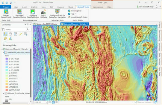
5th July 2018
Geosoft add-in enhances integration with ArcGIS Pro
29th June 2018
trajectoryXyzt GEOSPATIAL INTELLIGENCE CONFERENCE ANNOUNCED
26th June 2018
Airbus to provide an end-to-end Geo-Information System to Thailand25th June 2018
Airbus and Planet join forces to bring new geospatial products to market19th June 2018
PCI Geomatics Attend 39th Annual Canadian Symposium on Remote Sensing19th June 2018
Call for Proposals - ISPRS Scientific Initiatives 2019
15th June 2018
CGG Delivers Final PSTM Products for Dunquin Multi-Client Survey8th June 2018
Sofradir and ULIS undergo structural reorganization
7th June 2018
Rezatec join forces with specialist contractor, Detection Services7th June 2018
Elbit Systems Launches MAY, a Wide-area Acoustic-based Situational Awareness Solution6th June 2018
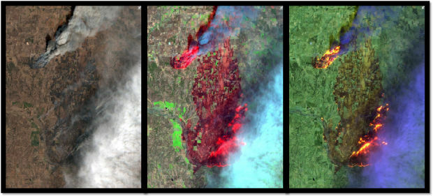
Earth-i Expands Team To Meet Demand for Insight and Analysis6th June 2018
Trimble RealWorks Announces Performance and UI Enhancements5th June 2018
SSTL awards Launch Services Agreement to Firefly Aerospace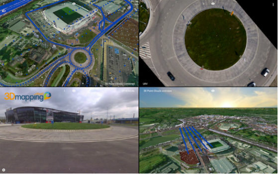
4th June 2018
Orbit GT releases upgrade of 3D Mapping Cloud SaaS platform31st May 2018
Merrick Releases Version 2018 MARS® Software Suite
30th May 2018
Esri Announces Release of Sentinel-2 Image Services25th May 2018
Take a leap into the exciting world of Hyperspectral Imaging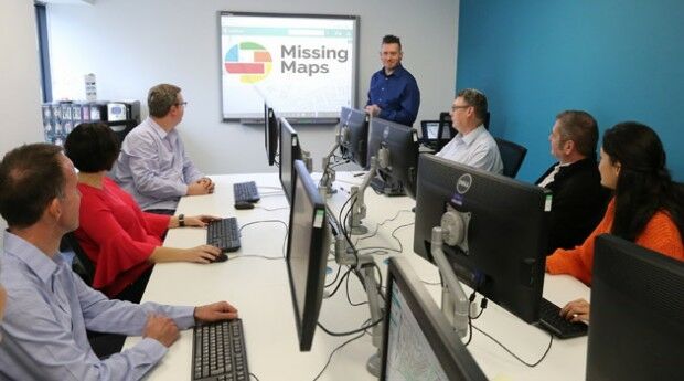
24th May 2018
thinkWhere Supports Global Humanitarian Project to Map Disaster Areas23rd May 2018
Global Mapper Helps Aerial Filmworks, Win Pulitzer Prize21st May 2018
CGG GeoConsulting Launches Robertson New Ventures Suite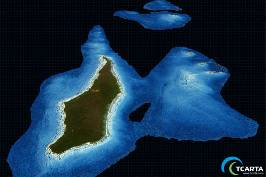
17th May 2018
TCarta Delivers Satellite Derived Bathymetry Data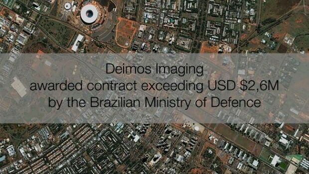
16th May 2018
Deimos Imaging awarded contract exceeding USD $2,6M by Brazilian MoD
16th May 2018
Mapping, Charts, Aerial Imagery Available from East View Geospatial
16th May 2018
Carlson PhotoCapture to be presented at GEO Business 2018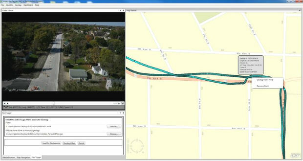
16th May 2018
Remote GeoSystems Releases All-New Video GeoTagger
14th May 2018
SphereVision Shows New 360 Imaging Tech at GEO Business

19th April 2018
New Indoor Mobile Mapping System from NavVis17th April 2018
LizardTech to Launch GeoExpress 10 with Expanded LiDAR Functionality
17th April 2018
Copernicus App Lab’s Earth Observation Data Tools Ready for Developers11th April 2018
GeoDATA Ireland Showcase 2018 two weeks to go11th April 2018
GEO Business 2018 reveal brand new seminar and workshop programme7th April 2018
Updated Global Mapper Academic Labs Now Available5th April 2018
1Spatial awarded contract by the European Union Satellite Centre
4th April 2018
Bentley Systems’ Year in Infrastructure 2018 Conference and Awards Gala3rd April 2018
East View Geospatial Launches On-Demand Milspec Geospatial Data28th March 2018
9th IGRSM International Conference and Exhibition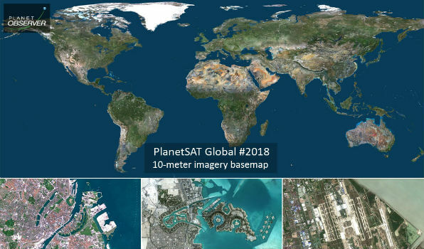
28th March 2018
PlanetObserver Announces Release of PlanetSAT Global Imagery Basemap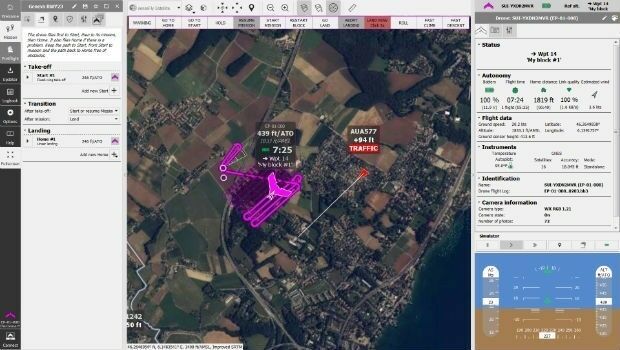
27th March 2018
senseFly takes drone flight planning & management to next level